Founder of the South African Coloured People’s Congress
Biography: Published by Dibanisa & Creative Books SA
Authors: Patric Tariq Mellet with Melissa Steyn
Intro Chapter & Contents Page follows –
INTRODUCTION
Home, Heritage, and Rootedness
Do you miss it? The neighbour, that friend, that talk, that slang, the school, that church and choir, that dance? It’s yours and mine. There is a bitter taste in my mouth, When I think of what we are denied. Naught shall comfort me; Naught shall comfort us. No house, no car, no suit, no plane will comfort me! I want my home in my street, with my friends, with my Comrades. Home, we shout! Do you want to go home, my brother, my sister?
– Reginald Kenneth September
‘I am September – Reg September,’ he said, as he introduced himself as Convenor of the First African National Congress (ANC) Interim Leadership Core for Western Capein those early days of 1990. He was back in South Africa after Nelson Mandela and others had been released as political prisoners and the ANC and SACP were unbanned. Reg September, sitting alongside Nelson Mandela, had just returned from 28 years of exile, and was meeting many new people as well as the ministers of the last Apartheid government. In his hometown, Reginald September as a founder and General Secretary of the former South African Coloured People’s Congress was to many, the Coloured Nelson Mandela of whom the younger generation had long heard stories but never seen.
Reg or Uncle Reg as many called him, is an iconic veteran figure, who rose from the oppressed communities who were classified as Coloured. From his teenage years in the late 1930s Reg had rose to top leadership, a figure of Mandela and Tambo’s stature. He was a humble man, with a very basic formal education, but a fount of wisdom and experience, who had cut his political teeth in the National Liberation League and trades union movement. He was the leading force in establishing the South African Coloured People’s Organisation (SACPCO) in August 1953, inspired by the founding principles of the African People’s Organisation (APO) established back in 1902. Reg thought of the SACPO, later renamed as the South African Coloured People’s Congress (SACPC) as representing a revived continuity of the APO.
Reg September was also one of the two first pioneering South African black diplomats, along with Vella Pillay when sent to London as a young man in 1952 to begin to lay the foundations for a mission abroad and a solidarity movement. On returning to London in the 1960s, when he was exiled, Reg could not be the ANC’s Chief Representative of Mission until the ANC had resolved the issue of whether Coloured people could once more be members of the African National Congress. Up until the mid-1940s Coloured people were allowed to be ANC members and office-bearers but with the advent of the Apartheid era, the ANC closed its doors to Coloured membership. Coloureds suddenly and absurdly began to be labelled as a non-African minority. Membership changed conditionally in 1969, where conditions were that Coloureds qualifying for membership had to be exiled and could not occupy any executive position. Likewise with Indians and whites. Only in 1985 could Coloured people inside South Africa become ANC members. Also, full membership was opened to Indian and white South Africans, and all regardless of race-labelling could be elected to the ANC executive from 1985. (Membership to MK and to the SACP was open to all.)
After the Morogoro Conference of 1969 in Tanzania resolved the question of membership being open to all who were forced to leave South Africa because of political opposition, with the caveat of barring minorities from holding executive positions, the ANC once more reverted to the practice up to the 1940s which had no bar on Coloured membership. OR Tambo, then in 1969 appointed Reg September as ANC Chief Representative in London for the ANC Mission to Western Europe. Reg had succeeded Mazisi Kunene as Chief Representative alongside whom he had been working as deputy from the SACPC to build on the initiatives that Reg had already set in motion in the 1950s. Through his pioneering work in 1952 – 1953 in starting the Solidarity Committee for a Democratic South Africa (SCDSA) in London, together with Vella Pillay, they had accomplished a historical first. Reg, from humble working-class roots thus was one of the two founding fathers of black South African diplomacy in Europe post World War 2.
Reg cut a fine and distinguished figure, with his receding grey hairline, above average height, an open friendly face, and a disarming smile. He was a man who cherished his Indigene African and Cape slavery heritage and spent his life building an African consciousness within Coloured communities. He consistently argued that the best interests of Coloured and Khoe and San communities were served by engaging in united action with all other Africans for liberation.
Many different labels were used by colonialism for what Reg September sometimes called Africans of creole heritage – terms ranging from Coloured, in his lifetime, back to “Free Black” in the earliest days of the Cape Colony. Only three of the many terms were forms of self-identification that were dignified. The earliest was the term “Watermans” or ‖Ammaqua, used by the early Khoe Indigene traders of Table Bay and adopted as a term of reference by the Europeans. The next was “Afrikander” or African, which was first used by mixed African-Asian enslaved people and Khoe, and the other emerged toward the end of the slave trade – “Liberated Africans”. The latter was a term of self-identification by those the Royal Navy called “Prize Slaves” and brought to the Cape. The navy rescued them from slave-trade ships on the high seas after slavery had been abolished in England. Liberated Africans continued to be brought to the Cape until the 1860s and had to undergo lengthy apprenticeships. One sees evidence of this in baptism records of city churches.
Throughout his life, Reg September was poised between being classified Coloured, by decree of officialdom, and his proud Liberated African heritage. He would often use his name to explain the history of slavery at the Cape and express the pride he had in being rooted in a people who rose above such great adversity to claim liberation.
This book is the Reg September story as told by two of his companions – a once young man whom Reg mentored, Patric Tariq Mellet, and the other, his spouse and soul companion in the evening years of his life, Melissa Steyn. In writing the story as far as is possible we use his own writings and biographical transcripts to allow Reg to speak beyond the grave.
Anyone who met Reg September during those long exile years would recall that there was never a conversation where he would not mention the word ‘HOME’. When he talked of home, Reg did not simply mean a locality or family dwelling. He meant a community, a spirit, a sense of belonging and an identity. He meant a “help-makaar” (help each other)and “kanala” (caring/pleasing) society born of many tributaries sharing a common struggle against exploitation and manipulation at the hands of those who believed themselves to be the masters of the universe. By “home” he also meant a connection with his ancestors, his roots, with his soul and with his people.
Reg September had a really strong sense of the past, which informed his present and helped him to navigate the future. He dug deep in coming to understand who he was and allowed it to inform his vision of a future, not just for himself but also for his people.
In his collection of notes and old papers, where he started to write up a format for his biography, he states:
I have no intention of just trying to write history, but I will want to write narratives, to narrate incidences which took place during my life and what informed me, and try to derive lessons from those experiences and events… I trust that I will not dwell too much on my own life.
It’s Monday 21 February 2005. Where am I today? In a couple of months’ time, I will be 82 years of age. Able to read and write, but knowing that time is not necessarilyon my side. I am very much aware of this especially noting that my old friend Joe Slovo’s biography had to be published in unfinished form after his having passed away a few years back. And he was not the only one. And I have so many questions which I need to deal with; so many questions to answer. I believe that ‘a life unquestioned is not really worth living’. Perhaps the most burning issue is facing what I sometimes jokingly refer to as the “half-caste” community of ours and the need to be part of resolving the present-day challenges of our communities who need to be prepared to bend our backs in furtherance of what faces us in our country and our continent. Our people have always been so poor; so destitute, and yet so many of us take refuge in our comfort zones.
Reg did not get to write his biography himself, so it became incumbent on us who knew him, learnt from him, and loved him, to capture his story from the many notes that he left us. And to remain true to his will and testament when putting pen to paper and when pouring over what he did write and collect in six boxes of papers, we have brought Reg’s own words into this story as much as possible, so that at least in part it is autobiographical. He left enough of his own words for us to do this.
In giving guidance to those who might write about him, Reg suggested that the product not be a ‘tome’. This word has a very bland meaning in the English language – a hefty academic publication, a volume; a reference work that is cumbersome, cluttered with citations to navigate and gathers dust.
Interestingly when you go to the Greek and Latin roots of the term “tome” you see a different and almost opposite meaning to the English version. Indeed, it’s this opposite meaning that speaks to what we believe Reg meant his biography to be. In the Greek, from which “tome” is derived, it simply meant “slices of life”. In elaborating on what he meant, Reg stated:
My story should be accessible to a broad sector of the reading public. And it should present guidance to Coloured communities specifically, and young people in particular. It should present an understanding of how persons from my community responded to the challenge of Apartheid in our time. It should outline the factors that shaped, and informed the consciousness and character of a person such as myself.
The authors, without Reg here to guide us, may not have been able to present the most comprehensive biography of this great man, but we have certainly tried our best to do justice to his life. Our aim has been to also improve the understanding of the motive forces and influences that propelled Reg’s passionate struggle in response to the legacy of colonialism, the destruction and havoc caused by Apartheid, and its legacy of disintegration of what Reg called “home” – the destruction of social cohesion of unique and somewhat unrecognised African communities branded Coloured.
We have taken our cue from his exhortation to outline, as he put it, ‘the factors that shaped and informed my consciousness,’ and in so doing presented the ‘slices of life’ that defined our dear Uncle Reg. We have also roped in perspectives of Reg from those who worked with him and knew him well.
Interspersed throughout the story will be thoughts that Reg September had on the issues and themes that emerged as a constant over his lifetime. (Reg’s direct voice is captured throughout in Italics script) Central to this is how he worked both with and around the controversial term Coloured, believing that until liberation one could not separate the Apartheid branding from the people and then expect to coherently talk of the struggles faced by Coloured communities. He also however said that a more dignified and historically grounded term for those labelled Coloured should emerge from discourse rooted among the people in a post-Apartheid South Africa, as a colourism or race term has no meaning. The indigenous African resistance to colonialism and Apartheid and African-Asian enslavement experience of facing and rising above adversity should shape the expression of self-identity.
And so, in telling this story, we have broken with the writing tradition and presented Reg’s entry into life not just as a story of the birth, childhood and life of an individual, but also as the story of the legacy that he was born into, the legacy which fashioned his life, and his responses to its challenges. It is a legacy of a set of marginalised communities brought together under the brand Coloured that defines not only Reg and his life’s work, but also his cherished understanding of “home”.
Over 32 years, I, Tariq, engaged in many conversations with Reg September from whom I learnt my ABCs when it came to the Coloured role in the political resistance arena. We often engaged in debate and discourse on the subject, and I can attest to Reg’s highly nuanced and sensitive approach to our history, heritage and political expression within the broader South African history and political developments. His was also a working class perspective rather than an intelligentsia missive on Coloured people.
I also engaged with Reg’s contemporaries, like Dr Richard van der Ross, when he was chairman of the board of an NGO which I co-founded – Inyathelo the South African Institute for Advancement. The chemistry created by these two men, including both their sparring and at times mutual antagonism on some perspectives, taken together with the greater mutual respect they had for each other, was amazing. Though they represented political opposites it was an education for me to see a working class organic intellectual with immense wisdom politically, wrestle with a man who was regarded as an illustrious educationist with a pedigree academic record. Reg was a natural strategist with a truly revolutionary mind whereas Dicky van der Ross, though a great intellectual, followed a course in life that can be called “attempting to extract trickle-down gains” through what Afrikaans-speakers call “toenadering” and the English call “cap in hand” politics.
Melissa Steyn, as Reg’s companion and wife, enjoyed the last two decades with Reg and has provided a very special perspective of Reg as husband, friend, comrade, Member of Parliament, and retired stalwart. Together we have worked in collaboration to bring you Reg’s story.
Along with our relating Reg’s story and providing perspectives on his life, we have also brought together the perspectives of others in one chapter (chapter 11). Many started their relationships with Reg with him in the role of their underground operative handler in the clandestine side of the resistance to Apartheid.
Reg’s life and work involves a few running themes, and it is the communication of these rather than just his biography that will be given thought and expression throughout this book. Each thread of the past will recur throughout the book, and also engage contemporary issues.
In the splintered world of the Cape Town political ‘fishbowl’, some will naturally raise their eyebrows at Reg’s views and others will be adulating. In wanting us to project his perspectives, Reg in no way wanted either to keep old antagonisms alive or encourage an adulation based on past divisions. He simply wanted to provide a window into the past with no holds barred as his perspective on what transpired. He wanted to help people broaden their understanding of what motivated him and, hopefully in doing so, contribute to the legacy of solution-finding for Coloured people in the broader African and South African political landscape. As the authors of this account, we have not sought to edit out controversy, nor opinions that some may find jarring, expressed by Reg at different times of his life about those with whom he differed. We have tried to accurately convey Reg’s views. This is part of history, and there are enough published works that elaborate the views of others which differ with that of Reg September. Reg was of the opinion that coming generations can read these differing views and decide for themselves as to what they think of those years of antagonisms, dispute and ructions that dominated in left politics in Cape Town.
In this biography we will draw much from our own engagements with Reg. We will also capture the times through which Reg lived and the mentors who influenced him. In this way we believe that justice will be done to this quiet man, whose voice penetrated and pervaded the political landscape without shouting out loud. This style of biography will be interspersed with Reg’s direct narratives left to us by tape-recordings and transcripts of interviews, papers written and correspondence.
What emerges from Reg’s life is his commitment to non-racialism and opposition to racism and any practice that has race, race-theory, and colour as a framework. Then there is his passion involving the building of African Consciousness in Coloured communities and resolving what some refer to as the “Coloured Conundrum” (as part of the “National Question”) by developing an understanding that the resolution of these issues lies in restoring the African identity of Coloured people . Furthermore, Reg argued that it is by clarifying and understanding San and Khoe history and heritage together with the other African-creole cultures rooted in the African-Asian slavery system at the Cape that will remove the barriers that separate all African brothers and sisters in South Africa, addressing the mischief of forced separation.
Reg strove for a transformative new system to roll back poverty and realise socialist hegemony in South Africa, not based on crude controls by the state, state-enterprises, and politicians, but through private and public civil partnerships supporting self-help underpinned by a state which facilitates the hegemony of the underclasses. Unlike some in the liberation movement Reg September was unambiguous about the fact that he was a socialist seeking much more than simply removing Apartheid.
Central to this he believed in educating Coloured people and all South Africans about the heritage of the communities from which he sprang, rooted in African-Asian slavery at the Cape and the heritage of the Khoe, San, Gqunukhwebe, Xhosa and other indigenous African groups.
In the political arena he believed that People Power or empowerment should be what democracy means. To this end he believed in building a democracy with a high level of public participation at its core and with such participation permeating all aspects of policy-making, governance and practice with openness and accountability to the public being central to everything. Reg had a natural aversion to extremist approaches and militarism, narrow-nationalism, tribalism, first-ism and any form of fascist exclusivism, while giving everything of himself to forwarding political education to give guidance on these pitfalls.
In the latter part of his public political life, he further took an interest in and explored building environmental consciousness to ensure sustainable futures for people and planet, and to put these before profit, using selflessness, honesty, and integrity at all times in an exemplary manner. He also took a firm stand against sexism and gender-based violence and for women’s rights. The violations of rights of gay, lesbian, bisexual and intersex people; the rights of people with disabilities, and those wrestling with mental health issues; the violation of the rights of the indigent, the homeless and jobless and that of all other marginalised people were all issues that he tirelessly championed for redress.
In a questionnaire which Reg completed while still a member of Parliament, and in the many documents that he left us, as well as in his communications with family, friends, and comrades, he made clear that the struggle for justice in all of these issues was his legacy and contribution to his people. It is this comprehensive approach to social and economic justice and not simply an anti-Apartheid struggle which jumps out loud and clear through every action in the story of his life – a story of a committed socialist and liberationist.
Reg had an acute sense of what his surname – September – represented, and it was a constant reminder of his roots. September was one of the calendar names that were given to the enslaved, and Reginald Kenneth September, born on 13 June 1923, was very proud of the fact that he came from an ancestral heritage of craftsmanship, creativity and innovation that characterised his enslaved forbears, who built the city of Cape Town, the towns, and farms of the Cape. He was proud of their endurance, resilience under pressure and their ability to rise up above adversity.
Reg did not see the enslaved as just being down at heel and cowed by their miserable conditions. He knew the history of those among the enslaved who first pioneered education, building, craftsmanship, farming, chemistry, writing, philanthropy and so much more that is so often falsely presented as having only been introduced by colonials.
His life story is a testament to his own lifelong resilience, endurance and rising up above adversity, which can be characterised by that statement of his close comrade and friend, Nelson Mandela, who said,‘The struggle is my life.’
The calibre of Reg September as a humble servant leader was no less than that of Nelson Mandela, O R Tambo, Ahmed Kathrada, Robert Sobukwe, Lillian Ngoyi, Walter Sisulu, Ruth Mompati, Steve Biko, Chris Hani, and such others of this stature. Because he studiously avoided the limelight it should by no means be concluded that he was not one of the top leaders in the struggle. It was no accident that he was among those in Nelson Mandela’s interim leadership core in 1990.
Reginald September also followed in the footsteps of a long line of the enslaved and indigenes who revolted in struggles against the slavery system and colonialism – leaders such as the slave leader Louis van Mauritius who led 326 slaves in the largest ever armed uprising of enslaved and Khoe apprenticed labourers in Cape Town in 1808. Like Louis van Mauritius, who was tried in the biggest ever Treason Trial in 1808, Reg September was one of the accused in the country’s second biggest Treason Trial in 1956. As much as Reg celebrated his forebears who were enslaved, he also celebrated his Khoe, San, Gqunukhwebe and other Southern African Indigene forebears. He had a strong sense of his African roots and the complexity of all of his roots, including an element of non-conformist European ancestry in the mix.
Reg learned how to work with the decreed colonial and Apartheid brand “Coloured” and indeed as circumstances dictated, he navigated a range of equally difficult substitutes – “Bruin”, “Gham”, “African-Creole”, “Half-caste”, “Minority”, “Non-European”, “non-African Minority”, “Blacks in General” and so on. He also found humorous and tongue-in-cheek ways of using this terminology to provide lessons. Tactically he often had to hold back from argument when narrow-nativists used the phrase “non-African minority” referring to those that Apartheid labelled Coloured. But he would always find simple but effective ways to disarm such expressions through explaining his own African consciousness and identity through story-telling. He found ways, for the sake of unity, to deal with contradictions without making a hullabaloo as he saw it.
Like everyone else in his community he struggled with finding a single term to give character to his community and in practice used the official term Coloured that had become the commonly used norm. This wasn’t an endorsement or acceptance of the term, but rather it was based on practicality. He further pleaded, ‘Please just don’t call me SO-CALLED’, for this expression suggested that he and his people did not exist. He was always encouraged that some were exploring a more dignified terminology for the sub-culture of the ‘creole African community from which he sprung’ (his own expression). He emphasised that showing leadership was not just about expressing what one was against, but clearly giving a lead in what one supported. In a post-Apartheid South Africa Reg’s exploration and engagement in discourse with others fostered a gradual emergence of the restoration of the names of San, Cape Khoe, Nama, Korana, Griqua as well as the possibility of the embracing of the name Camissa Africans for those who embraced their African-Asian enslaved ancestors and their Khoe and other local African ancestral-cultural heritage, along with the admixture of some Eurasian and European ancestors. This approach made much more sense that a term like Coloured which said nothing about the heritage of the people so-named.
Reg was proud of his sub-culture and not afraid to express what this meant to him. He was proud of what he called being “mixed” or having multi-continental ancestral heritage tributaries. This, he felt, made him no less an African than any of his fellow African brothers and sisters. Until such time as an African-pride and consciousness developed among Coloured people, and they could express a preference for a term that captured their sub-cultural heritage as Africans in a more dignified manner, he chose to use the adverse brand Coloured as a practical means to convey an understanding of the Coloured experience. The word demonstrated the survival of a form of oppression and manipulation by the racist regime.
Reg elaborates on this as follows:
I am a Coloured and at times I jokingly (tongue in cheek) refer to myself as being a half-caste, and at other times I jokingly refer to myself as Gham. I do this as a way of emphasising that I am of mixed ancestral and cultural origins. Believing as I do that there is no such creation as ‘pure-bred’ persons, clans, or nations. It is a myth perpetuated by those who pushed division. I see myself as an African with a mixed ancestral-cultural heritage and would dearly like to find a dignified way of expressing this.
Reg, who often used words provocatively to convey a lesson such as saying ‘Us Gham’, once asked me where I thought the term “Gham” came from, and when I explained its history, he was enthralled by how close one of its meanings was to an aspect of history wherein we could express great pride. On the negative side, “Gham” as used by white people in reference to coloured people, referred to as the biblical children of the “curse of Ham”. This was a twisted version of the biblical story of Noah’s curse on Ham’s children of Canaan, whereby it was argued that they would forever be a servant class. Racists then created a biblical justification for the enslavement of black people, saying that the Canaanites were black. So “Gham” for white South Africans were slaves, servants, and their descendants.
But I once explained to Reg that on the positive side, the term “Gham” is very close to the Khoe term ‖Amma meaning water, and ‖Ammaqua or ‖Khamis sa meaning Water-people, the name by which the first Khoe who established a port service at Table Bay, called themselves. They were settled on the banks of the Camissa River (‖Khamis sa – Sweet Water for All). The term “Gham” is also close to ǀXam, the original San people of the Cape, wiped out by genocide. This explanation put a twinkle in Reg’s eye. ‘My word; is that so?’ he responded. ‘We must look at this more deeply.’
The 1960s were particularly difficult for Reg as he found himself in the middle of an almighty fight in the political arena between extreme views on the ultra-left and on the political right. The battle raged around terminology on the one hand and also about the de-Africanisation of Coloured people on the other hand. This fight on two fronts actually left him gravely ill, requiring hospitalisation in the German Democratic Republic (GDR) and the Union of Socialist Soviet Republics (USSR). He skilfully navigated a middle road by using tactical compromises while he played the long game. For the sake of the struggle, Reg participated in shaping a way forward that did involve tactically accepting for the time being that debate about terminology was a distraction and should be deferred until liberation had been attained. He also firmly believed that for Coloured people the best approach would be to accept that the leading force in the struggle was the majority of our fellow African brothers and sisters who were worst affected by Apartheid and colonialism from 1948 to the 1990s, – those referred to as Natives, Bantu, or Blacks in Apartheid terminology. He saw this as vital and argued against any separatist-Coloured struggle. Reg would argue that Coloured people must pay attention to building their own African Consciousness and that this would break the artificial barriers of divide and rule.
The nuanced tactical position that Reg took was not an endorsement of colonial and Apartheid labelling for all time, but rather a practical means towards an end. He took this stand regardless of how those on the divisive far-left, as he saw them, criticised him with accusations of tactically accepting the ANC referring to Coloured people as a “non-African minority”, and lumping them together with white and Indian minorities.
An indicator of his deeper feelings, however, is illustrated by this story that Reg related:
I remember very well walking into a meeting in Oliver Tambo’s home in London when he was meeting with a group of people whom we referred to as the Gang of Eight. They were narrow ethno-nationalists who called themselves the ANC – AN (African Nationalist). One of them, very shortly after I entered the meeting, spoke about me, and objected to me representing the ANC. He said, ‘Well we all know that Reg is not an African’. I stopped him there and I said, ‘What are you saying – that I am a Greek or a Portuguese?’ The man was very dark, but he turned red and shut up from then onwards. I knew that I could count on OR Tambo’s support.
While Reg was well known for his diplomacy and flexibility, for his quiet and thoughtful nature, and for being a unifier, a tactician, and a strategist, he took a very strong line against racism, colourism, and narrow ethno-nationalism. Politically he was a socialist and had been a leading member of the Communist Party since his early working days. Throughout this story of the life of Reg September there are recurring themes, and the issues pertaining to the indivisibility of being both Coloured and African is a constant. This was true even during the era of the ANC referring to Coloured people as a non-African minority, to placate the narrow nationalists. It pained Reg but he adhered to the discipline of taking a united position, seeing it as a temporary inconvenience.
In 2007 Reg September had his DNA genetic testing done to shed light on his ancestral roots. He was part of a pool of 368 people tested by the African Genome Education Institute’s “Living History Project” carried out by Professor Himla Soodyall and her team from the University of the Witwatersrand’s (Wits) National Health Laboratory. Reg’s paternal Y-Chromosome DNA result indicated the J2 Chromosome haplo-group, which is the West Asian, Near Eastern and Middle Eastern marker in the genetic tree. Reg’s maternal MTDNA test revealed the M5 Haplogroup which is the South Asian and Southeast Asian branch of the genetic tree, which is also found in East Africa and Madagascar. Read with Reg’s genealogy this confirms Reg September’s linkage to Eastern slavery, African slavery from East Africa and Madagascar and some European ancestry. This reflects only Reg’s father and mother’s ancestral roots and does not give us his paternal grandmother’s lineage nor his maternal grandfather’s lineage, which are likely also to further confirm Reg’s African and Asian DNA lines. Unfortunately, Reg did not test for his autosomal DNA, which would show at least 50% of one’s spread of genetic influences around the world. Reg’s DNA testing does give some confirmation that his roots did go back to the slave trade in Africans and Asians and that his lifelong emphasis on being proud of having multiple ancestral roots going back to slavery was accurate.
As he grew older Reg expressed an understanding of the community soul with greater clarity. He believed that it was deeply rooted in a past that few today understood, as they had been so denuded of cultural heritage, and there was a huge gap in our psychological landscape, just like the wide, open space of dusty District Six, sans its homes. District Six which was raised to the ground through forced removals under Apartheid is there but not there. (Around 70 000 people were forcibly moved from District Six) We exist but have not paid sufficient attention to the protection of our cultural definition. The plot of land is there, but not the homes.
For Reg the struggle to reconnect within our society with the sense of community and identity and ethos is still very much with us. The need to build African consciousness and to express ourselves as Africans remains a cornerstone of the struggle of Coloured people, now more often finding expression as Camissa African people. This struggle for liberation is a deeply emotional struggle, demanding emotional intelligence which links learning, understanding, and feeling. This biography of Reg September will take you the reader on Reg September’s journey along the resistance road that saw him develop positions on all that has been raised in this introduction as the struggle became his life.
Table of Contents
Introduction: Home, Heritage, and Rootedness
CHAPTER 1: The roots of the Laatlammertjieof Onderdorp
CHAPTER 2: Childhood in the September home
CHAPTER 3: Entry into politics – organisational and ideological
CHAPTER 4: Entry into politics – the mentors
CHAPTER 5: From trades unionist to mass mobilisation
A Short History of how the suburb of Salt River emerged
Patric Tariq Mellet – author of the Lie of 1652
(A former resident of Salt River)
Today, opposite the Locomotive Hotel, at the Salt River Circle, are the buildings known as Bridge Mansions where its last shopfront creates a curved corner-shop. The corner shop is now refurbished with its art-nouveau façade proclaiming – “Wish U Were Here”. As a child it was a laundry and drycleaner’s shop, one of a chain called Nannucci Brothers, where my mother worked after they relocated her from their shops in District Six. I often sat in that shop with my mom looking out through the large glass shopfront at the world going by outside. In my adulthood my focus has shifted to look around the area, researching what is unseen or intangible, to ascertain what the unseen has to say to us today.
Bridge Mansions, and the transportation arteries around it – road and rail, also provides a useful historical marker as much of these built roads, bridges and railway tracks were developed on top of old waterways and indigenous travel routes – human and livestock tracks. Between 1862 when Salt River station became a railway junction on through to the 1930s, as the area became industrialized, commercial and residential built environments flourished. The Bridge Mansions building was completed in 1927.
The main casualty of development in the area was the almost complete eradication of the riverine and estuarine environment, and repositioning of the sea and obliteration of the beach, where humans fought against nature using landfill to radically change what once was.
CREEPING DEVELOPMENT AND CONTROL OF WATERS
Development was a gradual creep that started with Jan van Riebeeck building roads along the old Khoe cattle tracks[1] (1653 Map 5) which today are Voortrekker Road, Albert Road, Salt River Road, Durham Avenue, Lower Main Road, and Main Road. Most of these in the old days, skirted the water dominated landscape. The sea and beach in those days were not very far from Salt River Circle as it exists today and what was once a prime fishing area is now no more.
MAP NO: 1 MAP NO: 2
(MAPS 1 & 2)[3] In the 1650s what would become the Salt River suburb is within the red ellipse on a 1657 surveyors map drafted by VoC surveyor Pieter Potter. The thin blue line is the sea and beach in the 1650s and the first land mass is Paarden Island. To the left of Paarden Island is the Salt River estuary with a little island in the middle of it. The thick blue line is the pushed back sea today. The area between the thin blue line and the thick blue line is all land infill to day. The Ben Schoeman docks was built on the reclaimed land. This land infill goes right through to Cape Town where the sea once came right up to Strand Street with the entire foreshore being land infill. Development has been at the expense of complex water systems involving the removal of both fresh water and seawater. The Green line shows the new late 18th Century Vaarsche Drift via Vaarsche Vallei. The black lines show where Albert Road, Durham Avenue and Salt River road are positioned today and connect up to Jan van Riebeeck’s first wagon road – today Main Road (also an old Khoe cattle track). The history of the Salt River area has also been replaced by a concocted historical narrative that relocates the historical story with a pseudo-narrative that shifts a mountain of historic events to a small piece of wasteland on the periphery of the arena beyond the new Liesbeek river.
MAP NO: 3
The 1657 and 1658 maps from the Netherlands archive are the earliest maps showing the 13 morgen allotments to Free burghers. The land grant marked R8 is the grant of 26 morgen given jointly to Jan Reijniers and Cornelius Mostert.
MAP NO: 4
It was re-purchased by the VoC commander Jan van Riebeeck at the end of 1659, when he added 6 morgen across the river to make it 33 morgen so that the Pega Pega fortified boundary could be erected. The Jacobs & Co fishermen’s allotment can also be seen near the Salt River estuary mouth.
The Vaarsche River / Amstel River which was the old Salt River branch of the Liesbeek River. as seen on the Maps No: 3 & 4. It ran into the Salt River Estuary not far from today’s Salt River Circle shown as a small red dot on Map No: 1 with the colour overlay. The yellow line on that map shows the routes making up the original Vaarsche Drift passageway (Khoe cattle-tracks) over the Black and Liesbeek Rivers of the 17th century. It branches off to the Khoe summer settlements to the left – Observatory, Mowbray, Rondebosch, Newlands, Wynberg – and to the right Table Valley and Green Point. The “uitwijk” (Swerve / Swaai) is where the (yellow route on Map No: 1) cattle tracks veer off away from the dangerous swamp area around where the Liesbeek split into two branches and beyond on the east side of the second branch of the Liesbeek. The swerved track passes through to the upper end of the Reijniers-Mostert 26 morgen farm (granted in 1657) a few blocks away from where Lower Main Road today branches from Albert Road. The farmhouse on the upper end of the swerve came under attack by the Khoe during the first Dutch-Khoe war and was left in ruins.
Jan van Riebeek during 1653 – 55 did some experimenting with growing crops like wheat and rice across the East Bank of the Salt River branch of the Liesbeeck which was easily accessed via the drift near to where the river entered the estuary with some positive results. Pathways (cattle tracks) can be seen on a 1653 map.
Between 1657 and mid 1659 with only around 18 months to create a farm from difficult virgin territory, Reijniers and Mostert had barely the beginnings of a farm. A combination of strong winds destroying wheat, being on the frontline of the Dutch Khoe war bearing the brunt of the Khoe attacks which destroyed the farmhouse on “the swerve”, as well as being in debt to Jan van Riebeeck, the sold the farm in a two stage process.
At the end of 1659 when van Riebeeck repossessed the farm for the VoC, he extended it by 6 morgen and named it Den Uitwijk (The Swerve). By 1800 Den Uitwijk was sub-divided and part of it became the farm Malta. The Liesbeek still flowed through the middle of today’s Malta sports greens and Hartleyvale sports complex – then the wheat fields of Malta Farm. When it was first built the old Liesbeek coursed its way fairly close behind the outbuildings of the Vaarschedrift Farmhouse, (through where the 1959 Railway Cottages stood). The split into the Salt River Branch and the branch flowing towards the Black River was at the foot of the original Reijniers-Mostert farm. When Malta Road and its bridge and Liesbeek Parkway were built, the positioning of the bend of the second branch of the Liesbeek was shifted further in the direction of the Royal Observatory and then changed from the old Liesbeek to the new Liesbeek in the mid 20th century. From being some distance to the right of Liesbeek Parkway/Malta Road looking towards Mowbray, it was moved over to the left of the road to link up with the canalisation further down, which also involved moving the course of Liesbeek.
The second map (Map No: 2) is from the early 19th Century is where one can see that the first phase of severing the Salt River branch of the Liesbeek has left a third of the branch and confluence still in tact with a small vlei in the vicinity bordered by Albert Road, Burns Road and Greeff Road. (One can also see that much of Salt River suburb is as yet undeveloped into a built environment). The confluence was pushed further back by the end of the 19th century and the Salt River branch of the Liesbeek totally filled in as though it never existed. The main part of Salt River suburb in the 17h century at the time of Jan van Riebeeck was the land above, and to the left and right of where the Salt River Circle is demarcated by a red dot (Map No: 1).
At that time and for centuries before van Riebeeck’s arrival, these areas above the river are where the outspan areas for the Khoe and their livestock. An outspan is where travelling herder communities made temporary resting places, before moving either into Table Bay or further into what today is Observatory, Mowbray, Rondebosch, Newlands and Wynberg. These and the distances from the Fort de Goede Hoop are described in detail by first-hand observers[4]. Much of Salt River was either passageway across the the rivers estuary and swamp wetlands or an expanse of dry outspan area as a junction for the Khoe to rest and await others to catch up. It was a sandy and windswept area with lots of little feeder streamlets from the mountain running into the water catchment area. On the east side of the Salt River branch of the Liesbeek there were bits of dry surface but much of the immediate land at the estuary was vlei and wetlands. The waters around present day Milnerton and Table View gives a reasonable impression of what much of Salt River suburb use to look like.
There is very little of the Liesbeek River that is natural today after total reconfiguration completed in the early 1960s. The last part of the reconfiguration was to create a fake boating pond opposite what was then Hartleyvale Football Stadium, and then a totally new canal was dug from the pond past the Royal Observatory creating yet another new confluence of the Black and Liesbeek Rivers. The two confluences of today’s reconfigured Black River and Liesbeek River are both man-made. This is the story of how Salt River suburb lost its estuary, vlei, old branch of the Liesbeek River and its own original confluence created by the two branches of the Liesbeeck. This was airbrushed out of history by the colonial environmentalist lobby.
MAP No: 5 MAP No: 6
On the Map No: 5 (1653) to the left the track paths crossing the original 17th century Vaarsche Drift is shown if enlarged.The map on the right (Map No: 6) is Pieter Potter’s Map of 1650/60 showing the extra 6 morgen of land added across the river, by Jan van Riebeeck and also showing the reason why this panhandle of land was added to Den Uitwijk farm. A dotted line shows the first phase of the Pega-Pega fence coming through to the end of the line and then at a right angle to the bottom of Hendrik Boom’s farm.
The area of Salt River that borders Observatory is a small enclave which we called the “Swaai” when I was a youngster living there. (Our use of “swaai” had more to do with the way we – from the area – walked with a particular rol) It was situated between Chatham Road and Cole Street, below the Lower Main Road and going down to Malta Road. Little did we know that there was a different coincidental history behind our street slang and the importance of our small area beset by poverty. The area existed on the border of and expanse of early colonial settlement land – the Reijniers-Mostert Free Burgher farm, Jan van Riebeeck’s Den Uitwijk, and later Malta Farm and Vaarschedrift hunting lodge and farm house. It is from these developments that the Salt River suburb grew. In my childhood the area was surrounded by industrial infrastructure.
The 1657 Maps (Map No:3 & 4) shows the initial Free Burgher allotments and the map of 1659/60 (MapNo: 6) shows the second development when the land was bought back by Jan van Riebeeck and expanded to include the first phase of his Peg-Pega boundary fence around the entire Free Burgher settlement.
On the map the first plot marked “R” is Pieter Jacobs, Martin Vlockaart, and Jan Adriansen’s VoC Fishermen’s allotment on the Salt River estuary. It was not just the first built environment development of Salt River, but it was also the second development in the early colony after the Fort de Goede Hoop. The second plot up-river is in part the plot jointly awarded to Free Burghers Reijniers and Mostert (26 m), which was bought back by the VoC Commander van Riebeeck in 1659 and extended by another 6 morgen across the Liesbeeck River (to make u 33m). This was for the purpose of building the first phase of the Pega-Pega defensive boundary fence described in detail in the Journal of Jan van Riebeeck part 1. The VoC in keeping with the regulation restricting Free Burghers to 13 morgen person only granted 26m to Reijniers and Mostert[5]. One can see the extension of the Uitwijk plot to accommodate the Pega-Pega Fence which also shows the boundary fence as a dotted line running from the Kijkuit tower via Keert de Koe tower, on the second map of Pieter Potter drafted in 1659/60. (below)[6] Other towers were Duynehoop tower and Hout den Bul tower.
Photo 1: The Estuary and mouth of Salt River looking towards the Mountain. Photo 2: Centre-left on the coastline – Paarden Island and the estuary mouth, looking from the mountain (Woodstock in the foreground) Salt River suburb beyond the trees centre-right. Note the expanse of beach and inland water.
The waterways were not what we see today in the form of the modern Black River, Liesbeek River and Salt River canal hidden from view. All of these are un-natural later human-made waterways. In fact, the coastline and the original Salt River estuary was radically different back in the 17th century of Jan van Riebeeck’s time than what it is now. In the 17th century right up to the 1940s the shoreline ran along Strand Street past what became the Castle of Good Hope, through to another Dutch Fort, Fort Knokke, which was in the area to right of the Church Street Bridge in Woodstock looking seaward where Beach Road, Woodstock, is the marker. From that point on the beach carried up to the coastline beyond Milnerton that we know today. But not far from what is left of Beach Road today was the mouth of the Salt River estuary entering the sea. The Salt River or estuary ran a long way up westward hugging Paarden Island which was almost surrounded by the river except that it was still adjoined to the greater land mass near Milnerton.
Further up westward from the Vaarsche River, the first branch of the original Liesbeek, the Black River ran independently into the Salt River estuary near to what is Brooklyn today.
Upstream the Black River was joined in the vicinity of today’s Voortrekker Road by the second branch of the Liesbeek River. Up from the mouth of the Salt River estuary flowing into the sea, flowed the saline mix of salty and fresh water, later becoming fresh water which was the first extension of the Liesbeek initially called the Vaarsche and Amstel River. It is after this stretch of river and the estuary that the area now called Salt River is named. The illustration overlaid on the map below gives one a reasonable idea of where the beach was and where the rivers were in relation to today’s built environment.
Today people ask, “why is the area called Salt River, because we see no river”? In the 17th century and right up to the mid 19th century there was more water than land between Maitland and the slopes of the mountain, than what we see today. The Salt River itself was a Vaarsche River (fresh water) and was not salty except at the last stretch where the river entered the Salt River Estuary.
Cape Town’s foreshore and Duncan Docks and the Ben Schoeman Docks were all built on landfill sites starting in the 1940s and only completed in 1979. In my childhood we saw Woodstock Beach disappear as landfill created the container dock extension. The watery parts of Cape Town were all either covered over or filled in. The landfill that filled in the Salt River Estuary and pushed the sea back from Salt River was already completed in the 19th century.
SALT RIVER BEFORE EUROPEAN COLONISATION
If we go back one and a half million years ago there was no Cape Peninsula as most of it was under sea, except for some rocky mountain tops. Mlambo and Parsons, in their excellent book “A History of Southern Africa”[7] which has been used to teach high school history in most Southern African countries for over 40 years, and continuously updated, tell us that 5000 years ago two meters of water still covered a large part of the Cape Flats, up to the airport, water covered much of the suburbs before the waters slowly receded. Over 370 years ago much of the Cape Peninsula was still covered by rich waterways, lakes, estuaries, vleis and marshland. Salt River was very much in that state when the Portuguese set foot here in 1510 and even when Jan van Riebeeck arrived in 1652.
The Khoe began arriving in the Cape Peninsula from down the west coast and down the east coast around 1100 CE. According to Sadr there is no proof that that the Khoe were in the Western Cape before 1000 years ago[8]. Prior to that time only micro communities of ǀXam, San peoples had lived around and later on what became the Peninsula for thousands of years.
The proto-Khoe first emerged in Southern Africa as migrant herders from East Africa of Nilotic, Cushite, Hadzabe, Sandawe, and Sub-Saharan African roots, who as a result of a slow migratory drift connected up and engaged with the San people of Angola, Zambia, Zimbabwe, and Northern Botswana – known as the Khwe and Tshua, around 2200 years ago.[9] Around 1900 years ago in the same area further migratory drifts of farmers with metallurgy skills[10] also brought West African, Central African, and other East Africans mixed together with the Tshua and Khwe and the proto-Khoe. We today know that the earliest archaeological sites showing artefacts and proof of iron smelting and crafting farmers go back to around 100 – 200 CE. Some people in South Africa still argue that Bantu language speakers “invaded” South Africa in the 1400s or later. This is a false “firstism” narrative borrowed from colonial and Apartheid
From this mix over time in stages known as Bambata, Ziwa and Zizho cultures developed into the proto-Kalanga people who emerged as the third Foundation People in the peopling of Southern Africa.
Further migratory drifts occurred over another thousand years from 200 CE. By 650 CE the descendants of both proto-Khoe and the trajectory birthing the proto-Kalanga traditions found themselves in Namibia, Botswana, Northern Cape, and Eastern Cape. In the Eastern Cape arena proto-Khoe and proto-Xhosa were living side by side together with the southern San peoples as attested by over 18 archaeological sites[11]. Thomas Huffman clearly identifies the pottery shards in the Eastern Cape around 650 CE as artefacts of West African origins[12]. This is a very different story to that told by colonial and Apartheid historians which emphatically said that “black aliens” invaded the Cape in the 15th century, a lie that some continue to propagate today. This false theory about an “empty land” gave rise to further false European theories of “Firstism” which argued that only a few primitives (whom they called Bushmen) still evolving into full human beings occupied South Africa before any “Negroids” later labelled “Bantu” arrived to colonize these “First People” at the same time as Europeans. This false theory and false notion of “First People” created by colonial writers like Mary Barber, Thomas Bowker, McCall-Theal, and Wilhelm Bleek (the father of race classification) is still propagated today by the “First Nation” lobby a white supremacist groups.
By the 16th century the Cape Khoe were well established in the Western Cape for 5 centuries. Three societies of Khoe peoples, who were skilled livestock farmers, with thousands of herds of cattle and sheep were engaging in transhumance travelling along the roots from Saldanha and Vredenburg to the Cape Peninsula and from Malmesbury down the river systems into the Cape Peninsula, arriving just before the summers and departing just before the winters. They were Cochouqua, Goringhaiqua and Cochouqua.
The dry pieces of sloping land beyond the drift in the direction of Cape Town and in the direction of Observatory were the outspan areas making up a junction for the livestock and the Khoe to rest before moving to the Table Valley on the one side and Rondebosch, Newlands and Wynberg on the other side. This outspan area was what became Salt River and Woodstock suburbs in the 19th century Woodstock- Salt River was one super-municipality and known as the second largest “Town” in the Cape after Cape Town.
In the springtime the Khoe would cross the large watery area of the Salt River estuary, Black River and Vaarsche River by means of shallow fords (drifts) very close to where the Black River and Vaarsche River entered the Salt River estuary curving around Paarden Island. Just before the winter rains set in the Khoe would leave for Malmesbury and the West Coast via the same route. One early survey map in 1653 (MAP No:5) illustrates the pathway into the Cape Peninsula and it’s crossing at the Vaarsche River (1st branch of Liesbeek) near to where it enters the Salt River. This was the first Vaarsche Drift and the only route into what would be later called Cape Town and the Southern Suburbs.
By the late 18th and early 19th centuries, this original Vaarsche Drift had been pushed much further upstream on both the Black River and first branch of what was now called the Liesbeek River which branched into two around the old Uitwijk Farm started in 1657. On a very early map in 1653 one can see a sometimes-seasonal shallow at the point where the Liesbeek river forks near to Uitwijk.
Uitwijk (or Swaai) means the “swerve” and this marked where the Khoe cattle tracks skirted away from the waterway and dangerous floodplain (area between the modern uninhabitable no-mans-land) confluence of the Liesbeek and Black River. The “swerve or uitwijk” passes along what today is the lower Main Road Observatory, then Main Road and on to Mowbray, Rondebosch, and Newlands – the favored areas for the Khoe summer kraals.
THE FIRST EUROPEAN-KHOE BATTLE IN 1510
In 1505 Dom Francisco d’Almeida and his Portuguese naval fleet packed with soldiers attacked, conquered, and colonised a number of East African towns and the Island of Zanzibar – including Kilwa, Barawa, and Mombasa, thus establish colonial hegemony for Portugal in East Africa. From there he went on to India, having been declared Portugal’s Viceroy for India, where through a series of battles he consolidated Portuguese domination in the east by driving the Ottomans and Egyptians from the region and subjected it to Portuguese rule which would go on for the next 100 years, before the rise of the Dutch and English as maritime powers.
In 1510 on their return voyage back to Europe from their colonial ravishing wars in Africa and South Asia the Portuguese fleet of Francesco d’Almeida, Europe’s most renowned military leader, stopped at the Cape to take of fresh water and whatever else could ease their onward journey home.
They anchored in Table Bay across from Salt River estuary. On the first day of their arrival a small party of ship’s crew followed the cattle tracks of the Khoe as far as today’s Rondebosch (1 league in from the beach according to one 16th century historian)[13] where they encountered a Goringhaiqua Khoe village. They were well received and did some trade, but then they violated their hosts and attempted to steal some cattle. They were beaten off and sent packing back to their ships.
On the following day, 1 March 1510, Dom Francisco d’Almeida agreed to dispatch his captains Pedro and Jorge Barreto to march on the Goringhaiqua village to go and seize some cattle and teach the local people a lesson. Francisco d’Almeida was not able to travel the full distance but instead waited some distance inland from the beach (in Salt River) while the boats that brought them all ashore went on to fill barrels of water at the Camissa River in Table Bay. This of course left both the awaiting d’Almeida party and the Barreto raiding party without means to retreat back to the ships.
This time the Goringhaiqua were prepared for the Portuguese and went to battle against the Portuguese, weighed down with armor. Using their cattle as cavalry driven before them as a tactic, where whistles and calls were employed to maneuver the cattle along the cattle-track route (through what we now know as the Southern Suburbs) they stampeded the Portuguese into flight while the Goringhaiqua in guerilla-style tactics used their spears and other light weaponry to also attack them.
A running battle from Rondebosch, through Mowbray and Observatory along the livestock tracks, pushed the Portuguese retreat back to d’Almeida and the others and onto the Salt River sand dunes and beach, where they were surrounded and trapped without escape. At this battle at the Salt River estuary the greatest European General of those years, well known for his conquests, was defeated, and killed along with 64 of his crew and soldiers, inclusive of 11 of his captains. This disastrous defeat for the Europeans was recorded in the writings of four famous European writers as well as becoming a tale that appeared in much other writings. All of these were not first-hand accounts, but there is no doubt about the veracity of the story.[14]
THE FIRST KHOE MAN TO GO TO LONDON IN 1613
In 1613 a Khoe man from the Cape Peninsula by the name of Xhore was kidnapped on the Salt River-Woodstock beach and taken to London on a ship – the Hector, by the English East India Company. The following year he was brought back to the Cape where he was supposed to assist the English in establish a small colony made up of ten convicts from Newgate Prison, under Captains Peyton and Crosse. The entire project was a disaster and concluded after three years when the last three survivors were picked up from Robben Island to which they had retreated. Xhore however remained as a trading agent for English ships until his death at the hands of the Dutch around 1626. The English in 1630 persuaded another Khoe man to travel with them to Java and back, and then set him up as their agent and Governor on Robben Island. Autshumao aka Ari (or Herri as produced by the Europeans) was assisted to move to the island with 30 of his followers, but by 1638 he and his community were assisted back to the mainland where they continued to be traders not only with the English shipping but also the other European shipping arriving in Table Bay.
THE //AMMAQUA TRADERS AND INCREASED EUROPEAN SHIPPING VIA TABLE BAY 1600 – 1652
Between 1600 and 1652, as verified using the Huygens database of shipping logbooks[15] in the Netherlands and consulting the works of maritime historians at Leiden University around 1000 ships (Dutch, English, French, Portuguese and Danish) passed through and stopped off, for an average of three weeks, in Table Bay. These collectively carried over 160 000 visitors to the Cape prior to the 1652 arrival of Jan van Riebeeck. A brisk trade developed as well as a number of other facilitative services rendered. In 1644 one group of 340 marooned Europeans stayed at the Cape for four months and in 1647 another group of 90 marooned Europeans stayed for almost a year. Both had cordial relations with local people. Jan van Riebeeck clearly was not the first European at the Cape nor the first to live there.[16]
In 1652 the small community of Khoe traders, referred to themselves as ǁAmmaqua or ǀKhamisons meaning “Watermans/Water People”(Jan van Riebeeck says Waterman’s was the preferred self-identification term used by Autshumao’s people) under the leadership of Autshumao. The Europeans initially called these Khoe, “strandloopers” and other Khoe used a derogatory name – “goringhaicona” meaning drifters and outcasts. Unfortunately, some in the 21st century falsely use these insulting terms to claim that “goringhaicona” was a tribal community name, whereas it was not. All community names end in “qua” or “koa” and the term “goringhaicona” was used only between the 1650s to 1720 to refer to a range of different groupings – the Sonqua line-fishermen, Autshumao’s traders, independent Khoe farmers, and a rebel group in the second Dutch-Khoe war.
Autshumao and his traders quickly found themselves in a struggle with the Dutch under Jan van Riebeeck who seized their land, place of abode and sought to wrest control of the shipping trade from them. Autshumao’s trader community were ordered to remain out of site behind the Lion’s Rump Mountain (Green point). Autshumao defied this and during the building of the fort and afterwards, Jan van Riebeeck notes that he was still there encamped[17]. In his journal Jan van Riebeeck noted that Autshumao emphasized that it was he who had started the trade at Table Bay[18]. Jan van Riebeeck initially tried to primitivize Autshumao and his people as being no more than beasts and called them scavenger Strandloopers. Later in his journal he notes that he was wrong to think of Autshumao and his people as being ignorant beasts, because he had learnt through his struggles with them that they were sharp thinkers.[19]
FIRST FORCED REMOVALS: KHOE TRADING SETTLEMENT AND FIRST FISHING STATION
Autshumao’s community of around 60 persons were largely an extended family[20] who were originally part of the Cochoqua and Goringhaiqua peoples. Autshumao’s people settled on the bank of the river mouth of the fresh water Camissa River as it went into the sea. This was the first strategic area and resource that was seized by Jan van Riebeeck in 1652 and where he built the first Dutch Fort de Goede Hoop. Along the original Liesbeek River stretch just before where it spilt into the Salt River estuary was a saline part of the river, teaming with fish, and popular with the Sonqua line-fishermen and Autshumao’s ǁAmmaqua (or ǀKhamisons) trader community.
This Salt River fishing spot, teaming with fish was frequently mentioned by European visitors prior to 1652 and was the second of two spots that immediately were identified by the Dutch for their exclusive use[21].
This was the second strategic spot and resource, a fishing allotment, that Jan van Riebeeck ordered to be seized and secured and a fortified fishermen’s residence was established here.
Later it was given over to three Free Burghers – Pieter Jacobs, Martin Vlockaart, and Jan Adriansen[22]. It remained an important fishing property for at least the next 60 years. It is part of the history of Salt River, that it also had the first formal fisherman’s site. Pieter Jacobs’ fisherman’s plot is marked on the earliest maps.[23]
THE PEGA-PEGA FIRST BORDER FENCE OF THE CAPE COLONY
In 1657 Jan van Riebeeck with the blessing of the VoC marked out and granted a number of farms, along the Liesbeek River on the east bank until Mowbray and then on both east and west banks through to Wynberg. Company officials were released to become Free Burghers (Free Citizens) and this is how the colony was first established. Between 1658 and 1659 Jan van Riebeeck started to change the face of Salt River by establishing a series of fortified redoubt towers from either side of the Salt River estuary mouth, and then near to the original Vaarsche Drift crossing which was not far from the place where the Liesbeek (Vaarsche River/Amstel) entered the Salt River Estuary. The first two fortified towers were Duynehoop and Uitkijk, and the one near the ford (drift) crossing was called Keert de Koe.[24]
From the Keert de Koe tower a straight line was drawn right through to a small piece of land below the Mostert-Reijniers farm (later after 1659 called Uitwijk and repossessed by the VoC) and Hendrik Boom’s farm.
This was after Jan van Riebeeck ordered the construction of a defensive fence which he called a Pega-Pega boundary. The boundary was then extended to the Kromboom and all the way to Wynberg, effectively becoming the first colonial frontier. Thus, part of the Salt River suburb history is that part of its boundary was the first physical border between the early Cape Colony and indigenous Africans who were expelled to the other side of that boundary. Keert de Koei effectively was the first port of entry established by the Dutch colonists.
Jan van Riebeeck’s Pega-Pega boundary consisted in part of natural deep-water barriers, vlei, wild bush, wooden palisades, areas planted wild bitter almond bushes, Kreupelhout tree branches that had been cut down for strengthening the barrier, as well as redoubt watchtowers. The detail of this exercise is elaborated on in some detail in Jan van Riebeeck’s journal[25]. Effectively Salt River became the only entry point to Cape Town and the Peninsula with Dutch fortifications and militia controlling in. Further redoubts would be built with cavalry militia components further down the barrier line. These were Ruyterwacht 1 and Ruyterwacht 2. Salt River as a control point and managed outspan was a key part of the colonisation process and the defenses of the colonial project.
THE JIJ REBELLION OF THE ENSLAVED IN 1808
In 1808 this was dramatically put to the test when a revolt took place by the enslaved and Khoe numbering 346 participants who had marched from Malmesbury and Tygervallei, after overpowering and capturing farmers and their families at over 40 farms en-route[26].
Led by Louis van Mauritius and Abraham van der Kaap the aim was to attack and seize the Castle of Good Hope, depose the Governor, and establish a free state and declare freedom from enslavement. Loyalist Irish Lord du Preez aka Lord Caledon sent out the Dragoons Regiment (cavalry) from the Castle to quell the Jij Rebellion at the Salt River crossing and outspan on the eve of the final march and assault on the Castle. The Salt River Circle marks the site of a most important moment in the liberation struggle of the enslaved and Khoe at the Cape. There is unfortunately no marker monument in Salt River to remember this event.
The rebels were routed and rounded up, split into two groups of leadership, incarcerated at the Castle for interrogation and trial, and the rest at Fort Knokke at Salt River for interrogation and handed over to their owners for punishment. Effectively what followed was the largest treason trial in South Africa’s history. Sixteen were sentenced to death after the trial concluded but 11 had their sentences commute and joined around 30 more who were given harsh sentences on Robben Island. Five were ultimately executed including Louis, Abraham and one of two Irishmen who participated in leading the rebellion – James Hooper.
The reference to being the Jij Rebellion against slavery and for freedom, and also sometimes referred to as Cape Town’s own Red October goes back to the trial record in which Abraham van der Kaap was accused of incitement. On the eve of the final push of the rebellion on 26th October 1808, after the previous two days of revolt and the long march, and before the Dragoons descended on them, Abraham addressed the rebels saying “tomorrow when we take the Castle and raise the red flag (bloody flag) above it to declare our freedom, you will be able to address your madams and masters as “sij” and “jij”. (“she” and “you”). For this insolence and incitement Abraham was sentenced to be executed.
Thus “Jij” became the Cape’s version of “Liberty, Equality and Fraternity”. The court and Governor ordered the hanged and mutilated bodies to be taken to various main roads into Cape Town including the Koeberg Road and Salt River entry point into Cape Town, where the bodies were to be trussed up in chains and left to rot and for birds and animals to feed on, as a deterrent to any enslaved and Khoe who dared to think of revolt.
Lord Caledon’s period at the Cape was a watershed in terms of formulating new policies governing the Khoe peoples. Successive British Governors since then focused on developing infrastructure to control all Africans from Cape Town to the Eastern Cape – road, rail, bridges, and European built environment was as much weapons of control as were troops and guns. Salt River became a pivotal point of support to colonial expansion. Its population increased dramatically as a result of the influx of British soldiers who demobilized and ended up increasing the poor population in the district. The result was that by 1891 there were only 11 Khoe people left in Salt River, Woodstock, and Maitland. The descendants of African-Asian enslaved mixed with a small element of the British working-class would slowly become the majority population.
REMOVAL OF THE WATER ENVIRONMENT THAT ONCE DEFINED THE AREA
From these dramatic events in Salt River until just post the emancipation from slavery, was when Salt River’s landscape would undergo its first dramatic changes. This was under Governor Sir Peregrine Maitland and the most senior British civil servant, John Montagu, Colonial Secretary of the Cape Colony from 1843 to 1853.
Already a catalytic moment in time for changing the landscape of Salt River had begun in 1783[27] when, as described by Jim Hislop, six morgen of land as part of what would become the Salt River area of today was granted to Frederik Wilhelm Alleman, on which he built a hunting lodge. Another owner, Clement Matthiessen, took over the property in 1799 through to 1830 when Pieter van Breda took ownership of the property. He then acquired another five and a half morgen. This is when he resurrected the name Vaarschedrift when naming and registering the plans for the property.
Jim Hislop[28] in his excellent book, Wheatfields and Windmills – mainly focused on Observatory, unfortunately does not look at the much earlier origins of the original Vaarsche Drift at the time of Jan van Riebeeck, when the riverine landscape was different to that of the late 18th century. As much as the estuary, two branches of the Liesbeeck and the confluences had changed over 130 years, so too had the Vaarsche Drift (or more correctly drifts) changed. There are distinctions to be made about the Vaarsche Vallei, the different Vaarsche Drifts over time, and the Vaarsche Drift homestead. The otherwise excellent book makes a number of similar mistakes about the older history of Observatory and environs sites, which can be challenged when reading older original documentation. These mistakes are often repeated in architect and surveyor’s reports – the most notable being the mistake that there was a farm owned by Cornelius Mostert on the opposite bank from Den Uitwijk in 1657. Mostert and Reijniers were jointly granted 13 morgen of land each (26 m) according to VoC rules at the time and as clearly shown on Pieter Potter’s map of 1657/58. Towards the end of the Dutch-Khoe War Jan van Riebeek bought back the land and added 6 morgen more, in a panhandle across the river for the purpose of creating the first phase of his Pega-Pega fence. This added panhandle and the fence line are clearly shown on Pieter Potter’s second map of 1659/60 showing the old plot marked “R” in the first map had now increased to 33 morgen and noted as Kommandantlanden. Both mas are in the Netherlands archive. The myth of a “Mostert’s” farm is repeated on second and third hand maps often used as a reference.
According to Hislop, after van Breda, the Vaarsche Drift property was bought in 1847 by the Mostert family and in 1860 it was bought by the brothers John and William Fell. The Fell brothers began to change the nature of Salt River when they started the tannery industry on the site. Then after 1867 under the ownership of Charles van Reenen Barry residential and further industrialized Salt River came into being with more subdivision of the broader territory bought by a range of characters who became the landlords of working-class Salt River and Woodstock. The “Uitwijk” or “Swaai” and the 19th century “Vaarschedrift” area was the starting point of the changing face of Salt River first through the tannery industry, then glass manufacture, soap manufacture, other small industries and dense working-class house building projects.
From the marker – the Salt River Circle, it was just around 700 meters to the sand dunes and sea, and around 450 meters to where the Vaarsche River entered the Salt River (not far behind Salt River Market). The Vaarsche River ran through somewhere between Salt River Circle and where the railway track is now situated and connected up seamlessly to the Liesbeek River, as at one with it, around just before where the Black River Business Park now stands at the end of Fir Street.
Thomas Baines painting of the Salt River end of Woodstock Beach 1847
At that time the Liesbeek still branched into two – the one originally named Vaarsche Rivier (and sometimes Amstel) then even later as Salt River after being severed from where the Liesbeek forked into two branches. The other branch ran downwards in the direction of Brooklyn but connected up with the Black River (also in a different position than today) near to today’s Voortrekker Road as it enters Maitland. Where the two branches of the Liesbeek forked, the Liesbeek ran for more than ten kilometers past Newlands, but in those days the Liesbeek ran through the middle of Malta Park and Hartleyvale sportsground around 27 meters in from the new human made Liesbeek canals as they stand today. The Vaarsche River branch was slowly severed between the mid-18th and late 19th century when it was referred to as the Salt River, and the branch linking up with the Black River down alongside Voortrekker Road near Maitland was pushed back to opposite Malta Park across from the Black River Business Park. Nothing that can be seen today looks anything like it once was. The present riverways are all modern human creations and manipulations of the natural environment. In the mid 20th century the SA Railways built a clubhouse for white railway workers on the otherwise degraded site in front of the Royal Observatory.
In my childhood between 1958 and the mid-1960s a quarry was dug opposite Hartleyvale sportsground and flooded to create a pond next to the bridge to the Royal Observatory that was built in 1842, and the new canal that was built across from the pond running past the Royal Observatory to meet up with the relocated Black River was also completed in the 1960s.. Waterlogged topsoil was removed to build up Malta Park, and trenches dug on the site known as the Liesbeek River Club site was where railways goods yard scrap and building waste from demolitions across Cape Town was buried and covered over to stabilize the pitch which became a sportsground and later a golf teeing course. The entire area became a junk graveyard and this resulted in regular flooding of surrounding districts and the clubhouse after rainstorms. This led to its classification as a degraded site.
Today there is really no Salt River, no Woodstock and Salt River beach, no Vaarsche River, no estuary, no marshlands, no wildlife, and none of the rich fishing as was associated with the first fishing allotment created by Jan van Riebeeck in 1652. Raven-Hart notes a visitor to the Cape, Gijsbert Heeck recording – “the shallop was again sent to fish, namely in the Salt River, where the crew had noticed much fish in certain pools. On their return they brought aboard more than 1200 harders, most of which they had taken from the said pools…”[29]
Fishermen setting off from Woodstock/Salt River Beach in the 1960s
If you drew a line at 90 degrees straight from Salt River Circle to the railway lines alongside the N1 highway, that was the beach and sea, only 800 meters away. In 1902, around 300 meters further from Craigs Battery was the Salt River Mouth as per the Cathcart reclamation survey map[30], but by 1958 it had been moved, now as a canal, more than 500 meters further away.
With the aforementioned in mind, what exactly was the SALT RIVER. Old Salt River was similar in look to the Milnerton lagoon, the Diep River and the Tableview wetlands. In the mid-17th century, the Salt River estuary, wetlands and the Black and Liesbeek Rivers was a similar sight to behold. The estuary almost created an island whereby a large piece of land existed with deep water almost all around it except on its western extremity where the land joined up with the greater landmass and water could only flow into Table Bay through the Salt River mouth. Salt River also had a beach that joined with Woodstock Beach.
The land mass between the Salt River estuary and the sea was Paarden Island with the estuary coming pretty close up to Voortrekker Road. The east side of Salt River, where Jacobs’ fishing allotment stood, joined up with the east bank of the original first branch of the Liesbeek which would have been a little distance behind the vegetable market and the old Railway Institute building. The old arm of the Liesbeek then ran all the way at an angle up to around where the Palace building and the grain silos are today – the beginning of Malta Road. Not far from there just after the foot of Malta Park greens the Liesbeek split into two directions – straight ahead coursing through the middle of Malta greens and Hartleyvale sports ground onto lower Mowbray and onward; and the second branch running towards Maitland.
When the Liesbeek Parkway was built the river was moved over to the other side of the road away from Observatory to where it now runs. From Observatory to Rosebank homeowners’ associations had been complaining of flooding of houses and asked that something be done to contain the river. By 1780 the old independent arm of the Liesbeek flowing through Salt River was severed and gradually by 1790 the only trace left was a small pond that existed until 1865 when the old confluence of the right arm of the Liesbeek and the old Black River was also pushed further back. This increased the river flooding of the lower reaches of Southern Suburbs properties.
By 1902 everything about the reason the district was called Salt River had changed as the water was expelled from the area. So, from being a place defined by much water, Salt River became a place of no water. From a place where the Sonqua line-fishermen made their catches and where the first European fishing station known as Jacob’s fishing allotment stood, just a short way further up would later become a fish market and fresh greens market surviving into the 20th century.
View of Lion’s Head from Woodstock Beach
ROAD, BRIDGES, RAIL & ELECTRICITY INFRASTRUCTURE
While this is the story of landfills, there is also the story about the building of roads, railway lines and bridges and of two very different places called Vaarsche Drift with 150 years between them. This story links the ancient past with the more recent past and is often blurred by colonial academic writings which have a different focus and agenda largely rooted in the interest of the European elite. It is also the hidden stories about the enslaved, the Khoe and the non-European working class in general which are almost blotted out by the stories of coloniality and the built environment.
Surveyor-General, Lieutenant Colonel Charles Cornwallis in 1842 designed and oversaw the building of a bridge constructed as a three-span teak timber bridge on stone masonry piers and abutments across what at that time they called the Salt River swamp. It was opened for use in July 1844 and named the Montagu Bridge. In 1861 a rail crossing bridge was also completed[31].
The Montagu Bridge built with money meant to be “Prize Slave” assistance funds for African enslaved rescued by the Royal Navy from slave-trader ships on the high seas. On being landed in Simonstown up to 15 000 Liberated Africans were forced to do between five and fourteen years compulsory apprenticeships. These funds were made available by the British Parliament to assist the Liberated Africans to make a new life for themselves.
Governor Montagu had redirected money from the “Prize Slaves” assistance funds (£37,164) , to building Salt River Montagu bridge and a hard road[32]. The actual bridge building was carried out using convict labour. Convicts were also used from 1843 to build the “hard road” which was called Maitland Road, and much later renamed as Voortrekker Road, largely over the old Khoe livestock tracks[33]. The bridge (opened for use in 1844) and the twenty-four-mile stretch of road which was opened for use on Christmas Eve 1845 was built using diversion of monies availed by the British government for easing the entry of “Prize Slaves” aka “Liberated Africans” into building a new life for themselves. When you look at Voortrekker Road today It causes one to think about those thousands of enslaved people rescued on the high seas by Royal Navy squadrons which intercepted slave trading ships carrying them. These “Liberated Africans” were brought to the Cape where they were forced to endure so-called apprenticeships for up to fourteen years duration – little different from slavery[34]. They were supposed to receive monetary assistance from the Governor who instead used the money to build a road and a bridge across the Salt River estuary, waterways, and wetlands. In the 1880s a solid iron bridge was built along the road from the Salt River circle to Maitland. This was the bridge of my childhood. My uncle Christian Clarke van Rooy who had a fish ‘n chip shop in Woodstock called ‘The Little Mermaid’ in the 1940s was called by my mother to assist her in trying to coax her first husband not to commit suicide by jumping off the iron bridge onto the tracks below when the train came along. My uncle Chris who had strong Indian features and my mother’s first husband use to call him a “Coolie” and he was also sick and tired of him fighting with my mother. So when her husband told my uncle Chris that he was not going to talk him out of jumping, my uncle Chris said “I’m not here to talk you out of anything. If you get down from up there I am going to give you a big hiding. You are going to jump, you bugger, even if I have to push you off myself.” At that moment the train could be heard coming and there was uncle Chris hollering “jump you bugger. Jump.” And Alan was crying to be let down because he did not want to die. My mother loved telling this story. The iron bridge was subsequently replaced in the late 20th century with a concrete bridge.
The real turning point to Salt River’s development was the first railway line was built by the Cape Government Railway in 1859 – 1861 from Cape Town to Salt River as part of a project completed in 1863 taking the line to Wellington was completed.[35] In 1862 it became a major railway junction and Salt River Engineering Works, has been at the heart of South Africa’s transport network since 1862, when the original workshops were built to maintain rolling stock on the Cape’s first railway line.
Salt River railway works and Salt River Station in the 1870s before the major built environment took off.
The Wynberg Railway Company was then established in 1861 to build a railway line from Salt River Junction to Wynberg, which opened on 19 December 1864[36]. In 1876 the WRC was then taken over by the Cape Government Railways. In 1883 Salt River was joined with Woodstock as one municipality. Effectively this new municipality became the industrial centre of Cape Town, in particular for textile and clothing manufacturing. Together with Woodstock it was the second largest town in South Africa after Cape Town. The railway line expanded rapidly with the extension to Muizenberg being opened on 15 December 1882. By May 1883 a further extension to Kalk Bay was opened and by the end of 1890 the line reached Simonstown. In 1928 the railway line was transformed into an electric railway.
Railways and harbours workshops were a dominant feature of Salt River as well as the first electric power station[37]. The initial installed capacity was 30 MW and generation commenced in February 1928. The power station known as Salt River 1 was extended to a capacity of 90MW by June 1936. A second power station, Salt River 2, was built adjacent to the first in 1955. These were closed down finally in 1994.
The first electricity power station that was built between 1928 and 1934 at the mouth of the Salt River estuary flowing into the sea.
POPULATION
When we look at the big picture of the impact of forced removals and displacement of the Khoe population in the Cape Peninsula over the period 1652 – 1891,the census of 1891 is an interesting measure[38]. The total number of people self-identifying as Khoe or “Hottentot” for the whole of the Cape Colony is 51,296 persons out of a total population in the Cape Colony in 1891 which stood at 1, 527 244 of which 376 987 were Europeans; 838 136 were Xhosa/Thembu/Tswana – Sotho; 312 101 were Mixed-Other (largely descendants of enslaved, indentures and black migrants 247 806)/ Khoe (“Hottentots”) 50 388/ and Malay 13 907). Over 99% of the Khoe were not in the Cape Peninsula but spread over the rural areas of the Cape. By 1891 there were only 11 people self-identifying as Khoe in Salt River/Woodstock and Maitland and another 166 across the Cape Peninsula, plus 200 working in Cape Town Harbour – a total of 371 Khoe (“Hottentots”) in the whole of Cape Town up to the outskirts of Malmesbury in the west and Stellenbosch in the east but not counting the Population in those two areas. In Salt River/Woodstock/Maitland/Mowbray the overall population was 2,583 non-Europeans to 6 088 Europeans. A significant number of these largely working-class Europeans, many demobilized British soldiers who served in the Eastern Cape, married, or cohabited with those classified as Mixed-Other and had children with them. Of the 3,685 Non-Europeans 418 were counted as Malays. For Salt River/Woodstock only – the figure of non-Europeans was 2,444 of which 139 were Malay; and Europeans 4 405. The Group Areas Act of 1950 and the forced removals from District Six, totally changed these demographics of Salt River. The impact of 300 years of social engineering, industrialization, and various forced removals over time totally changed the population demographics of Salt River.
INDUSTRIALISATION AND BUILT ENVIRONMENT
As Salt River was industrialized its built environment changed to include rows of terraced Victorian-styled cottages for working class inhabitants, as can still be seen today. What use to be the banks of the first branch of the Liesbeek (Vaarsche River/Amstel River) up to Salt River Circle became Albert Road leading to Malta Road and Lower Main Road, and small shops and businesses, with residences and offices above, lined the road. The roads in the area all got the names of British notables or British place names – Albert, Pope, Tennyson, London, Rochester, Chatham and so on.
Historian Leftwich[39], makes the point well in listing the growing occupations of Salt River over time – “As the settlement grew, diversification of trades and occupations did too, especially in the town and its immediate environs. There were artisans of various kinds – many emerging from the ranks of the slaves, and others from the employees of the VoC. There were seal-engravers, pump-makers, gunsmiths, silversmiths, blacksmiths, sword-cutters, bakers, glaziers, coppersmiths, tanners, wigmakers, carpenters, millers, shoemakers, tailors, inn-keepers, and fishermen.”
It is from this point of the industrialisation of Salt River that layer upon layer of micro urban social history evolved and involved community centres, schools and training centres, churches and mosques, clothing factories, the Muslim graveyard, the fire station, the institute for the blind, sports clubs, the Railway Institute, bioscopes, trades union meeting places, Community House, NGOs.
From this social and economic environment trades unionists, religious, political, and academic leaders emerged. In their lifetimes some were arrested, tried, imprisoned, and even killed because they opposed injustice and fought for freedom, just like the Khoe and enslaved had done in previous times here in Salt River. This is another part of the history and heritage of Salt River that I will leave others to relate.
CONCLUSION
But, in closing, I must say that I am one of those Salt River boykies, the Cleaner’s Boy from the “Swaai” area of Salt River who chose to follow the trades union path and the armed resistance path in fighting for liberation and justice just like my historical heroes Louis van Mauritius and Abraham van der Kaap. Also, some of my most important liberationist mentors like the founder and first General Secretary of the South African Coloured People’s Congress, Reg September and his wife Hettie McCloed September were graduates from Wesley school in Salt River. I encourage all to continue to peel back the layers of untold stories in the 20th and 21st centuries. As author of the biography of Hadji Ojer Ally[40] from Mauritius with a family going back to India, this is just one of many Salt River stories that needs more exposure. Ojer Ally established the Muslim cemetery of Salt River and had a broader political role in Kimberly and South Africa as a whole as the right-hand man of Mahatma Gandhi. There is a bigger history picture to be exposed, because in this short history of how the suburb of Salt River came into existence, I only have scratched the surface of the many stories of Salt River. Her story, his story, our story ultimately must be told by the people, the families who live in homes in Salt River or who work in the commercial and industrial premises in Salt River.
[1] Mossop(Mossop Dr EE; Old Cape Highways; 1926; Cape Town
[4] Outspan areas described by first-hand observers – 7 December 1653 / 7 April 1654 / 24 November 1655; Moodie D; The record: a series of official papers relative to the condition and treatment of
the native tribes of South Africa. Cape Town (1838)
[5] The freemen were to have plots of land along the Liesbeek, in size forty roods by two hundred-*-equal to thirteen morgen, – History and Ethnography of South Africa before 1795;
[7] Mlambo AS & Parsons N; 1; pg 14; A History of Southern Africa; 2019
[8] Sadr K; Invisible herders? The archaeology of Khoekhoe pastoralists; Southern African Humanities Vol 20; pp 179-203; (2008)
[9] Huffman, T.N. Handbook to the Iron Age: The Archaeology of Pre-Colonial Farming Societies in Southern Africa; University of KwaZulu-Natal Press: Pietermaritzburg, South Africa, 2007.
[10] [100CE – 200CE dating for EIA sites] Biemond WM;The iron age sequence around a Limpopo River floodplain on Basinghall farm, Tuli Block, Botswana during the second millennium AD; MA degree Archaeology UNISA (2014) / also Shenjere-Nyabezi P & Pwiti G; Chapter 4 Ancient Urban Assemblages and Complex Spatial and Socio-Political Organization in Iron Age Archaeological Sites from Southern Africa in: Africa, the Cradle of Human Diversity; pp 111-147; Cultural and Biological Approaches to Uncover African Diversity Series: Africa-Europe Group for Interdisciplinary Studies, Volume: 26; Brill Publishers (2021)
[11] Feely JM & Bell-Cross SM; The distribution of Early Iron Age settlement in the Eastern Cape: Some historical and ecological implications (2011);The South African Archaeological Bulletin 66(194):105-112
[12] Thomas Huffman Kulundu artefact identification; Steele J; First-Millennium Agriculturalist Ceramics of the Eastern Cape – South Africa: A investigation into some ways in which artefacts acquire meaning; Submission for MA Art History UNISA (2001)
[13] De Barros J – Identifies the villages as being one league distant. A league is approximately 6.2. kilometres.
[14] Portuguese writer-historians – Fernão Lopes de Castanheda; Damião de Góis; Gaspar Correa; João de Barros; and the poet Luis Vaz de Camoes each have a version of the clash between d’Almeida and the Khoe.
[15] Huygens Database; The Dutch East India Company’s shipping between the Netherlands and Asia 1595-1795; https://resources.huygens.knaw.nl/das/EnglishIntro Read together with: Gaastra FS & Bruijn JR; ‘The Dutch East India Company’s shipping, 1602-1795, in a comparative perspective’, in Bruijn, JR (ed.), Ships, sailors and spices. East India companies and their shipping in the 16th, 17th and 18th centuries, pp. 177-208, NEHA, Amsterdam. (1993)
[16] Mellet PT; The Lie of 1652 – A decolonised history of land; Tafelberg NB; Cape Town (2020)
[17] Riebeeck Jv. Journal of Jan van Riebeeck. Volume 1656-1662 .Edited by H.B. Thom (1954) and translated by J. Smuts. Cape Town: A.A. Balkema
[18]Van Riebeeck J; Precis of the archives of the Cape of Good Hope, Journal of Jan van Riebeeck Part I; pp 37 H.C.V. Leibrandt; p.; Cape Town; W. A. Richards & Sons: (1897)
[19] Van Riebeeck J; Precis of the archives of the Cape of Good Hope, Journal of Jan van Riebeeck Part II; 18-19 H.C.V. Leibrandt.; Cape Town; W. A. Richards & Sons: (1897) and Van Riebeeck J; Precis of the archives of the Cape of Good Hope, Journal of Jan van Riebeeck Part III; pp pp.85-86
[21] RAVEN-HART R. Raven-Hart R; Cape Good Hope 1652-1702; pg 42; (13 April 1655)
[22] Martin Vlockaart, Pieter Jacobs, and Jan Adriansen, who were to maintain themselves as fishermen; Theal G M; History and Ethnography of Africa South of the Zambezi Vol 2; pg 68; https://watdevolk.co.za/boeke/History
[24] Duynehoop, Kykuijt, and Keert de Koe RAVEN-HART R. Raven-Hart, Cape Good Hope 1652-1702 (pg 42) [April 1655] Notes of 4 Gijsbert Heeck
[25] Jan van Riebeeck Journal; Precis of the Archives of the Cape of Good Hope – January 1659- May 1662; HCV Liebbrandt, Keeper of the Archives -Part 111; Cape Town WA Richards & Sons (Entries 7 August 1659 – 22 November 1660)
[27] Hislop J; Vaarsche Drift – Wheatfields and Windmills – Old Homesteads and farms of Observatory and surrounds pp74-85; Craft Print International; Singapore; (2014)
[28] Hislop J; Vaarsche Drift – Wheatfields and Windmills – Old Homesteads and farms of Observatory and surrounds pp74-85; Craft Print International; Singapore; (2014)
[29] RAVEN-HART R. Raven-Hart R; Cape Good Hope 1652-1702; pg 42; (13 April 1655)
[31] Montagu Bridge; Walter DE; Chapter 4 – Road building and the central road board at the Cape Colony c1843 -58 (pg 82); Wagon bridges of the Eastern Cape – c.1840 – 1900; The contribution of engineering to infrastructural development; for Doctorate of Philosophy Rhodes University (2018)
[32] Governor Montagu had redirected money from the “Prize Slaves” assistance funds. (£37,164) – Walter DE; Chapter 4 – Road building and the central road board at the Cape Colony c1843 -58 (pg 82); Wagon bridges of the Eastern Cape – c.1840 – 1900; The contribution of engineering to infrastructural development; for Doctorate of Philosophy Rhodes University (2018) [http://vital.seals.ac.za:8080/vital/access/services/Download/vital:28500/SOURCE1]
[33] Convicts were also used from 1843 to build the “hard road” which was called Maitland Road, and much later renamed as Voortrekker Road; Walter DE; Chapter 4 – Road building and the central road board at the Cape Colony c1843 -58 (pg 82); Wagon bridges of the Eastern Cape – c.1840 – 1900; The contribution of engineering to infrastructural development; for Doctorate of Philosophy Rhodes University (2018)
[34] Liberated Africans – Mellet PT; THE LIE OF 1652 – A decolonised history of land; Tafelberg NB; (2020)
[39] Leftwich A; Colonialism and the constitution of Cape Society under the Dutch East India Company – 2 Volumes; Department of Politics of the University of York for the degree of Doctor of Philosophy (D. Phi].(1976)
[40] Mellet PT; ‘The dapper man with the Fez and a Do or Die Attitude’ – Hadji Ojer Ally; Biography No:5; The Long Road to Freedom – Lives of Struggle (10 Biographies) Vol 1 / pp 41-52; Oliver & Adelaide & Tambo Foundation – National Monument Project (2007)
The Liesbeek old River Club site as a ‘Heritage Site of Significance’
(The Pega-Pega Boundary – Verifiable ‘heritage narrative’ vs False ‘sacred-site narrative’)
Patric Tariq Mellet – author ‘The Lie of 1652’
Another name for periphery is ‘boundary’ and the name that Jan van Riebeeck used for his barrier-fence as the first settlement boundary – the first frontier, was the Pega-Pega Boundary. Euphemistically is also referred to, less accurately, as “The Bitter Almond Hedge Boundary”. It locates just 50 meters in from the old Liesbeek River in 1660 and only 25 meters in from todays Liesbeek arm parallel to the Liesbeek Parkway and stretches just 300 meters
THE PEGA-PEGA BOUNDARY – JAN VAN RIEBEECK’S FIRST FRONTIER ON THE FIRST COLONIAL SETTLEMENT PERIPHERY
The real significance of the Liesbeek Leisure Property Trust Site aka Liesbeek River Club Site has nothing to do with being it being an epicentre of land dispossession, or being a sacred site, nor the site of atrocities, but has everything to do with the Pega-Pega Boundary barrier on the periphery of the settlement and its meaning then and now. The colonial lies that attempts to sweep this fact under the carpet and disguise it rather with false attributes, could be argued as a deliberate neo-colonial attempt to marginalise legitimate claims across the Southern Suburbs of Cape Town and to shift those historical sites to the periphery. To deny that this site is peripheral and claim it to be everything but what it actually is, is to falsify the facts.
I open with three quotations – one from former President Thabo Mbeki and the two other from Jan van Riebeek –
“a few kilometers east of Cape Town, are the remains of a 340-year-old almond and thornbush hedge planted by Jan van Riebeeck to keep the “menacing black African hordes of pagan primitives” at bay. The thorned hedge soon proved inadequate to protect the enclave of “European civilization” perched precariously at the Cape of Good Hope; it became impossible to continue the civilizing mission except through the enslavement of the people to the law, the whip, and the gallows. The almond hedge marked off the native reserves that we were persuaded to describe as our homelands…. An illegitimate state was imposed upon the majority of the people-a state whose codified system of injustice the international community justly declared a crime against humanity. It is this reality of a state founded on conquest that led to the gross violations of human rights.” – President Thabo Mbeki (1999; Haunted by history; Harvard International Review Vol 21 – Issue 3; Pub. Harvard International Relations Council, Inc.)
“February 25th 1660 —“…the intention is to plough a breadth of one rood and sow it with bitter almond trees and all kinds of blackberries and thornbush which grow rapidly, and to plant and sow the whole so closely that no cattle or sheep will be able to pass through it, so that it will be in the form of a fence or enclosure…. and have here and there round watch or guard towers with bars between, in order to protect the farmers from attacks from outside; for a similar object the watchhouses already existing and the barriers connected with them will be of great service….. In 4 or 5 years’ time they would form a good thick and strong fence, suitable for the object intended, for it has been found that the bitter almond grows as luxuriantly as any willow in the Fatherland, and giving thick wood would be difficult for even human beings to penetrate when intertwined with the thorn bush. No cattle would therefore be able to break through it, and they would only be able to pass through the barriers with consent of the mounted watchmen at the watchhouses. Thus, the whole settlement, with its agriculture and forests, &c., will be beautifully enclosed as in a half moon, and safe from the Hottentoos”
The Hottentoos argued “… and if you say the land is not big enough for us both, who ought then in justice to retire, the real owner or the foreign usurper?”
They therefore adhered to their old right of natural ownership, and desired to be allowed at least to collect bitter almonds which were growing wild in large quantities in that neighbourhood as well as to dig roots for their winter food. This likewise could not be permitted as they would find too many opportunities to injure the Colonists, and because we shall require the hitter almonds this year for ourselves in order to plant them for the projected fence.
… they steadfastly adhered to their claims, it was at last necessary to tell them that they had now lost the land on account of the war, and therefore could make sure of nothing else than that they had lost it completely…. that accordingly their country, having been fairly won by the sword in a defensive war, had fallen to us and that we intended to keep it.” – Jan van Riebeeck Journal; Precis of the Archives of the Cape of Good Hope – January 1659- May 1662; HCV Liebbrandt, Keeper of the Archives -Part 111; Cape Town WA Richards & Sons
Introduction
Much has been written about Jan van Riebeeck’s ‘Wild Bitter-Almond Hedge’ barrier which he planted at the Cape, but that is only part of the story of the first frontier Barrier-Fence.
The full story involves creating a “Barrier Fence” along a boundary line demarcating the first colonial settlement, using eight methods for creating an effective frontier-line barrier for controlling the movement of people and livestock into and out of the first Cape Colonial Settlement, and for its military defence involving –
a.) the erection of fortified watchtowers or redoubts.
b). control of the only seasonally shallow fords used by people and livestock coming in and out the fertile south-peninsula (Vaarsche Drift).
c.) the erection of palisades along a demarcated frontline.
d.) use of hostile natural barriers including the rivers and marshes.
e.) deepening the river in places and creating steeper banks.
f.) piling up cut branches of kreupelhout dragged from the forests.
g.) establishing cavalry units at demarcated camps along the defence-line.
h.) the planting of the fast-growing wild bitter-almond hedge and berry thorn bushes.
Jan van Riebeeck called it a Pega-Pega Boundary fence. It is this Pega-Pega boundary fence that is cause for consideration that a small part of the LLPT Site may be proclaimed a NATIONAL HERITAGE SITE. There is no other reason for the broader LLPT Site to be declared such. The broader site was an uninhabitable, dangerous piece of peripheral wasteland not used by the Khoe nor the settlers and has no other ancestral-cultural attributes as has frequently been claimed.
Vaarsche Vallei (orange dashed lines) map and painting showing the cattle/wagon tracks and river crossing fords. Liesbeek River left and Black River right. (18th Century map) The red dots sow the shallow ford crossing in summer months.
The illustration (below) shows in RED the Liesbeek River and its 2 branches as well as its vleis and rivulets in 1660. In ORANGE it shows the river in 1905 and in BLUE it shows the Liesbeek as it is today, after the recreation of a radically different man-made Liesbeek between 1952 and 1968.
The present Black River is also a completely modern construction far removed towards the west from its original position.
The original environment is long gone, completely degraded, but around the Royal Observatory and Raapenberg Bird Sanctuary a small modern man-made cosmetic green environment has been created on the east side of the canal (in blue) created between 1958-68.
See Enlarged bit of the 1660 Map below the next set of maps where the old Liesbeek is marked with a red line and the new Liesbeek with a yellow line. The Pega-Pega Boundary fence (barrier-fence) is 25m eastward from the yellow line (50 m from the old Liesbeek red line)Look at these aerial photographs and see how close both Liesbeek (nearer by 25 m) and Black River (60 m) has come towards the Royal Observatory from its original positions and see how different its course and shape looks. This shaping and reshaping of the Liesbeek and Black Rivers and the destruction of the Salt River estuary/lagoon, and disappearance of Paarden Island has gone on for over 370 years, and what remains is almost totally a human construct, void of its environmental character. We can just barely find a small 25m x 300 m piece of this area where through tangible validation we can address something that is no longer tangible – the position of part of the Pega-Pega Boundary Fence – the First Frontier.If we were able to have had aerial photographs going back to 1900, 1800 and 1660, 1657, 1510 we would be able to peel back layer upon layer of a different landscape changed by events and human hands. At 25 m from the bright yellow line, if one looks on the high quality large 1660 map in the Netherlands archive one sees the Pega-Pega Boundary line very clearly as a dotted line ending at the southern edge of the panhandle bit of land on the west bank opposite Hendrik Booms’s property. The area between the red line and yellow line demarcate the original Liesbeek (red) and then moved (yellow) to the new Liesbeek. This is more easy to see on the next map. This map between the purple and pink is the only bit of LLPT Site that is of national heritage interest. The yellow circle of [15 m X 15 m], is what could cover a section of the palisade fence, water, and bush of the Pega-Pega with viewing space all round for a memory centre.
There has been much hyperbole and what can only be called ‘dubious claims’ and skewed campaign-driven research regarding the old River Club land (Liesbeek Leisure Properties Trust – LLPT Site) opposite the high-rise Black River Business Park [BRBP] in Observatory built in 1999, (on half of the site of the original 1657 Reijniersz-Mostert west-bank farm 13 morgen + 14 morgen. The area behind the BRBP is railwayline, private residential area, and the old Lion Match Factory development).
After the well recorded destruction of the Reijniers-Mostert farm in the first Khoe-Dutch War, there was inclusion of the original 6 morgen (15000X 2500sq m) of land across the east bank of the river to make up the original apportioned 33 morgen as the VoC Den Uitwijk farm under Commander Jan van Riebeeck’s direct control. This fact can be validated by the VoC official surveyor maps for 1657, 1658 and 1660 which will be shared in this paper…. and the historical facts as to why only farming only took place above the west bank in 1657 – 1659.
Originally the size of the total plot awarded to Jan Reijniersz and Wouter Mostert was a total of 100 Rood x 200 Rood, which translates into a measure of just over 33 morgen. Although originally 33 morgen, the VoC then, by the end of May 1657, standardised the maximum amount of land that could be awarded to any one person, to be 15 Morgen. On the 1660 Map one can see that the two shares together, acquired by Jan van Riebeeck from Mostert (via a sale to Claasz) and Reijniers, actually is stated as 13 morgen and 14 morgen respectively marked Commandeurslanden, while the overall plot now with the east bank pencilled in, is 33 morgen. This all reverted to the registered owner (VoC Commander on behalf of the VoC) – namely including the further original 6 morgen. There was never a separate “Mostert’s farm on the east bank.
Practically this small part of the land on the east bank was un-usable. All of these factors explains the farm borderline on the 1657 and 1658 maps. This also accounts for the fact that the two shares were 13 and 14 morgen rather than 15 and 15 morgen as can be seen written on the 1660 map. The variance between the two portions may be the allowance for the swerve of the road at the top right-hand corner of the farm. It also may be due to the fact that Jan Reijniersz actually had no money of his own to purchase land and had to make a loan from the VoC (effectively Jan van Riebeeck) to be able to purchase the land grant.
[Subsequently in the early 20th century a number of map makers incorrectly record that the (panhandle) strip of land across the river was “Mostert’s Farm”. Mostert was out of the picture in terms of ownership of that land in 1660. I will include copies of these erroneous maps in an Addendum to this paper.]
One can actually see where the end line between the pegs has been erased when viewing the original in the Netherlands archive on the high-resolution enlarged copy. [‘Free Burghers’ in SESA, Vol. 5, pp.32-33…. Also notes the 15 morgen restriction] This is the only reasonable explanation as to why the 1657 and 1658 maps show that the farms then did not extend across the river. It is abundantly clear is that prior to the reacquisition by Jan van Riebeeck the two official surveyor maps clearly show that there was no farm on the east bank that was operational between 1657 and 1660. It should also be noted that Jan Reijniersz was indebted to Jan van Riebeeck and was unable to meet his debt (after the farm was destroyed early in the war) without the transfer of the land to the VoC Commander. (I will here in this submission, provide the details so that the original maps from 1656 to 1660 can be accessed).
We should be clear about a sequence of layered histories on this land (as with everything in history) and not conflate the various usages in different eras, as the researcher for the OCA-LAC campaign does. The farms of Boom and Reijniersz-Mostert are but a snapshot in time (an absolutely important snapshot in time). Over the 18th, 19th and 20th century those farms changed in size and shape and in name (effectively they disappeared just like the VoC eventually disappeared). On the farm becoming one of the VoC properties under Commander Jan van Riebeek it got the name “Den Uitwijk” – describing the swerving of the cattle track road from Vaarsche Drift as it moved in the direction of Rondebosch. The farm would later change name to Malta. But these facts are not relevant to what the significance of the LLPT Site is between 1657 and the early 1660s. Its significance lay in the fact that it was the location of a small 50m x 300m bit of periphery wasteland which was part of the first phase of creating the Pega-Pega Boundary. The social-political-heritage meaning of this, becomes erased when false and exaggerated narratives are attached to this bit of land.
The first two farms on the west bank of the Liesbeek River, namely the shared Reijniersz-Mostert property and the Hendrik Boom property, today makes up much of the suburb of Observatory and it is largely in private hands and where there has been not a single effort by the residents and business association now called Observatory Civic Association at memorialising the indigenous history and ancestral-cultural heritage. They certainly have had plenty of opportunity but instead used the area in Station Road, called the Village Green, to relocate, at some expense, a World War 1 imperial memorial from Settlers Way to be reconstructed at this key spot on the old Khoe lands. Observatory proper is the real “SACRED LAND” and not the LLPT site….. a clear case of deflection.
It should be noted that over the many decades of the past, none of the listed TRUP Association organisations have developed any places of memory for the San or Khoe peoples. It should also be noted that in 2012 some of these Southern-Suburbs constituencies actually called on the police to forcibly remove the older Khoe organisations and Mannenberg Residents and homeless for establishing a three-day Occupy Rondebosch Common Summit, on a Khoe heritage site (and the eviction, manhandling, destruction, and arrests was carried out with violation of Khoe rights by the police and those residents). The ORC Summit came in the aftermath of the Occupy Wall Street and other “Occupy” events globally and was never a permanent intention to unlawfully occupy. The white aggressive stance knew exactly what it was all about, yet took drastic and unjust measures against the Khoe protest.
It therefore does seem strange that only a few years later, that a largely privileged white constituency have found some newly formed Khoe revivalist formations to front their campaign. Until the closure of the golf, bar, and recreation club facility on the LLPT Site, it was frequented popularly by the largely privileged Southern Suburbs communities with no talk about the Khoe and San and their heritage whatsoever. The genesis of the club was a whites-only recreation centre established in the late 1930s for white railways workers. As such it does not fall under heritage protection.
I take an even-handed critique of the Liesbeek Leisure Properties Trust too, as it needs to be pointed out that until 2015 the LLPT Site was state owned land that was sold that year into private ownership. It is important to note here that the conflict over this land – Erf 151832 has its genesis in this 2015 transfer as the site was sold by a state entity into private hands. The land and building prior to that transaction was being leased by Liesbeek Leisure Properties (Pty) Ltd from TRANSNET formerly the South African Railways.
TRANSNET curiously sold the land in 2015 for a mere R12m to Liesbeek Leisure Properties (Pty) ltd – who were the then current long-term tenant on the basis of ‘first-refusal’. The LLP (Pty) Ltd company was given an almost immediate valuation after buying the property of R100 million by INVESTEC, and transferred the land to a trust that they established – the Liesbeek Leisure Properties Trust (LLPT). While there has been some murmurings about what on face value seems to be an irregular transaction, the loudest noise about the site has not been this most important issue.
Starkly put, the land was sold to the sitting tenants, who ran the golf and recreation club at an undervalued price of R12 million in what seems to have been a non-transparent and non-public manner for below value, as it was almost immediately revalued at R100 million. Because this was state land, this was a highly questionable transaction where land restitution issues should have been considered. This was the start of what has become a development conflict, complete with numerous claims and counter claims and an opposing line-up of commercial multi-purpose development vs a public-private (CoCT and the TRUP Association –NPO/NPC Trust ) park-zone development. The core issue of the questionable approach to the actual sale at the below value transaction, seems to have been muted in favour of adopting a new Khoe cultural-heritage argument alongside the environmental arguments which were losing traction and that do not make much less sense because the site was a degraded environment site according to the various bodies consulted. Like the OCA-LAC, the LLPT developers also had no historical relationship with the Khoe and San Foundation Peoples.
Thus, a relationship with the Khoe and San Foundation Peoples suddenly became a currency for two different vested interests.
Thus, my own critique has tried to follow a non-partisan critique, and which poses questions about both sides of this contestation. My critique however separates the genuine Khoe Restorative Memory and Restorative Justice questions, from that of the two real conflictual parties which effectively is the TRUP development lobby vs the LLPT. It is unfortunate that contrive narratives quickly had become the norm in public discourse and Khoe activists got caught up within this project on both sides of the interests at play. The manner in which it has involved Khoe revivalists, needn’t have followed either of these two vested interest groups trajectories, and handled differently it could have strengthened the hand of the Khoe claimants. It became a repeat of the classical “Divide and Rule” pattern of 1652 and beyond.
The result of so closely aligning with the two vested interest development groups is certainly not going to benefit the Khoe and all other African social groups, as well as the descendants of the African-Asian enslaved…. All of whom are stakeholders in the historical events that cross the broader Liberation Heritage Precinct of the Salt River- Maitland-Brooklyn-Ndabeni- Pinelands districts right all the way across the Southern Suburbs through to the Claremont, Kirstenbosch, Wynberg, Bishops Court. I will present what I believe is still a salvageable better deal for Restorative Justice at the conclusion of my paper.
Despite diversionary presentations of the case in the public media, the present difference over this site by opposing parties is a case of it being on the one side a commercially driven multi-purpose business development (by LLPT) vs the other side which presents a case for defence of the site as mixed (soft) commercial, recreational, and potentially environmental development site. (soft commercial endeavours are already on the broader TRUP Site eg: Hotel and restaurant) The case on the latter lobby/campaign has become garbled with misinformation and false claims linked to fairly recently established Khoe formations and is not quite as simple as it seems if one digs a bit deeper. (Already we can also see that conflicts of legitimacy have cropped up between individuals claiming to be spokespeople for a social group which historically never existed – “Goringhaicona” a derogatory word meaning outcasts, deserters, and drifters. All social group names end in “qua” or “koa” which means people.) The SAHRA has no mandate to be prescriptive in such a civil matter, nor to declare whole swarths of land – private and state-owned to be a heritage site. Its role is to identify and protect specifically identified sites that carry a heritage story that is of national importance and can be validated as such.
Notably none of the self-proclaimed Khoe formations ( those based on 17th century formations and the San, Nama, Korana and Griqua formations) are legally recognised Khoe formations in terms of legislation governing all indigenous African communities. Some of those who have aligned with the LLPT Development are however longstanding communities which regrouped in the late 18th century, and who have been campaigning for over three decades, and been in negotiations with government and had represented Khoe interests to the United Nations investigation team that reported on marginalised indigenous peoples facing discrimination (as the Khoi-San National Council). These are the San, Nama, Korana and Griqua, who have a form of de facto recognition as participants in the House of Traditional Leaders and consultative partners with government of developing criteria and a means for legal recognition.
Some of the longstanding groups representing the Revivalist Cape Khoe (17th century formations) have a good relationship to leaders of the other four formations. Until applications for recognition occur and recognition granted, it is important that official bodies like those making decisions about heritage, do not do anything that can have legal consequences and/or by default can be seen as trampling on sensitivities. As much as some traditional organisations have face discrimination and marginalisation, we should also keep in mind that “Identity Theft” is a violation of human rights too. In this murky and shifting sands situation regarding the Revivalist Khoe, some things are better left alone until the two-year process is completed (Started early 2022) in terms of who is the rightful Cape Khoe formations. Thereafter the courts will be empowered to hear challenges and all issues requiring legal arbitration.
Both of the development perspectives thus actually represent vested interests of propertied elites, where substantial financial investment, energy and time has been spent on the two very different projects – the LLPT Commercial development and the Two Rivers Urban Park Association development (Reg: NPO/NPC Trust). The latter Association is comprised of the following 16 constituent interests:
• Cape Bird Club
• Environmental Centre, Valkenberg
• Friends of the Mowbray and Rosebank Greenbelt
• Friends of the Liesbeek River
• Friends of the Black River and Vygekraal River
• Maitland Garden Village Residents Association
• Observatory City Improvement District
• Observatory Ratepayers Association (now renamed Observatory Civic Association)
Notably there is no mention of the heritage of the Khoe and San in the Aims & Objectives of the TRUP Association (NPO/NPC Trust)
Though not affiliated, the University of Cape Town is also an interest party in that it owns the neighbouring site to the LLPT Site on the east bank of the Liesbeek which was the 1661 van Deventer-de Jongh farm. This in fact was the first farm per se on the east bank nearest to Salt River. Here the university has a profitable commercial investment in a Hotel and Restaurant – (leased to a commercial development) occupying a heritage site with no heritage memorial to the Khoe. Also, a fellow-traveller organisation of TRUP Association (NPO/NPC Trust) is the Friends of Rhodes Memorial. One of the listed organisations, the Royal Observatory has also long expressed a view that it would prefer no further commercial development around its precinct which is now a National Heritage site. There is much history to consider about the interest organisations which largely represent colonial descendent interests and not San or Khoe interests. These have every right to make their case and make representations and campaign as stakeholders, without the subterfuge of using the names of the Khoe and San to bolster their case.
Heritage sites are scattered over Observatory and Mowbray, and indeed over the broader Liberation Heritage Precinct. Starkly noticeable is any meaningful reference or memorial to the Khoe and San Foundation Peoples or to the African-Asian and Free Black heritage at these heritage sites. The massive high-rise and spread out BLACK RIVER BUSINESS PARK sits squarely on the major part of the first two farms and no noise was made about this development. Indeed a huge part of Observatory is now covered by commercial buildings and high rise buildings by Southern Suburbs based white interests without these being challenged out indigenous peoples interests.
THE MBEKI MESSAGE AND COSMETIC ENVIRONMENTALISM THAT AIDS SPATIAL SEPARATION
It is well worth reading the full address by Thabo Mbeki which I used to open this submission, because it has a direct relation the Jan Van Riebeeck’s Pega-Pega Boundary Fence. It also raises how other means are used today to entrench the colonial land interests.
That quote goes on to talk about how today the railway line is often the dividing line between white privilege and black depravation and injustice. Across the Cape Peninsula a social separation still exists today with the cosmetic colonial environmental belt being used as the dividing line.
Former President Thabo Mbeki says – “The question of race is the defining parameter in South Africa’s continuing struggle for national unity and reconciliation. For many years to come, we will be able to measure our progress as a nation by the degree to which we have succeeded in closing the racial divides that continue to separate our communities.”
This makes it vital that within whatever development does take place on the LLPT Site Restorative Memory of the Khoe resistance to colonisation must be considered and from that consideration, Restorative Justice must flow. At present on both sides of this conflict there are many questions to answer pertaining colonial vested interest not just about the LLPT Site but also about Rondebosch Common, UCT properties on the east bank of Liesbeek, Observatory sporting grounds at Hartleyvale and Malta greens, as well as other heritage sites across the Southern Suburbs. Cosmetic environmentalism and private vested interests should not be allowed to be used as a tool of separation. (Mbeki, Thabo. “Haunted by history.” Harvard International Review, vol. 21, no. 3, summer 1999, p. 96,95. Gale Academic OneFile, http://www.gale.com/apps/doc/A30586176/AONE?u=anon~2e901246&sid=googleScholar&xid=9486c3f0 )
This paper addresses understanding of what the nature of the ancestral-cultural heritage of the LLPT Site can be determined to be with some certainty and validated, and what heritage claims could not possibly be attached to this site and the damage that such claims could have to restorative justice. Without restorative memory it will be extremely difficult to craft restorative justice. Cheap sensational and opportunistic trendy campaigning approaches is no replacement for decolonialisation in the arena of ancestral-cultural heritage, indeed even for restorative environmental endeavours.
The paper will go on to argue why only one small, identified, part of this Liesbeek Leisure Properties Trust (LLPT) site should be declared a National Heritage Site because it is the only area, across the entire original first colonial settlement, where it can be accurately proven where that section of Jan van Riebeeck’s “Pega-Pega Boundary” fence or “First Frontier” was positioned.
While there is no tangible fence that remains, there are tangibles in the form of four maps and documented measurement of the location of the fence that is available, as is a description and measurements of the palisades constructed and used, as well as the natural barriers used, both of which pertain to this site. This is a clear-cut case of where validateable tangibles meet the intangible. This submission will provide the proof. This submission is also clear that the Pega-Pega Boundary site on the LLPT Site further represents PROXIMITY to many occurrences and sites of memory across the first colonial settlement area and to subsequent events over the years that form complex layers of history and heritage.
However, this paper will also argue that all other emphatic claims about the site, both environmental and ancestral-cultural are spurious and, these are damaging to the history and heritage of the Khoe people, somewhat insulting to the memory of our forebears and shifts the epicentre of struggle, and indigenous peoples claims regarding the real epicentre of the first land struggles, to the margins.
Effectively recognition of spurious claims will firm up the colonial narrative, give it legitimacy, and undermine restorative justice. These falsities that have only in recent years been attached to the TRUP lobby of the privileged colonial descendants, alongside roping in recently formed “Khoe and San Revivalists” can be regarded as a cynical exploitation of issues of the indigenous peoples to give some credibility to the eroded argument that the LLPT Site is an environmentally sensitive site – which it is not.
I will first outline the case for declaring a small-identified part of the LLPT Site as a National Heritage Site and the need for an important heritage marker on that site. The best place to start is to look at the comparative maps. The best resolution images can be found by using the provided Netherlands Archive URLs. Thereby one will be able to magnify the specific area to see where some alterations have been made on the 1660 map in comparison to earlier maps.
I also note that the manner in which this matter has been handled publicly is disgraceful and has been divisive, rather than an opportunity to “close the divides that separate us”. Vilification and counter vilification is not the way to proceed. Shouting each other down and bullying on the basis of passionate beliefs all round does not do any favours the five indigenous peoples who have faced marginalisation and discrimination, and who have steadily been working towards recognition and Restorative Justice over the last three decades – The San, Nama, Korana, Griqua and Cape Revivalist Khoe.
FOUR SETS OF MAPS OF THE SETTLEMENT LAND 1656 – 1660 [Netherlands Archives]
1656 Maps – The Year before the first Free Burgher Settlement
The actual extent of the width of land across the original Liesbeek River west to east would be one morgen (2500 sq m = 50 m X 50 m) in from the original common lower border pegs between the Hendrik Boom farm and the Rieijniersz-Mostert farm on the 1658 map, and 300 metres in north to south length, totalling 6 morgen (15 000 m2).
Today as a result of pushing the Liesbeek River eastwards by around 25 metres from the 1658 farm borderline, the width between river today and the Pega-Pega Boundary Line is now around 25 meters in from the Liesbeek (1958 branch). The LLPT Site measures 150 000 square meters. It is relatively simple to identify the potential cultural heritage area within the site. It is at the 25 m line, and a position halfway between the two outer limits of the LLPT Site, where at the centre-point a 15 m X 15 m site could be demarcated, a transferred by title deed to a Trust established in the name of the Khoe and San Foundation People and with a proviso that as a NATIONAL HERITAGE SITE this site has meaning for all South Africans and the story of land dispossession and war.
It is on this that this submission for consideration of National Heritage Site status, rests its case. At the centre or anywhere along this line a portion of land at least 15 m X 15 m (or 225 m2) could be provided to have a heritage memorial presence relatively accurately within the larger LLPT Site. This should be the focus for the declaration of a National Heritage Site based on a section of the Pega-Pega Boundary.
This is a proportional diagram, with actual land measurements based on the information on the 1658 and 1660 maps. (The pink and green together make up what was to be called DEN UITWIJK)
The piece of land that is a small part of the 150 000 m2 of the LLPT Site is shown by the RED arrows and measures in from the Liesbeek left bank just 25 meters set back from the present Liesbeek River in width and is 300 m in length.
Most of this old first 2 farms make up the suburb of Observatory today, with its many other layers of history. It is simply dishonest to shift this fact to the other side of the river.
Some researchers erroneously have replaced the original Vaarsche Drift, with what by the early 19th century was the Vaarschedrift farmhouse far removed from the actual river ford and narrow valley crossing both the Black River and the Liesbeek River going up to the swerve (Uitwijk).
THE CASE: THE FIRST FRONTIER: “THE PEGA-PEAGA BOUNDARY FENCE OF THE FIRST COLONIAL SETTLEMENT”
The case for declaring the site of the barrier-fence, referred to by Jan van Riebeeck as the “Pega-Pega Boundary” marking the resistance to colonisation and loss of land, is of vital importance in terms of Restorative Memory regarding the LAND QUESTION. This is the case for seeking National Heritage status for the identified site within the larger LLPT Site.
The Pega-Pega Boundary Fence was the name of the barrier-fence that was given by Jan van Riebeeck. Here we are concerned with the first phase of its erection from Uit Kijk tower to Keert de Koe tower and then on to a small section of the present day LLPT Site which appears on the official VoC Survey Map of 1660, validating its position. ,
In the second phase up to Ruijterwacht (around Rondebosch Common) and on to the Kromme Boom (Kromboom Road) it was more difficult to implement the fence as effectively, but by using krupelhout branches they were still able to fill the gaps to effectively construct the boundary. Further on along its 3673 roods length to Bosheuvel it would seem that the fence was ineffectual in places. By the end of 1661 reports continued to be made that the Khoe had taken a long route around the fence and breached it at its weak points, particularly around “Bosheuwel” – another of the VoC farms directly controlled by Commander Jan van Riebeeck.
The only mapped area of the position of the Pega-Pega Boundary, clearly stands out on the Pieter Potter 1660 Map (sometimes wrongly called a 1661 map). It is marked with a dotted line running from the watchtowers until the edge of the 33 morgen panhandle on the east bank.
Ultimately during the time before the second Khoe-Dutch War and its conclusion, it was the introduction of the Ruijterwacht units of cavalry at different points around the Pega-Pega boundary that excluded the Khoe and their livestock and when it came to the second Khoe-Dutch War it changed the course of war in favour of the Dutch, along with their use of divisive tactics among the Khoe, for their advantage. Today’s Rondebosch Common was roughly the site of one of the cavalry units. Initially the VoC had no horses. Then they got four horses, one of which died in the Liesbeek along with its rider, Corporal Giers [Jan van Riebeeck Journal Volume 111; 8th August 1660] But steadily between the two wars they increased their complement of horses to 25 and then more. Notably the Giers drowning was not the only one that attests to the danger of crossing the Liesbeeck other than at Vaarsche Drift or at Westerford. The other drowning was when a farmer drowned while trying to place a fishing net in position. [Jan van Riebeeck Journal Volume 11; 18th January 1658]
Regardless of the successes or failures of the Pega-Pega Boundary it is a vitally important part of the colonisation process and resistance to this process. As shown in former President Thabo Mbeki’s address on the conclusion of the work of the Truth and Reconciliation Commission the Pega-Pega boundary, sometimes is referred to (less accurately) as the Wild Bitter Almond Hedge, and as such it has remained a symbolic metaphor for over 340 years of violence, division, suppression, exploitation, and expropriation.
Fiction novelist and historian Daniel Sleigh launched a malicious and historically dubious attack on former President Thabo Mbeki for making this address accusing him of spreading a falsehood to sow division among black and white in South Africa. I will later deal with the attack and why this attack by Daniel Sleigh was not historically sound and that it was Sleigh that was spreading the falsehood and branding former president as being malicious and as such being malicious himself. It demonstrates just how white and black South Africans are unable to hear each other and the result is that people speak past each other and therefore this too makes it vitally important that a heritage marker site of this type does become a place of Restorative Memory.
The very first forced removals occurred in Table Valley when the Watermans, or ǁAmmaqua traders, under the leadership of Autshumao, were displaced from their settlement alongside the Camissa River to behind the Lions Mountain (Green Point) in 1652 when the Fort de Goede Hoop was erected on the Khoe trader’s site.
“The Watermen live in this Table Valley and behind the Lion and Table Mountains. Herri remains with us with wife and children to serve as interpreter – his people subsisting behind said mountains…” [Van Riebeeck R; Van Riebeeck J; Precis of the archives of the Cape of Good Hope, Journal of Jan van Riebeeck Part I; pp38-39 H.C.V. Leibrandt; p.; Cape Town; W. A. Richards & Sons: 1897]
My biography of Autshhumao entitled “HERRI – Autshumao between what is said and what is kept silent”, published in HERRI the Arts Journal of the Africa Open Institute for Music, Research and Innovation (an independent and autonomous interdisciplinary institute in the Faculty of Arts and Social Sciences) at Stellenbosch University and is accessible from https://herri.org.za/1/patric-tariq-mellet/ It provides a more in depth look at the cold war preceding the first Khoe-Dutch War and the roots of the forced removal that ultimately led to the Pega-Pega Boundary fence.
Ultimately in 1658 Autshumao was arrested, summarily tried, and incarcerated on Robben Island and the ǁAmmaqua/Watermans forcibly disbanded. During the Khoe-Dutch war that extended over from the latter 1658 to the end of 1659 with the beginning of peace talks lasting into 1660, Jan van Riebeeck put a bounty on the heads of all of Autshumao’s followers. Three were killed by bounty hunters and the rest of the community fled to Saldanha Bay while Autshumao escaped from incarceration on Robben Island to join them. The war saw the beginning of its drawn-out end in September 1659 and finally concluded in 1660. This was the period when the Pega-Pega Boundary began to be erected. By the end of 1660 the effectiveness of the Pega-Pega Boundary was still subject of notes in Jan van Riebeeck’s Journal.
The Pega-Pega boundary fence, erected at the tail end of a bitter war, was however symbolic of Khoe resistance and of conquest, loss and forced removal by the Dutch, as well as the beginning of a pattern of wars and creation of ever shifting frontiers in the course of 19 wars across the Cape over 235 years. The Pega-Pega decade between the first two wars (1659 – to 1669) is symbolic of the fact that the Khoe did not willingly surrender their land but continued to breach the fence whenever they could.
‘Breaching the Pega-Pega’ became symbolic of resistance. The fence idea began to be pursued in August 1659 and in September 1659 the first peace talks began, and the Dutch demand for the Khoe to strictly comply with the purpose of the boundary became the cornerstone of the peace negotiations. The idea of separation was something Jan van Riebeeck considered in different forms before the Pega-Pega.
At one stage Jan van Riebeeck concocted a plan to seize all of the Khoe and put them in chains as slave labour in chain-gangs, while taking control of their cattle. This plan was not supported by the VoC. Another idea was to round up all of the Khoe, pen them into Hout Bay with a series of watchtowers as a kind of large concentration camp where they could raise livestock for the VoC. Then van Commissioner Rijkloff Goens proposed cutting a canal from False Bay to Table Bay to create a cut off and fortified peninsula “island” separated from the rest of Africa, and trapping the Khoe on the Peninsula to breed cattle for the Dutch. All of these ideas were rejected by the VoC as being too expensive. They were still born ideas but the notion of using watchtowers and some sort of boundary fencing went on to be implemented. The trajectory of these ideas demonstrate clearly that all of the thinking related to indigenous Cape Africans was within a paradigm of separation and control. [Discussed in Richard Elphick; Khoikhoi and the founding of White South Africa; Raven Press – Johannesburg 1985 PP102-103, Ref Jan van Riebeeck correspondence with the Chamber of 17; April 22nd 1654 /October 30th 1655/ March 5th 1657)
Although the Pega-Pega was put in place, the arduous job was not done very well by the Dutch and Van Riebeek was always trying to do the job in the least expensive manner. There is much detail on the Pega-Pega Boundary fence in his journal. I have chosen to provide much quotation of original text from the Journal of Jan van Riebeeck so that one can see how for over 18 months how preoccupied the Dutch were with this fence, how it arose as a direct result of the first Khoe-Dutch war, and how resistance to forced removal continued despite the fence. It also provides evidence that dispels the notion that the Pega-Pega Boundary was simply used to look after cattle and stop them from wandering as argued by Daniel Sleigh. Furthermore, it gives dimensions for the Pega-Pega Boundary and it gives evidence and context that Wild Bitter Almond bushes were cultivated as part of the barrier-fence. (See Addendum on the Sleigh attack on former President Thabo Mbeki.)
THE GERMINATION OF THE PEGA-PAGA BOUNDARY IDEA (Jan van Riebeeck Journal)
[Jan van Riebeeck Journal; Precis of the Archives of the Cape of Good Hope – January 1659- May 1662; HCV Liebbrandt, Keeper of the Archives -Part 111; Cape Town WA Richards & Sons]
August 7th (1659)— Fine calm weather. The Commander went out to measure the exact distance between the Fresh River at Jan Reyniersz’s residence and the sea shore, in order for the reason already mentioned to close it off with palings (schutpalen/palisades). The shortest distance was found to be 500 Rhineland roods; the other (distance) above the Kromme boom, above mentioned, will also be measured at once, in order to be able to decide with more certainty what would be the best course to adopt for the safe custody of the cattle and at the least expense.
August 8th (1659) — …during the last days especially he had found, after much trouble, accompanied by his Councillors, and the chief burghers and agriculturists, that the Fresh River Liesbeek, from Jan Reyniersz’s house to the “ Krommen boom,” above the house of Jan Maartense of Vreelant, inclusive, if cleared of weeds, would be so deep and steep that it would be impossible to drive any cattle across it, except at three or four small places which could be easily deepened, and that hitherto the Hottentoos generally crossed between the sea side and the said Jan Reiniersz, a distance of about 500 roods, and (via a ford crossing – Vaarsche Drift) also between the said “ Krommen Boom” and the forest of the free sawyer Leendert Cornelisz : of Sevenhuysen, a distance of about 11 or 1,200 roods;
….. it was resolved and decreed to have the two fences erected at once on the places mentioned, as it was the cheapest plan, and also because these fences could be protected by daily supervision, so that they would not be broken down, but kept sufficiently strong to keep the cattle in, as there would be on their inside sufficient fine pastures, without any other cornlands near, than those of the Company, Stevens, Vreden, Boomtjes and Jan Reyniersz, about 170 morgen altogether. But no more shall be given out for agricultural purposes there, that there may always be sufficient pasture for the cattle within the enclosure, in accordance with the well-conceived opinions and instructions of Mr. Van Coens. It was further decided to attach two wooden watch-houses, twelve feet square, to the fence, one about 100 roods from the Liesbeek and Salt Rivers, and the other on the downs on the coast as the best look-outs can be obtained from those spots, which are likewise the most frequented thoroughfares of the Hottentoos and Saldanhars. A third watch-house may also be erected between the free sawyer Leendert Cornelisz and the agriculturists of Yasagie’s company, on the south side of the “ Krommen Boom,” opposite the clay-hills and “ Bosbergen,” in order to graze under their shelter the plough oxen of most of the freemen and the Company.
To hurry on the work as much as possible it was decided that the Company’s woodmen and carpenters were to do the distance between the residence of Jan Reyniersz and the seashore, together with the two watch-houses so highly necessary…
PALISADE DIMENSIONS FOR CREATING THE FENCE PART OF THE PEGA-PEGA
August 8th (1659) continued… The timber was to be of the following dimensions : — Each rood to have two poles, each pole to be 6 inches across at the thin end and 8 feet long, 4 feet of the same shall be charred and 3 feet of it planted in the ground, that it may last the longer. Five feet shall remain above ground. Spars of the same thickness and 13 feet long were to be fixed along the top of the poles and scarfed together, and similar ones four inches across, halfway down, so that the cattle may neither be driven over or under it.
…..the fence will remain necessary, as they can never be trusted, even if peace be made with them; for the less opportunity is left them the more secure will be our intercourse with them, and the less chances will they have to steal and drive off our cattle, for it is the experience of the whole world that the opportunity often creates the inclination, so that the Company’s woodmen and carpenters were ordered in accordance with this day’s Resolution at once to make the two watchhouses of wooden frames and planks.
August 13th (1659)— Resolution. — “Decided to fence the Liesbeek as proposed by the Commander yesterday, and to carry out the Resolution of Monday last, regarding the 540 roods distance between J. Reyniersz’s homestead and the seaside, as no trees are to be found there, and the soil is very loose and sandy. Since Monday the woodmen have already been employed to cut the required timber, and the carpenters at the fort busy with making the projected three watchhouses, which are to be erected at once, as it is the principal spot over which our cattle can in the easiest manner be driven off, and must be daily guarded by two horsemen and many soldiers.
In order to find out the condition of the Liesbeek between the two fences, whether it was sufficiently deep and steep, it was decided to order the freemen to clear it the breadth of two feet on the side of the undergrowth, each one as far as his land extended, that it might be deepened wherever necessary …..even now, with all the thoroughfares guarded, it still remains very difficult to protect the cattle from these impudent and nimble — Hottentoos.
USE OF THE TERM PEGA-PEGA FOR THE BOUNDARY FENCE
August 22nd (1659) — The Commander went out early to inspect the works everywhere. He found the pega-pega (= boundary fence) commenced from Leendert’s forest, already 600 roods advanced
August 25th (1659) – This morning the frame work of one of the watch houses was carried to its destination very early by four wagons of the freemen, and the Commander having pointed out the site, the carpenters commenced erecting it, and quickly covering it with planks. It is 1 2 ft. square, 8 ft. high, with a protruding breast work of 3 feet. It is named “Uijt Kijck,” as it is being placed on a high sandhill near the seashore in order to enclose the passage between Salt River and the beach, and prevent our cattle being driven off by the marauding Hottentoos, &c. To-morrow or the day after, the masons will also commence work at the other watchhouse by erecting large outside buttresses of stone, as there is not sufficient timber at the works for beams and joints, and that we may the sooner be ready and in a state of defence.
August 26th and 27th (1659) —The masons set to work on the other watch house for which the stone has for the most part been brought on, whilst the woodwork for the roof and the beams are nearly all lying ready between the Salt River and the Fresh River Liesbeek on a high hillock well covered with bush and sand, right in the middle of the passage or ford of the Hottentoos (Vaaersche Drift) Here the foundation for the structure has been laid, which will bear the name of “ Keert de Koe,” and is fully 340 roods distant from the watchhouse “ Uijt Kijck,” the Salt River running between both.
September 2 (1659) – The stone watchhouse named “ Keert de Koe ” was so far finished that the upper woodwork and thatch, prepared at the fort, and already conveyed thither, will presumably be finished this week as well as the wooden watchhouse. There will likely be no great hitch in the Pega-Pega for the enclosure mentioned, as under the sergeant’s superintendence, so that the fence of palisades and trees between the two watchhouses and will soon be completed. The woodwork for the purpose has nearly all been cut this week in the forest, and will soon be ready;
September 15th (1659)— Fine weather. The Commander was out and tried the fence made of branches like a Pega-Pega. Some of the strongest cattle he ordered to be chased against it to see whether they could break through it; but it proved quite strong enough. It is more than 1,150 roods long, and was made in 20 days by 30 men. The only difficulty is that it is very much liable to be burnt, and therefore three fire watchmen were appointed (to take care of it). Three carpenters in the forest were also told off to prepare the woodwork for the third watchhouse,
September 30th (1659)— The Commander was again out early in the morning to make his usual rounds of inspection, it being fine weather; also to mark off the site of the third watchhouse, the timber for which was now ready. He named it “ Houd den Bul.” He also selected 21 men to strengthen the river where ever it was necessary, and to steepen the banks to prevent the cattle from being driven across by the Hottentoos as often mentioned.
…. and the more so as at present entire fence (in course of erection to prevent the cattle from being driven off by the Hottentoos) is not yet finished, and we can do little more that protect our cattle with all our might,
…. at such spots where cattle may be driven through. And all open lands not belonging to any one shall for greater security be fenced in by the Company with Pega-Pegas or bitter almond trees; which the freemen will also have to do as soon as the fence is finished, and for that purpose they shall be permitted to cut down the wood without charge and remove it from any forest, except that of the Company or of Leendert. The poles as far as they are sunk into the ground shall be thoroughly burnt that they may last the longer, they shall be 8 feet long and have double cross bars, standing 6 feet from one another, just like the one now being erected by the Company, and the sooner it is done the better, as it is a matter of urgent necessity.”
BARRIER USE OF CULTIVATED THORNY BERRY BUSHES, & WILD BITTER ALMOND BUSHES
February 25th 1660 — This day the circle (area) of the Cape settlement was measured off (surveyed), and was found to be from the seaside at the first watchhouse “ Kykuyt ” and further on around the lands of the freemen and the Company and over the back of the Bosheuvel as far as the Bosbergen to the forest of Leendert Cornelisz : inclusive, a distance of 3,673 roods., viz: from the seaside to the principal projected cavalry watch house 1,320 roods, and the rest 2,353 roods, along which distance the intention is to plough a breadth of one rood and sow it with bitter almond trees and all kinds of blackberries and thornbush which grow rapidly, and to plant and sow the whole so closely that no cattle or sheep will be able to pass through it, so that it will be in the form of a fence or enclosure…. and have here and there round watch or guard towers with bars between, in order to protect the farmers from attacks from outside; for a similar object the watchhouses already existing and the barriers connected with them will be of great service….. In 4 or 5 years’ time they would form a good thick and strong fence, suitable for the object intended, for it has been found that the bitter almond grows as luxuriantly as any willow in the Fatherland, and giving thick wood would be difficult for even human beings to penetrate when intertwined with the thorn bush. No cattle would therefore be able to break through it, and they would only be able to pass through the barriers with consent of the mounted watchmen at the watchhouses. Thus, the whole settlement, with its agriculture and forests, &c., will be beautifully enclosed as in a half moon, and safe from the Hottentoos”
BREACHING THE FENCE – ILLUSTRATION OF WEAKNESSES IN THE PEGA-PEGA BOUNDRY AT THE END OF 1660
November 6th (1660) “no other thoroughfare having been left open to them, every place having been nicely fenced in, which gives us greater security ; which barriers it is not only necessary to keep in good repair, but every effort must be made to make the area occupied by us, stronger with a close hedge of bitter almonds and thorn trees, which we have already begun to plant this year, &c.
November 22nd (1660) — ….to-day the Saldanhars had already grazed their cattle right to the palisades within the lately planted fences, so that the young trees were very much trodden down, and the plantation was put back for the whole year. We can only with sweet words keep them beyond. The Caapmen also, camped near the ‘Bosheuvel,’ had trodden down the whole plantation far within the beacons erected between them and ourselves, and moreover had been de-pasturing their cattle almost among those of the freemen on the other side of the river. The latter had accordingly been obliged to retreat inward, so that the departure of these natives will he highly necessary. Hence the corporal of the mounted guard had kindly advised them to retire, but they had requested to be allowed to tarry a little longer, until they had spoken with the Commander…”
The Maps of 1656 – 1660 give further documentary evidence to locate the Jan Reijniersz and Wouter Mostert joint farm which did not extend across to the east bank until the creation of the fence shown on the 1660 Map. Jan van Riebeek’s journal shows how almost from the time that Reijniers and Mostert got the farm, they were beset with problems of their own making and as a result of the war. Likewise, did Hedrik Boom suffer similar. The war over 1658 and 1659, prevented ploughing of the lands and it preventing pasturing of livestock where strict instructions had been given not to pasture anywhere that made it difficult to quickly round up the livestock and bring them to safe enclosure. Jan Reijniers and Wouter Mostert quickly lost all of their livestock and farming equipment. When Hendrik Boom did not follow this instruction, he too lost all of his livestock. The arguments about farming across the river where there was no bridge and where there was inhospitable marshland terrain is fallacious. It makes for sound research to look carefully at all of the facts before jumping to conclusions about where the “other side of the river” was or what the “east side of the river” means, as the river had two lengthy branches right down to the ford crossing almost two kilometers away.
Because the LLPT Site is the only place where the Pega-Pega Boundary position can be reasonably accurately located, this small part of the LLPT Site should be considered a place of memory, a site of resistance, a site symbolising the need for redress of the core African land claims as being the cornerstone of liberation, and a site that speaks of understanding and restorative memory. In some ways the Pega-Pega Boundary is South Africa’s first Wall of Separation – the genesis of Apartheid separation into white and black group areas. It is a place where there should be a memorial to “Breaching the Fence”- and “Resisting the Fence” as well as memory about how Europeans expropriated land of Africans without compensation – by conquest. (“Breaching the Pega-Pega” speaks to non-acceptance of the Apartheid separation trajectory) It was the first form of a liberation struggle against colonialism and Apartheid from the mid-17th century to the present.
While it is an important site for the Foundation Peoples – San, and Khoe, and any resolution must offer the Khoe and San a central custodianship role, it is also a NATIONAL HERITAGE SITE as its meaning is shared by all dispossessed Africans throughout South Africa.
VOICES OF THE PAST ON THE LAND QUESTION
The most important issue for post-Apartheid South Africa is what is referred to as the LAND QUESTION. Here below is the voice of Jan van Riebeeck relating what Autshumao, and a Khoe delegation, said to him in negotiations at the end of the first Khoe-Dutch war of 1658-1659 and how he responded.
Thereafter, I will share the voice of Gonaqua Khoe leader Gaob Klaas Stuurman as spoken to General van der Leur in 1799 during the first British Occupation of the Cape. His brother David Stuurman continued the resistance and was twice incarcerated on Robben Island as was the only person to escape from the Island twice. After his third capture he was sent to Australia as a prisoner where he died and was buried.
Then finally the voice of Solomon Tshekisho Plaatje (1876 – 1932) on the passing of the Native Land Act of 1913.
These represent just three of many voices that spoke about the loss of land – one in the beginning, one in the middle and one born at the end of 235 years of 19 wars of defence and dispossession of the land, and who spoke up loudly representing all, in 1913, when the final nail was hammered into the coffin of land dispossession as the result of colonisation.
Their voice is the greatest voice of advocacy today that says preserve and memorialise the memory that our ancestors fought for their rights and land to such a degree that the colonists had to build watch towers and defensive barriers, and mobilise horses from abroad to create a unit of cavalry soldiers to keep out those from whom they had taken the land.
The Voice of Autshumao and other Khoe leaders – as recorded by Jan van Riebeeck
“they firmly maintained their grievance that we had more and more taken of their lands for ourselves, which had been their property for centuries, and on which they had been accustomed to departure their cattle… They also asked whether they would be allowed to do the same thing if they came to Holland, and added that it would have mattered little if we had confined ourselves to the Fort, but that instead we were selecting the host lands for ourselves, without asking them whether they liked it or not, or whether they were inconvenienced or not.
They therefore urged it very pressingly to be permitted once more to have free access to the same for the purpose mentioned. At first, we replied that there was not enough grass there for their and our cattle. They answered “Have we then no cause to prevent you from obtaining cattle, as having many you cover our pastures with them? And if you say the land is not big enough for us both, who ought then in justice to retire, the real owner or the foreign usurper?”
They therefore adhered to their old right of natural ownership, and desired to be allowed at least to collect bitter almonds which were growing wild in large quantities in that neighbourhood as well as to dig roots for their winter food. This likewise could not be permitted as they would find too many opportunities to injure the Colonists, and because we shall require the hitter almonds this year for ourselves in order to plant them for the projected fence.
… they steadfastly adhered to their claims, it was at last necessary to tell them that they had now lost the land on account of the war, and therefore could make sure of nothing else than that they had lost it completely…. that accordingly their country, having been fairly won by the sword in a defensive war, had fallen to us and that we intended to keep it. – Jan van Riebeeck discourse in negotiations at the end of the war of 1658 – 1659; Jan van Riebeeck; Journal 1659 – 1662; April 5th and 6th – 1660 ; page 117 – 119; Precis of the Archives of the Cape of Good Hope; HCV Liebbrandt, Keeper of the Archives -Part 111; Cape Town WA Richards & Sons; Government Printers.
Voice of Gaob Klaas Stuurman- as recorded by Barrow in the presence of General Vandeleur 1799
“Restore the country of which our fathers were despoiled by the Dutch, and we have nothing more to ask. We have lived very contentedly before these Dutch plunderers molested us, and why should we not do so again if left to ourselves? Has not the Groot Baas (God) given plenty of grass roots, and berries and grasshoppers for our use; and, till the Dutch destroyed them, an abundance of wild animals to hunt? And will they not return and multiply when these destroyers are gone?”– Gaob Klaas Stuurman 1779 – address to British General Vandeleur.
Voice of Solomon Tshekisho Plaatje on the Native Land Act of 1913
“Awaking on Friday morning, June 20, 1913, the South African native found himself, not actually a slave, but a pariah in the land of his birth.” – Solomon Tshekisho Plaatje; Native Life in South Africa before and since the European war and the Boer Rebellion (1916); (Johannesburg: Raven’s Press, 1982), p. 21.
The aim of the defensive Pega-Pega Boundary barrier was multifold as explained by Jan van Riebeeck himself in the various statements that he made in his journal and fully noted in this paper from beginning of August 1659 to end of September 1659.
Effectively it was designed to keep the Khoe away from their traditional land and traditional pursuit of providing fodder during the summers for their livestock.
Historian Richard Elphick has this to say in evaluating what he calls the “decline of the Khoikhoi society”
“By “decline” I mean the erosion of Khoikhoi society as it existed in 1652, virtually independent of European economic, political, and cultural influences. For Khoikhoi to remain “independent” (in this broad sense) five conditions were necessary; Khoikhoi must (1) ensure secure possession of their livestock, (2) be able to maintain satisfactory living standards without losing manpower to the colony, (3) be free to make political and economic decisions without European dictation, (4) have secure and exclusive occupation of traditional pastures, and (5) retain their traditional culture.”
Elphick goes on to say that the rapid disappearance of their autonomy was due to the ‘colonial system’ “ – by which I mean the Company and the settlers in combination – assaulted all five components of independence together: it absorbed livestock and labour from the Khoikhoi economy, subjugated Khoikhoi chiefs to Dutch overrule and their followers to Dutch law, encroached on Khoikhoi pastures, and endangered the integrity of Khoikhoi culture, And it did all these things in such a way that inroads in one area undermined Khoikhoi resistance in others.” – [Richard Elphick; The Khoikhoi and the founding of White South Africa; pp 237-238; Raven Press Johannesburg (1985)]
The Pega-Pega Boundary or First Frontier together with the recorded laying down of future restrictions as demarcated by the Pega-Pega Boundary at the peace negotiations at the end of the war encompassed all five of the ‘decline’ factors that Elphick identifies.
For the Khoe, “breaching the fence” became a decade long struggle ending in the second Khoe-Dutch War and a testament that right from the beginning that land was expropriated from the indigenous Africans and that the Khoe did everything that they could to stop this from happening, as did every African society from Cape Town to the borders of the Cape Colony in one war of resistance after the other. The broader LLPT Site was not the expropriated land of the Khoe because that land from the suburb of Observatory through to Wynberg and Kirstenbosch was the real expropriated land. The small piece of the LLPT Site identifies that this was where the BOUNDARY…. The FRONTIER FENCE passed. It is a travesty that this was not recognised by campaigners against the LLPT and those LLPT Trustees too. Instead, a lot of highly questionable and false attributes have been given to this heritage site that has muddied waters and brought Khoe Revivalists into disrepute.
The actual fence was not simply a traditional fence in that it was a barrier, a defence line for the expropriated land and a boundary that was a tool of imposition of VoC Resolutions (policies). In places it was palisade fencing, but it also included natural barriers such as water courses, marshes, and bits of vlei from the Liesbeek (as shown in the map of 1660 indicating the Den Uitwijk extension across the river), the deep and steep parts of the Liesbeek itself, bushes, and obstacles. Then there were the redoubts or watch towers; and the integration of cavalry guards after horses had been acquired (Ruijterwacht 1 & 2). Cut down branches of tangled kreupelhout trees were also used to supplement the barrier-fence. Then finally Jan van Riebeeck also ordered the planting of fast-growing thorny berry bushes and bitter wild almond bushes. The latter named bush became a euphemism for the entire fence and has also been used as a metaphor for colonial division and Apartheid as former President Thabo Mbeki did in his speech on the conclusion of the work of the Truth and Reconciliation Commission, as per the opening quotes in this submission.
Where palisades were erected as part of the fence these would be of stated dimensions where cattle could not be driven under or over the fence and even if attempts were made to destroy the fence it could not be done without noise or commotion. (text on dimensions to follow)
The full text, of which there is an excerpt in the opening of this paper from the Journal of Jan van Riebeeck from 25 February 1660, begins with land-measurements –
“February 25th 1660 — During the night the S.S.E. began to blow strongly. This day the circle (area) of the Cape settlement was measured off (surveyed), and was found to be from the seaside at the first watchhouse ‘Uitkijk’ and further on around the lands of the freemen and the Company and over the back of the Bosheuvel as far as the Bosbergen to the forest of Leendert Cornelisz : inclusive, a distance of 3,673 roods., viz: from the seaside to the principal projected cavalry watch house (Ruijterwacht) 1,320 roods, and the rest 2,353 roods…”
– and is most unambiguous in describing the fence and its purpose.
Early August and throughout August 1659 was when the idea of a barrier fence as a defensive cordon was born.
“2 August 1659 – The Commander, Secunde, Fiscal and Sergeant, accompanied by the chief burghers, were out again for the same purpose, and found that the principal spot, about 500 roods broad, through which the Hottentoos for the most part drive off the cattle, might be closed off with a fence in order to stop the cattle from passing, just like the fences formed of poles for a cattle market at home. That two watch huts should also be erected to guard the fence; that this would he the cheapest and the only feasible plan, as no permanent ditch can be dug or breastworks thrown up, as the soil everywhere is soft and shifting and would always crumble away. “
Jan van Riebeek here is referring to the non-marshland known as the Vaarsche Vallei where there was also one of the only two ‘fords’ Vaarsche Drift whereby humans and cattle could pass to come right into accessing Table Vallei and left into accessing the Liesbeek Valley (today’s Southern Suburbs). The ‘SWERVE’ (to the left), in the Dutch language ‘Den Uitwijk’ was at the top of the Reijniersz-Mostert shared farm Where Jan Reijniersz had his home. (The other crossing point was the Westerford near the Kromme Boom)
Jan van Riebeeck began to measure off the distances to be covered by the proposed fence on 7 August 1659. The Reijniers-Mostert farm became a marker point in being at the edge of what was thought to be the most vulnerable passage for the settlement through which Khoe and cattle would pass, Vaarsche Vallei.
The area below the farm at its west bank corner closest to Vaarsche Vallei, saw the Liesbeek split into two routes – first (no longer in existence) towards the Salt River estuary and second towards the Black River, providing a natural barrier for humans and cattle. Across from the Reijniersz-Mostert farm and where the Liesbeek River split, was land that had two large vlei ponds, rivers, marsh, reeds, and bush that made it impassable and uninhabitable, and which Jan van Riebeeck had ordered that it needed to be cleared around the banks in order to create the barrier-fence.
“August 7th. — Fine calm weather. The Commander went out to measure the exact distance between the Fresh River at Jan Reyniersz’s residence and the sea shore, in order for the reason already mentioned to close it off with palings. The shortest distance was found to be 500 Rhinelandroods (1,88 km); the other (distance) above the Kromme boom, above mentioned, will also be measured at once…”
In another passage in the journal the distance is put at 540 roods (2,03 kms) ;
August 13th. — Lovely, calm sunshine, but very cold weather, but there was a pretty severe frost during the night, and ice had been formed in various pools.
Resolution. — “Decided to fence the Liesbeek as proposed by the Commander yesterday, and to carry out the Resolution of Monday last, regarding the 540 roods distance between J. Reyniersz’s homestead and the seaside, as no trees are to be found there, and the soil is very loose and sandy.
August 26th and 27th. — Fine lovely weather. The masons set to work on the other watch house for which the stone has for the most part been brought on, whilst the woodwork for the roof and the beams are nearly all lying ready between the Salt River and the Fresh River Liesbeek on a high hillock well covered with bush and sandy, right in the middle of the passage or ford of the Hottentoos. Here the foundation for the structure has been laid, which will bear the name of “ Keert de Koe,” and is fully 340 roods distant from the watchhouse “ Uijt Kijk,” the Salt Fiver running between both.
This would locate the Keert de Koe redoubt (watch tower) around 200 Roods from an extension line running down from the edge of the Reijniers-Mostert land, between the two separate flows of the Liesbeek River at that time. One sees this very clearly on the 1657 and 1658 map. Only in the 1660 map do we see that when implementing the Pega-Pega Boundary fence do we see by means of a dotted line from Den Uitkijk to Keert de Khoe and then along the new boundary line for Den Uitwijk, just 50 m from the original alignments on the earlier maps. The mapping by the surveyor does not lie. Common sense also says that with the technology of the day it was literally impossible to sign for a grant of virgin unbroken land one day and on the next day or year or two, a farm as we would know it later, supposedly would just be conjured up. Academic research needs to put more thought into how a situation appears at anyone time in history, by taking many factors and different documents into consideration. The seeming contradictions between maps is not that difficult to understand.
An enlargement of the same map shows the split in the Liesbeek, the pools and rivulets on the 50 m X 300 m of land that had to be cleared to create the fence. The inhospitable terrain complimented the palisade fence that created a further impediment for entering or exiting across the Pega-Pega Boundary. Wild bitter almond hedge and berry thorn bushes were planted along the fence. *See map below and a visualisation of this piece of 6 morgen land and the wooden palisade.
THE PEG-PEGA BOUNDARY (Palisades; Natural Obstacles; Cultivated Obstacles)
Palisades as illustrated on the left were just one part of the fence. Natural obstacles like the rivers, rivulets, pools of water (vlei), marshes and bog, bushes and reeds; plus cultivated obstacles such as thorny berry bushes, the wild bitter almond bushes, were all also complemented by watchtowers, and by a cavalry guard as horses became available. This form of defence and movement control of Africans and of livestock was the primary purpose of the Pega-Pega Boundary. Its euphemistic name has been the Wild Bitter Almond Hedge.
The 1657 & 1658 maps dispel the spurious conclusion that Mostert had a farm on the east bank as shown on a number of false maps created in the beginning of the 20th century. (I will include copies of the erroneous maps as an addendum 1). Mostert sold his half share to Claasz in August 1659 after there being no farming on the land he shared with Reijniersz over the previous year due to destruction. Claasz sold the same land to VoC Commander Jan van Riebeek in September 1659. There was never a separate Mostert farm on the east side of the river, let alone such a farm belonging to Mostert in 1660 when for the first time the strip with the Pega-Pega shown on it was produced. The 1660 reproductions also do not show the split branches of the Liesbeek on te plot, nor the two vleis, nor the rivulets, all shown on the original 1660 surveyor’s map.
Researchers at times also make an assumptive and unsubstantiated argument regarding the east bank of the Liesbeek, where quotes are selectively chosen out of context of a broader narrative from the Van Riebeeck journal to imply that he is referring to the LLPT Site, when talking about the east bank. The map of the piece of land in question also demonstrates how fallacious the arguments are that this piece of ground was habitable, site of a village, a battle, and a pasture for livestock. The entire terrain was much different in 1656 – 1660.
The actual east bank of Liesbeek also included 500 Roods (1,88 km)of river from the coast to the beginning of the Reijniers-Mostert Farm, as well as the over 10 kms from the Reijniers-Mostert Farm to Bosheuvel. Then too there is the second branch of the Liesbeek no longer existing today in which the river changes course from west to east to join up with the Black River around 1,5 kilometers away. (it was replaced by 1967 with a totally new confluence and the land around the canal shored up with heavy landfill waste.)
River Crossings: Furthermore, there was a narrow ford crossing both the Black and Liesbeek Rivers. Both the crossing of the Black River in what is today Maitland and Brooklyn and after that, over the Liesbeek River crossing in the lower reaches of today’s Salt River suburb. The outspan camp areas of the Khoe with their cattle is another of the group of sites falsely portrayed away from where they actually were, to locate them instead at the LLPT Site. Very specific distances are given in all quotes about the outspan camps and village sites hence there is no excuse for wrongly placing these.
The Khoe were experienced livestock farmers (cattle and sheep) who would not have driven their cattle into dangerous rivers and marshland to their east when there was plenty of other space available, that records show were cleared of marsh and bush. There was no means for crossing the Liesbeek at the LLPT at this stage. The nearest other ford crossing was according to van Riebeek’s record at around the Kromme Boom (Westerford)
The Observatory Civic Association – Liesbeek Action Campaign and a researcher backing the claim that Mostert had a farm on the East Bank of the Liesbeek River with inference that the LLPT Site was habitable Khoe land and grazing for cattle is simply wrong. The argument is based on a less than thorough study of the various surveyor’s maps as provided by this paper and on an erroneous reading of the Journal of Jan van Riebeek. This claim actually negates what should be the real claim that a tiny portion of the LLPT Site was part of the chosen boundary fence “Pega-Pega” on the periphery of the colonial settlement, which was covered in natural obstacles.
The references made to the east bank of the Liesbeek River by Jan van Riebeeck during those years did not specifically apply to that particular part of the Liesbeek River (LLPT Site) as inferred by some arguments. The campaign researcher’s argument also wrongly identifies the Khoe outspan encampment areas as being on the LLPT Site.
The Original Land Grant (1657): “…grant to Jan Reijniersz of Amsterdam and Wouter Cornelisz Mostert of Utrecht, a plot of land under the aforesaid conditions, 100 by 200 roods in extent. – In the Fort “The Good Hope,” the 15th April, 1657. (Signed) JAN VAN RIEBEECK. Precis of the archives of the Cape of Good Hope, p.263. Alongside – 1658 Map Note the 13morgen + 14 morgen plot R5 and the line-of-sight 4 to the Salt River measuring 500 Rood or 1,8 kilometers.
The plot marked R5 in the above map shows that the original Reijniersz-Mostert farm of 1657 dd not cross the Liesbeek. One could assume that the 100 roods x 200 roods = 33 morgen is simply this site but in the 1660 Map one sees that the bottom line of the R5 Plot has been erased and the plot is extended across the river with a note that the two half shares of this acquired from the previous grantees was 13 morgen and 14 morgen respectively – together 27 morgen (It is written next to Commandeurslanden in the 1660 map). This would mean that demarcated strip was the missing balance of 6 morgen situated on either side of the original Liesbeek.
The demarcated virgin-land requiring much work had not be used in mid-April 1657 on receipt of the grant –it was the beginning of winter so de facto the land had to undergo breaking in 1657-58 and in 1658 there was the beginning of the war. By 1658-1659 as a result of the war there was almost no farm development with the Fort hosting families that fled including that of Reijniers and Mostert whose livestock and all of value were no more. En was used, is the creation of the Pega-Pega Boundary.
The explanation for the initial shrinking of the 33 Morgen plot may well be that the VoC placed a restriction in place to only allow Free Burghers allotted plots to be a maximum of 15 morgen each, and the 33 morgen went beyond this. The cattle track “swerve” (Den Uitwijk”) would seem would have created a natural boundary at the top end of the farm and the small triangular piece of land along the west bank of the river would account for the 13 and 14 morgen rather than 15 and 15 morgen. The correction in 1660 on the map takes care of the discrepancy. Certainly the 6 morgen (300m X 50 m) strip of mainly waterlogged land in no way represents a separate farm. The seasonal flood lines across the split Liesbeek on that piece of land and with the vleis and rivulets on the map affected not only the eastern part of the land but also the bank of the western side too. The curvature of the river on the map also disappeared with the straighten of the river in recent times.
Effectively that strip of land is known as a “panhandle” meaning a long, narrow, strip of land that projects from the main body of an area.
(The conditions of allotment, limited the size of a holding to 15 morgen (11,5 hectares) – ‘Free Burghers’ in SESA, Vol. 5, pp.32-33.]
QUESTIONS REGARDING REFERENCE TO OBSERVATIONS OF KHOE OUTSPAN AREAS, CAMPS & CATTLE
Were these sightings of the Khoe on the LLPT land? The simple answer is that it was not the LLPT land.
Any researcher examining the various references to early sightings is able to read in the texts that it gives clarity as to where these numbers of Khoe, livestock and villages were situated – and it certainly is nowhere near the LLPT Site. The orange arrows point out where these Khoe movements were seen. In blue one can see where the cattle-track and early settler road was located and where the river crossings (Vaarsche Drift) were located.
On the map above the Khoe coming across the Vaarsche Drift would move along the Vaarsche Valley cattle track shown in blue, to join the track from the fort shown on the map, either to Table Valley or to the Liesbeek Valley. The colonists used these same tracks to develop their roads.
Let us just briefly examine three erroneous example texts given by the OCA-LAC researcher who suggests that the following is proof that the Khoe occupied the LLPT Site. The fact is that the quotes provide proof that there is no way that the LLPT Site was a passage-way, outspan area, grazing area, or camp of the Khoe. It is insulting to the Khoe livestock expertise to suggest that they would have defied logic and caring animal-husbandry to choose such a dangerous site for their sheep and cattle.
7 December 1653 – “The Saldaniers, who lay in thousands about Salt River with their cattle in countless numbers, having indeed grazed 2,000 sheep and cattle within half a cannon-shot of our fort.”
(Moodie p22) [half a 17th century cannon shot is 2500m from the Fort in what is today Adderley Street and would be in the vicinity of Beach Road in Woodstock. Notably the researchers do not understand what the Salt River estuarine and riverine environment and position was at that time. Also notable from Duijnehoop to the Fort there was also around 2000m and from Duijnehoop to the edge of the Liesbeek’s first mouth into the Salt River was around 200m and from there to Jan Reijniersz residence near the top end of his and Mostert’s farm there was just 1,8 kilometers of land. Jan van Riebeeck describes this strip between Duijnehoop and Jan Reijniersz home in some detail including the measure of 540 Roods]. So there is no way that this refers to the LLPT Site.
7 April 1654 – “On advancing about 1,5 mile (Dutch myl) from the Fort, behind the mountain, saw several herds of cattle and sheep, and a little further a whole encampment of inhabitants, with women and children, about 100 in number ….their camp, which consisted of 16 tolerably large dwellings, neatly disposed in a circle and enclosed with brushwood fastened together as a breastwork, with two openings or passages, for the cattle to be driven out and in …”
(the historic 1,5 Dutch mile conservatively is around 7 to 8 km and would be in Rondebosch/Newlands and not anywhere near the LLPT Site. Rondebosch is the true epicentre of the Khoe struggles in the 1650s and indeed is also the only place that matches the length of Portuguese march (“1 league” in 1510.) The historical definition a Dutch Mile arises from one hour’s walking (uur gaans), which meant around 5 km, or 20,000 Amsterdam or Rhineland feet (respectively 5,660 m or 6,280 m). Again, this is nowhere near the LLPT Site.
24 November 1655 – “Near and beyond the Redoubt Duynhoop, we found the country everywhere so full of cattle and sheep, as far as the wood, where our people lie, fully 3 mylen from this, and fully ½ myl broad, that we could hardly get along the road, and the cattle required to be constantly driven out of our way by the Hottentoos, otherwise it seemed impossible to get through; not only were the numbers of cattle impossible to be counted, but the same might be said of the number of herds of cattle; and it was just the same with the people, of whom we could see at one look around us, probably 5000 or 6000, young and old, for their curiosity to see us was such that we were so enclosed by them, that we could scarcely see over them from horseback; there were also 4 to 500 houses, rather large, and pitched in circles close to each other, within which the cattle are kept at night, the circles could scarcely be walked round in a half hour, and looked like regular camps.”
[This distance of 3 Dutch Miles is more than 15 Kilometers. The road is given as a marker along which the narrator found it hard to travel. It is an account that describes the caravan of people along the road from “near Duijnehoop watchtower” ie: the Vaarsche Drift and all along the road to beyond Wynberg.]
All three of these accounts have nothing to do with the 6 morgen (50mX300m) of water swamp land which is a part of the LLPT Site. Pure ignorance, lack of thinking, or alternatively shoddy research would draw such a conclusion. Or perhaps it is just the zealousness of putting campaigning goals before sound research. Whatever the case, it shifts the centre of real struggles over valuable land expropriated by the colonists, to the periphery. There would be no problem if it was simply an argument of proximity rather than the false claim of actions on the LLPT Site. Another name for periphery is BOUNDARY, and it is this Pega-Pega Boundary that has been lost among the falsehoods, including is central meaning in terms of loss of land. The LIE OF 1652 HAS BECOME THE LIES OF THE 21st CENTURY.
IS THE EAST BANK OF THE LIESBEEK SIMPLY WHERE THE LLPT SITE IS SITUATED?
One should also ask whether the LLPT Site is where the real confluence of the Black River and the west branch of the Liesbeek River occurred?
The fact is that the writer- researcher for the OCA-LAC / TRUP, who provided the Daily Maverick historical report on the basis for the claims of the campaign, sans any reference to the actual bizarre claims made by the campaigners, seems to have done no first-hand research of the rivers and its terrain because the site of the confluence was more than 1,2 kilometers away from the site. (https://www.dailymaverick.co.za/article/2022-07-07-the-battle-for-history-and-a-river-the-liesbeek-and-the-river-club-site/ ) This submission has already provided enough to counter this argument and to focus on the real heritage issue.
Here I simply want to explain the fallacy of the LLPT Site being the real confluence of the Liesbeek and Black River, and establish a better understanding of what the “East Bank” meant in 1657 – 1660 and a century after that. What was at the edge of the pre 1659 Reijniers-Mostert plot was the fork of two branches of the Liesbeek and at that time the one branch of east bank continued for the best part of two kilometers towards Duijnehoop watchtower. The other branch of the Liesbeek and its east bank changed direction westerly for a kilometer and a half before conferencing with the Black River. Unfortunately, we have a case of campaign propaganda rather than research at work. So, when grasping at straws it is argued – “mention is also made of his cattle grazing on the other (or eastern) side of the river (Journal Van Riebeeck, vol. III, 20 May 1659, p. 50)” the campaigning researcher ignores the fact that there was a great length of Liesbeek or “Fresh River” in three directions.
The campaigning researcher again grasps at straws is saying “Located on the Liesbeek, Reijnierssen’s farm was ideally located to undertake a private cattle trade with the Khoe pastoralists. In December 1657 Van Riebeeck noted: “The freemen again obtained a cow and a calf at the house of Jan Reijnierssen, situated about an hours’ walk from the fort and right in the path of the Hottentots at the Fresh River, very suitable for trade.” (Journal Van Riebeeck, 16 December 1657, p. 193)”
Again, with this quote there is a failure to take cognisance of the fact that the Fresh River had two branches of 1,8 kilometers and 1,2 kilometer before reaching Jan Reijniersz home which was nearer to the Khoe cattle paths than the LLPT Site… ie: The Lower Main Road. Reijniersz did not have his house in the lower watery reaches of the farm. The farm itself was not an instant farm. It was a site requiring development and a huge amount of work. This trade took place at the “swerve” (uitwijk) as the cattle tracks pass the top end of the farm.
The campaigning researcher tailoring argument for the bizarre claims of the OCA-LAC finally gets to the proximity of the LLPT Site when referring to “Van Riebeeck mentioned the success of the rice harvest sown in the marshy land east of the Fresh River (Liesbeek) opposite the farm of Hendrik Boom”.
The Liesbeek continues southerly for 10 kilometers beyond the Reijniers-Mostert plot. Much of Boom’s farm goes past the length of the panhandle strip on the opposite east bank that operationally became part of Uitwijk only at the end of 1659 and early 1660 (noting planting and harvesting times). Jan van Riebeeck enjoyed a special relationship with Hendrik Boom, the former foreman of the VoC Gardener in Table Valley, and who was given a much more favourable 12 year tax-free land grant deal than the other Free Burghers. As van Riebeeck himself did not directly farm, it would have been Boom who assisted him, and as the Liesbeek was not easily crossed at that point it would have presented a challenge. The researcher is clutching at straws when trying to suggest that the vlei-land opposite the 1657/58 Reijniersz-Mostert farm as noted in the maps of those years was a farm site before it actually was. One cannot selectively cherry-pick research in the manner done for campaign purposes. It was only once past the one of two small vleis as shown on the 1660 map that any rice experiment could take place.
Much of the argument made in Daily Maverick is highly padded with generalities that have nothing to do with this specific site and is laced with argument about proximity. If the researcher argued a simple case as is done here about what the real heritage site is and locates it more specifically and accurately, there would be a service rendered to the ancestral-cultural and experiential heritage of the Khoe. Without doing this it is just a bit of neo-colonial shifting of important sites of struggle to the periphery.
Unfortunately, the questionable manner in which “campaign uber alles” has been such that academic voices have lent credibility to claims of – holocaust site, genocide site, practices of injecting slaves to render them unconscious and burning them on the site, site of a Khoe village, a grave site, site of the battle against d’Almeida, indigenous astronomy site and so on. If the researcher spoke up to dismiss these bizarre claims it would at least have attempted to be an honest appraisal.
These kinds of claims do no favours for the Khoe but instead open Khoe revivalists to ridicule. Shifting sites of struggle away from the valuable private property-built environment of the Southern Suburbs to the periphery simply with the excuse that this small wasteland of degraded environment is the only piece of land still undeveloped, is patronising and compounds injustice, besides the fact that it is simply not true. Much of Lower Observatory is also still available, as is the property owned by UCT on the east bank, site of the substantial first farm proper, on the east bank.
SPURIOUS AND FALSE CLAIMS
There is a fine line between what we call the ‘intangible’ and ‘fakery’ and to be able to discern the difference even the ‘intangible’ is subject to validation. In the campaigning around the LLPT Site there has been much fakery involving both Khoe identity and what is claimed to be ancestral-cultural heritage as pertaining to the site. I will later address the defining of tangible and intangible.
Is the Liesbeek and Black River today and its confluence in the 21st century anything like it was in the 16th and 17th centuries as claimed? The historic Trans Salt River Estuarine and Riverine Territory which stretches from the edge of the old Salt River estuary and wetlands through to Newlands, inclusive of both the various old and modern two-rivers confluence, and the fresh-water rivers themselves, among other natural features. At the time of Jan van Riebeeck and before 1652 there was a split in the Liesbeek River with one branch going straight through (for 1,8km) to the west end of Salt River estuary/lagoon with a second branch meeting up with the Black River in a confluence around 1,2 kilometers away from the bottom of the Reijniersz-Mostert farm. There was no Two Rivers Confluence where it no stands after a canal creating the modern confluence was completed between 1962 and 1967. Effectively the two rivers flowed into the Salt River Estuary in two different places in 1660. This would pertain to 1510 as well.
Much of the Cape Flats and lower parts of the Cape Peninsula was completely under water 5000 years ago (Mlambo AS & Parsons N; 1; pg 14; A History of Southern Africa; 2019) with high tides breaking around where Cape Town International Airport is today. Waters steadily receded until 500 years ago where the remaining markers were a series of estuaries, vleis/lakes and streams running along the coast from Table View to the large Salt River estuary around the then distinctive Paarden Island on the Table Bay side, and the equally prominent similar estuaries, vleis, lakes and streams at different points on the False Bay side. The scenario just before Table View and including Milnerton is what the area today called Salt River and Paarden Island, looked like. Regular heavy rains, floods, and windy storms continuously shaped and changed the course and features of this scenario but finally the human built-environment wiped out these water features of this part of Cape Town. The present situation around the Royal Observatory is a purely human created cosmetic environment, with none of the original waterways existing today. The topography is a degraded environmental site and is officially recognised as such.
Some form of costly development and renovation is required on the site, but it will never be what once was and restoration is ear impossible. The fight between LLPT and the OCA-LAC / TRUP is simply a conflict between two different development projects, each having a different view on the nature of the development. Both incorporate environmental renovation but differ on how such can be brought about. The original confluence with one branch of the Liesbeek is 1,2 kilometers away downstream and not on the LLPT Site.
Was the LLPT Site a sacred place of burial, alternatively the site of genocide or a holocaust? In the history of the struggles of indigenous Africans we have colonisation, war, war crimes such as bounty-hunting and desecration of bodies, forced removals, slavery, ethnocide, genocide, forced assimilation, and Apartheid, but one cannot just generalise as each of these are specific known historical events and not all of these were faced by all Khoe peoples. Today these fall under crimes against humanity in terms of the Rome Statute of the International Criminal Court (but not retrospectively in law).
The world also recognises unique and specific terms for the annihilations, atrocities and other disasters faced, such as with Slavery known as the MAAFA, the Jewish HOLOCAUST or SHOAH, the Roma and Sinti PORAJMOS, the Armenian MEDZ YEGHERN, the Nama ǀAOǂANAAXUB, and the Palestinian NAKBA. Each has its own characteristics. Nobody should abuse and willy-nilly use terminology of this type for trendy campaigning because this is an insult to the memory of those who have experienced such. Unfortunately, there has been public and sensationalist indiscriminate use of these terms by people in the OCA-LAC campaign.
The subject of genocide in South Africa is comprehensively dealt with by Mohamed Adhikari in “The anatomy of a South African Genocide – The extermination of the Cape San peoples (UCT Press 2010)”. It is further dealt with by Nigel Penn I “The Forgotten Frontier: Colonist & Khoisan on the Cape’s Northern Frontier in the 18th Century; (Ohio University Press; 2005)”; and for the Nama, !Kung and Herero in Namibia, Casper W Erichsen; “The angel of Death has descended violently among them – Concentration camps and prisoners of war in Namibia 1904-1908”; (Leiden: Africa Studies Centre 2008); and for the Gqunukhwebe-Gonaqua, Martin Legassick; “The struggle for the Eastern Cape 1800 – 1854”; (KMM Review Publishing 210). These issues are well aired and understood and thus it is inexcusable for the OCA-LAC to misuse terms and falsify the nature of the LLPT Site. By doing this they actually take away the memories of those who suffered specific crimes against humanity, and it brings the Cape Khoe into disrepute.
When it comes to genocide in South Africa this pertains to specific actions against the San (the ǀXam people in particular) and Gqunukhwebe-Gonaqua in South Africa, and the !Kung, Nama, and Herero in Namibia. (The war crime of bounty-hunting was experienced by the ǁAmmaqua and recreational ‘game’ hunting of the San is also a genocidal crime against humanity).
The Khoe in the Cape largely experienced war, forced removals, forced assimilation, ethnocide, and Apartheid, and these are bad enough without any need to misuse other terms which do not apply and bring Khoe communities struggling against marginalisation and discrimination into disrepute. There was no genocide nor holocaust at the LLPT Site, and it has no mass graves nor any grave at all.
No graves or human remains have been found on the LLPT Site. No such graves are lodged according to the skeleton register at either Iziko Museums or the UCT medical school – these being the official repositories of such finds.
The abuse by the OCA-LAC of terms holocaust and genocide in relationship to the LLPT Site is inexcusable. None of the bizarre claims are supported either by research or known oral histories and beliefs about the site.
Was the LLPT Site a centre for secretly giving lethal injections to enslaved people who then had their bodies thrown into a furnace? While earlier experimentation with primitive forms of injections under early laboratory conditions, few and far apart, had previously taken place, the injection syringe was only invented in the mid-19th century 20 years after the emancipation from slavery and was not used in widespread applications globally for some time thereafter. As a longstanding scholar of slavery at the Cape, there is no evidence to support this claim. The punishments, various tortures, and forms of execution of the enslaved is well recorded and one of the hallmarks was doing this in PUBLIC, not in secret, because these punishments and executions were used as a deterrent to revolt.
There were enslaved and Free Black people on all of the Liesbeek colonial farms, and there were incidents related to four enslaved people at the Reijniersz-Mostert farm in Observatory (Lion Match Factory Development & the Black River Business Park – not the LLPT Site), but nothing remotely like the sensationalist fake story spread by some in the campaigning to regard the site sacred for this spurious reason. The abuse of Cape Slavery history and memory in this crass manner is inexcusable.
Paths of travelling – Is the LLPT Site a pathway of passage for the Khoe and a site where conflict with Jan Reijniers took place? The twisting of history to fit the OCA-LAC campaign is inexcusable. Entwined with all considerations has to be the Khoe pre-1652, and post-1652 transhumance travel utilization to gain access of the Table Bay territory from the foot of Table Mountain to the sea and its resources such as the Camissa River system and its grazing as part of their summer settlement and pasturage as livestock farmers; and the utilization of the passage across the Trans Salt River Estuary and Riverine Territory along the Liesbeek. Likewise, is the consideration of what were the routes for the Khoe and their livestock to move to the lush grasslands between the forests and Liesbeek River which today is the wealthy Southern Suburbs of Cape Town.
The Khoe were expert livestock farmers of sheep and cattle. Sheep in particular are vulnerable in particular types of terrain such as marshland and riverine environments. Livestock in Khoe culture represented the most valuable common-wealth of the people. The OCA-LAC campaign insults the intelligence of indigenous livestock farmers, skilled in animal husbandry, by suggesting that the dangerous LLPT Site could safely be used for livestock management. The dangers of the area are indicated by documentation and maps from the mid-17th-century to the 19th -century when the Royal Observatory was being built.
In the annals of the South African Astronomical Observatory the LLPT Site, some 160 years after 1660, in the 1820s, was described by astronomer Rev Fearon Fellows (1820-1831) and his successor Thomas Henderson as ‘dangerous’, a ‘dismal swamp’ or ‘the Slough of Despond’ around the snake infested Snake Hill (Slangkop) where leopards and hippo could still be found.
Jan van Riebeek records the drowning of a cow, the drowning of a farmer setting fishing nets and on another occasion the drowning of Corporal Giers and his horse.
The full route of the transhumance journeys of the Khoe involved livestock tracks along the river systems from the Berg River, along the Diep River, through the Vaarschedrift and Vaarsche Vallei along the first of the two branches of Liesbeek River, swerving past Jan Reijniersz home and going through the Southern Suburban heartland to beyond Wynberg. This route was closely linked to indigenous agri-science which ensured that grazing grassland had time to be used to graze and time to recover again seasonally. Dr EE Mossop in his comprehensive history of roads – (Mossop Dr EE; Old Cape highways (1927) published by Maskew Miller) makes the point about how the Europeans built their roads along the indigenous people’s cattle-tracks.
What occurred between 1652 and 1660 was progressive forced expulsion of the Peninsula Khoe peoples and the total disruption of their grazing rotation methods resulting in a complete undermining of the local livestock farming system. The relatively small fertile belt of the Cape Peninsula, (Observatory proper through to Wynberg/Kirstenbosch) outside of the bounds of the salty estuary and the sandy and sand-swept Vaarsche Vallei which took up a large part of the land, and outside of the further marsh wetland around the Liesbeek and Black Rivers was first occupied by Dutch farmers in 1657. The Cape Flats and much of the mountain slopes were not ideal for livestock farming. The first Khoe-Dutch war which was fought over this Khoe livestock grazing land versus the colonial farmers expropriation of the land per design with the VOC.
To attempt to shift this epicentre of struggle to a peripheral site is inexcusable and no amount of twisting historic facts to support a cosmetic veneer environmentalism of the colonial descendant community can change the facts. There are numerous parts of the Cape Urban built environment where “cosmetic environmentalism” has been used to control various African communities in terms of building restrictions, but where a different set of regulations were bent to accommodate the white built environment all across the Cape Peninsula. Hout Bay is one such glaring example.
Was the LLPT Site the site of a Khoe village and a grazing area for Khoe livestock, and was it the site of the battle with the Portuguese under Francesco d’Almeida? The LLPT Site was bordered on three sides by the broadest and deepest sections of the Liesbeek and Black Rivers, without any crossings around this stretch of inhospitable riverine and marshland environment. In terms of the topography of the 16th and 17th century it would have required a diversion for the Portuguese and much wading through water and marsh as well as the need to cross deep rivers, to either have passed through this site, or to find a village and cattle at this site.
The only passage over the two separate rivers at that time was through the two drift points making up Vaarsche Drift and the Vaarsche Vallei. This area was a stretch of around 1,8 kilometers wide (it was measured and recorded in Jan van Riebeek’s journal as 540 Roods), allowing free unhindered passage for the Khoe and livestock to travel either northwards to Table Valley or Southwards to the Liesbeek Valley. No person would risk their people and animals to tackle an obstacle course such as the area where the LLPT Site is situated. The cattle tracks have traversed the passage of time because this is now Lower Main Road and Main Road. The Dutch name “Den Uitwijk” means “The Swerve” denoting that the farm referred to by that name had Jan Reijniersz home at the top end (Lower Main Road) where the cattle tracks swerved towards its connection with Main Road much further on past Hendrik Boom’s farm. These two farms make up the most part of the suburb of Observatory. It is simply wicked to try and shift the fact that Observatory proper is the struggle site of the Khoe, to a small piece of ground, most of which is where the present day new Liesbeek had been shifted to in the mid-20th century. This is colonial mischief and rewriting history with an abuse of texts in Jan van Riebeeck’s journal to try and justify claims to those ignorant of context and positioning. This is inexcusable on the part of the OCA-LAC and its researchers.
There are a number of topographical considerations that must also be taken into consideration when trying to come to grips with what did or did not happen on this terrain.
To gain a better picture of the Salt River estuary and Liesbeek River and Black River, riverine environment, I would like to draw attention to the study done by Kathinka Krause; (Kathinka Krause; Salt River Estuary Restoration – Restoration methods for urban rivers on the example of the Salt River in Cape Town, South Africa; Masters thesis in Water Environment, Department of Civil Engineering, at the Bauhuas University, Weimer, Germany – 2020 – https://issuu.com/kathinka.k/docs/2021_04_20_final_thesis )which looks at the historical and graphical evolution of the Salt Rive estuarine and riverine environment in which she was motivated by the fact that –
Urban estuaries are under threat all over the world, they are drained, cut off or and piped. The Salt River canal in Cape Town, a former lagoon, is currently concrete lined with no lateral or interstitial connection. The historical analysis of the evolvement from an estuary to a canal, which is presented as a graphical analysis with historical maps and aerials, sets the scene.”
What is important to note is that Cape Town has experience much land reclamation from the sea, one-time estuaries, and its rivers. In the city roughly where Strand Street is today, was the seashore until the mid -20th century. Duncan Docks was built next door to Victoria and Alfred Docks during World War 11. All of the Foreshore is landfill. Then Woodstock Beach only disappeared under landfill by the completion of the Ben Schoemann container Docks in 1977. Paarden Island and Salt River Estuary continued to exist until the early 20th century in ever decreasing character. Thus, the differences in what must be measured in terms of distance has to consider the radical changes.
The confluence of the original one branch of the Liesbeek and the Black River was around 1,2 kilometers away. A second branch of the Liesbeek ran from a split in the river at the bottom of the Reijniersz-Mostert farm and was around 1,8 kilometers in length.
When SAHRA in terms of its guiding legislation has to declare a site as a NATIONAL HERITAGE SITE it is not about declaring that an extensive acreage of land is the heritage site because one type of development is argued to be better than another, as is what the OCA-LAC campaign is seeking. SAHRA’s focus is not about choosing development types but rather identifying and protecting the actual heritage that needs to be declared on a site and as such must be specifically identified.
If SAHRA had to declare that a heritage site of a whole area, then the entire Southern Suburbs should be that site and that would be impractical. In this case we need to examine the facts and the topography and within the LLPT an actual heritage site that this paper identifies This is the subject of this submission.
Given the many changes through built environment, only a narrow line (eg: a few metres on either side of the identified Pega-Pega Boundary Fence (first frontier) makes up the site only 25 m in from the present-day east bank of the old arm of the Liesbeek as can be seen in this diagram above. This is the only relevant piece of land. The red shows the original Liesbeek River, vleis and rivulets; and the pink dashed-line shows where the fence was. The pink-dash line demarcates a place anywhere along that line within the LLPT Site land where a heritage site could be proclaimed on a sound basis.
The argument by the OCA-LAC that the whole site is a potential National Heritage Site is simply wrong. It is not the case.
There exists a win-win resolution to declaring a small part of this as a heritage site, which should be ceded to a Foundation People Community Trust as part of the national heritage estate on which a centre for memory and understanding of Cape Indigenous heritage could be built as well as a First Frontier section of fence and the named plants could take centre-place. The diagram below demonstrates how the terrain has changed from the mid-17th century to present.
Addressing the 1510 Portuguese incursion and battle under Francesco d’Almeida we only have five texts to examine for guidance of identifying where this battle may have taken place.
INTANGIBLE argument is based on the only indicative measures in the narratives of five Portuguese writer-historians, not eyewitnesses, written 40 years after the event – Fernão Lopes de Castanheda; Damião de Góis; Gaspar Correa; João de Barros; and the poet Luis Vaz de Camoes. Many others of different nationalities have also written accounts over the years, but all are based on these.
Their writings do attest to the fact that the events did occur, but it does not give us enough information to explicitly pinpoint where the events happened, except for just one of the accounts that gives us a distance of one league which is 6,2 kilometers and behind the mountain ridge that comes down roughly just before Settlers Way..
This information suggests that somewhere between Mowbray and Rondebosch could be the site. Rondebosch is frequently suggested as being the place of a large village.
The “round bush “ (Rondebosch) that existed in Jan van Riebeek’s time was said to be a barrier around the village made of sapling branches which then sprouted and formed a bush enclosure.
The shortest and well-worn cattle track from the beach next to Salt River estuary mouth and sand dunes follows the cattle tracks (Main Road) and avoids the rivers, vleis and marshland. It was the easiest route without dangerous obstacles, whereas the LLPT Site certainly was dangerous for humans and animals with significant obstacles.
The track cuts across the top of the Reijniersz- Mostert farm – called the “swerve” (Uitwijk).
Mossop(Mossop Dr EE; Old Cape Highways; 1926; Cape Town) notes that there were movements of large herds of livestock across the landscape which left broad trails, which could have become the basis of the main road systems of today.
This too suggests that the running battle following the course of these broad old livestock-track paths passed through the heart of today’s suburbia. This trajectory is highlighted in yellow on the map, but of course the livestock tracks would be much narrower running through the centre.
Notably the cattle were skilfully used in this running battle similarly to how a cavalry is used in warfare. The battle culminated at the sand dune area between where Woodstock Seaboard and Salt River mouth would have been. That entire area is altered by the modern built environment.
It is not possible to pinpoint the exact place of battle, but we know from the accounts about the fleeing Portuguese being cornered on the beach (Beach Road vicinity in Woodstock) at the location where the boats sent to fetch water, were to pick them up, but has not yet arrived, that final battle did not occur elsewhere.
An overview of the map of settlement and the history of the Khoe Dutch war clearly shows us that by no stretch of the imagination could the description of the LLPT Site by the OCA-LAC be considered the epicentre of the struggles and war of 1658 to 1659.
This visually the terrain of settlement and clearly the epicentre is Rondebosch/Newlands and that Observatory suburb sits clearly in the middle of expropriated Khoe land.
Where the two ellipses meet is the place which aligns to documented sites of a large Khoe settlement.
One does not have to labour this point of where the epicentre was… at the coming together of the two yellow ellipses in the diagram.
The likely site of a Khoe village as large as described by some is depicted by a circle with four black dots on it, just where the two ellipses cross. The Ronde Doring Bosch.
little bright yellow spot shows where the LLPT Site sits in comparison.
The OCA-LAC campaign is simply wrong on their point that the LLPT Site is the epicentre and not the periphery.
They are in in fact presenting a distortion of history and heritage in deliberately shifting the site of struggle that could negatively impact on possible land claims and other restorative justice potential actions in the future.
DEFINING CULTURAL
The legacy of physical and non-physical attributes of social groups that are inherited from past generations, maintained in the present and bestowed for the benefit of future generations
Cultural Heritage is the physical and non-physical expressions of the ways of living developed by communities and passed on from generation to generation, including customs, practices, places, objects, built environments, creative expressions, value systems, beliefs, traditions, and lifestyles that traces from antiquity to the recent past.
DEFINING TANGIBLE HERITAGE
Tangible heritage that can be seen and touched. This is perceptible by physical evidence, visual presence, touchable and it is able to be mentally grasped. It is the palpable, ponderable, and sensible.
Sites and Places, Physical Natural Features, Buildings, Built-environments, Monuments, Artworks, Craft, Artefacts, Documents & Records, and other Resources constituting palpable physical evidence inherited from past generations, maintained in the present and bestowed for the benefit of future generations.
DEFINING INTANGIBLE HERITAGE
Intangible cultural heritage is commonly defined as not having a physical presence. It is the traditions and living expressions inherited from ancestors and passed on generation to generation socially to descendants through customary practice.
Intangible heritage includes traditions, social and spiritual practices, oral traditions, language, traditional skills, techniques and knowledge, dance, stories, crafts, healing arts, indigenous sciences etc. This includes association of these with places as kept alive within communities.
Intangible heritage involves ancestral legacy or transmission over time as a distinguishing feature from simply being a contemporary belief or conviction. Intangible cultural heritage is by nature communal as distinct from a set of individual beliefs, convictions, interpretations, or practices and therefor requires validation
DEFINING VALIDATION
Both tangible and intangible heritage involves validated and verifiable testament arising out of long- established communities rooted in an ancestral tradition with multi-generational trajectories from the past to present which can be verified by means of social record, oral traditions, collective consciousness, social and spiritual practices, beliefs, expressions, and convictions rooted in history – tracing from antiquity to the present.
Ancestral in the context of community implies social transmission over time, and thus is integral to heritage. There also always will be an interplay between tangible validation and intangible validation. In cases of ‘revival of distant heritage’ this will always arise out of communities rather than individuals, and will involve negotiation with such traditional communities which survived over time despite impediment and persecution, and with other claimants, within the parameters of traditional custom and law and non-duplication.
Specifically, this also involves local, national, and international laws that protects social identities from crimes against humanity such as forced assimilation on the one hand or cultural and identity theft on the other; or from marginalisation and discrimination.
{Informed by the United Nations Convention for the Safeguarding of the Intangible Cultural Heritage – Sixth session of the Intergovernmental Committee for the Safeguarding of the Intangible Cultural Heritage 22-29 November 2011, Bali, Indonesia https://ich.unesco.org/doc/src/15164-EN.pdf & The 2009 UNESCO Framework for Cultural Statistics (FCS) Prepared by the Institute for Statistics of the United Nations Educational, Scientific and Cultural Organization (UIS) https://unstats.un.org/unsd/statcom/doc10/BG-FCS-E.pdf ]
NOTE:
Reference to the OCA-LAC campaign Researcher refers to a submission published in the Daily Maverick by respected academic Lalu Meltzer who made many erroneous assertions in an article – “The battle for history and a river — the Liesbeek and the River Club site; Daily Maverick 7 July 2022”. It is unfortunate that the article attempted to specifically give the impression that much of what she was putting forward as events or happenings between 1656 – 1660 specifically pertained to the 25m x 300m panhandle ground, shown on the 1660 map to infer that these happened on the LLPT Site. She emphatically says that it was not a marginal piece of wasteland at that time at the periphery of the land over which the Khoe struggled for control.
When the critique in the Daily Maverick was made to counter criticism that the OCA-LAC distorted claims of this piece of land being the epicentre of the Khoe land struggle, rather than being the periphery wasteland, and that it emphatically was a 1510 battle site with the Portuguese, a Khoe village site; that is was not dangerous river and marshland; that it is a Mostert farm site; that is was operational farmland in 1657 and 1658; that it was a Khoe-Dutch battle site; it was a sacred land site; that it was a site of genocide; that it was a site of a holocaust; that it was an astronomical indigenous knowledge site; etc… the article set out to discredit as non-factual, the non-partisan opinion by broadly saying that basically the site was the centre for what the campaign said took place there. This came after the OCA-LAC had already attempted to discredit and vilify non-partisan research that challenges the falsehoods.
CONCLUSION – THE WAY FORWARD – recommendation
As a concerned and informed member of the public, invoking my public participation rights I recommend the following:
There really was no need to fabricate stories about what is otherwise a wasteland site that was never a site of habitat or of grazing cattle, nor a site of a famous battle. Furthermore, there was no genocide nor holocaust at this site. It is not a burial place either, nor an ancient astronomical place. These are all stories created in the 21st century. Furthermore, this site is not the epicentre of the struggle of the Khoe and the loss of land. The epicentre is Rondebosch and the heartland of struggle and forced removal is Observatory (where there is nothing honouring the Khoe and San despite plenty of opportunity to do so), and all along the wealthy Southern Suburbs which should be the real focus for Restorative Memory and Restorative Justice. The shifting of the real historic and heritage sites to a peripheral waste site where a Pega-Pega Boundary fence was erected just 25 m from the present one arm of the redirected and reconfigured Liesbeek River is hoodwinking of the public in a grand manner. All of these issues should be left aside.
The focus has to be the coming together of the tangible evidence with the intangibles of meaning and memory.
The entire LLPT Site is a degraded environmental site far removed from the 17th century environment, not just at the LLPT Site but across the Southern Suburbs. This simply cannot be restored, and that restoration be afforded protection and conservation, due to erasure by the present built environment and reconfiguration. At best all of the rubble and waste just beneath the surface could be removed, comparable infill to what was removed replacing the waste dumped there, and then some kind of environment friendly renovation be instituted. This would be a high-cost endeavour, but any development that occurs on this spot should incorporate such in consultation with city experts and concerned public organisations, at the developer’s own expense. This should not be optional but in terms of the SAHRA mandate it cannot prescribe such as this is the jurisdiction of the local city authorities.
The core issue for NATIONAL HERITAGE is that the identified space at a central point of the LLPT Site, along the line running 25 meters in from the present arm of the Liesbeek alongside Liesbeek Parkway and opposite the Black River Business Park, measuring a circle or square of no less than 15 meters x 15 metres be ceded by title deed ownership as a NATIONAL HERITAGE SITE into a legal Community Trust of the various Khoe and San peoples who are legally recognised. This should not be the property of any individual’s and the Khoe and San Foundation Peoples would be the community custodians named by that Trust and the Board of Trustees. The National Heritage Site as the name implies also recognises that the site has meaning for all African societies in South Africa who lost their land as the Pega-Pega Boundary regarded as the First Frontier gradually over 235 years through 19 wars of dispossession saw one new boundary frontier established one after the other to result in in the Cape Colony at the time of the formation of the Union of South Africa in in 1910. As a result of the Great Trek, the foundation of the Orange Free State and Transvaal Republics this frontier culture and all that is associated with it in terms of dispossession and resistance was extended to the Limpopo border. Then in 1913 just after the formation of the Union of South Africa the majority population of South Africa saw this separation and Pega-Pega Boundary institutionalised in the form of the 1913 Land Act. This fact, of its meaning for all South Africans must be enshrined in the granting of custodianship to the descendants of those who first lost this land to colonialism.
The present gentleman’s agreement between the LLPT developer and some of the Khoe and San does not go far enough, when it commits to simply making provision of a space or centre within the development for the Khoe and San, and the use of the primacy term of “First Nations” cannot be part of such and agreement. The historical term is “Foundation Peoples” or historically marginalised indigenous peoples who faced discrimination. The space or centre must be on the identified area where the Pega-Pega was erected, and as part of that space or centre a memorial that incorporates the image of breaking through the Pega-Pega Boundary should be a feature, along with water, the name, and the story. A wild bitter almond bush and thorned berry bush could also be included. But most importantly that piece of LLPT landed must be title deeded to the Foundation People Community and it must be stipulated that it cannot be sold, transferred, or destroyed. It must also carry the National Heritage Site emblem. If we stick to the facts and negotiate the title deed transfer of a centre-piece of ground, as a National Heritage Site, ceded to the custodianship of the Foundation Peoples for a site of memory, this rather than a gentleman’s agreement would be the best way forward.
The LLPT Site has no other significance except for its peripheral proximity to the many real heritage sites across the epicentre in the heart of the Southern Suburbs. There can be no other significant reason for halting any development on the site. A calm engagement without narrow vested interests dominating should look at the aesthetics of how development proceeds. SAHRA should also call on all who have businesses and property within the broader central built environment that once was the pasture and seasonal homelands of the Khoe and San Foundation Peoples to address their history and heritage from being excluded. There should be sites of public memory, celebration and understanding identified and developed all over the real heartland or epicentre of forced removals from the 17th century to the present, and practical efforts should be made to transform and deracialise these districts with greater urgency.
Patric Tariq Mellet
25 August 2022
ANNEXURE 1:
CREDENTIALS
Reason for making a submission, qualifications, and declaration:
The opinion in this submission is simply an informed opinion made and submitted by an individual citizen of Cape Town, active in the heritage arena, with a specific interest focus on San, Khoe, and African-Asian enslaved people at the Cape.
I do so in terms of the right to Public Participation as enshrined in the Constitution of the Republic of South Africa, and a belief that ‘Restorative Memory’ is essential to achieving ‘Restorative Justice’. In pursuing ‘Restorative Memory’ it is both the ‘tangible’ and ‘intangible’ that requires investigation and validation. This opinion is also important in that the core of the arguments made by some of the Khoe revivalists and the two lobbies or campaigns fought out in the public gaze, does a great injustice to Khoe forebears in that it shifts the epicentre of forced removals of Khoe and successive generations of descendants, away from the real colonial seized lands to a peripheral piece of wasteland.
The legal implications of such a move would be disastrous in terms of land restitution and heritage protection and this would underwrite support for colonial denialism.
It came to my attention that my name and my book “The Lie of 1652” was being used to defend positions and to used in campaigning which I cannot in good conscience support as it represents the antithesis of my intellectual work.
This put me in a quandary as I am a councillor on the SAHRA Council of governance and as such had remained out of the fray of both polarised parties in the public conflict over this site. I shared this feeling with my fellow councillors and asked to be reclused from deliberations and any decision-making on this contentious issue. It was conveyed to me that if my argument was a non-partisan intellectual contribution, this would not be a conflict of interest. I understood this, and certainly have no vested interest in this case, but felt strongly, that in order not to give any credibility to an argument of conflict of interest that I must insist on standing aside and this was accepted by my colleagues. This also would give me opportunity to clarify my position through a written submission as a member of concerned public.
Qualifications: I have a Master of Science degree from the Buckinghamshire New University (formerly Buckinghamshire Chilterns University College) in the United Kingdom. My MSc is in Tourism Development and Management with my dissertation having been on Heritage Tourism involving the niche area of Cape Indigenous Peoples and the African-Asian Enslaved people at the Cape.
I am the author of a comprehensive published history on Cape African and other black migrant communities at the Cape and restorative memory and restorative justice in the areas of land loss and identity loss – “The Lie of 1652 – A decolonised history of land”. I am also the founder and conceptualizer of the Camissa Museum for Restorative Memory at the Castle of Good Hope and give public service as a heritage activist.
I declare my contribution to be non-partisan and that I have no personal interest to declare regarding vested interests in the development or non-development of this property. I also have no attachment to either of the two opposing lobbies/campaigns.
ADDENDUM 2
Addressing the Daniel Sleigh critique of Thabo Mbeki’s Speech on the conclusion of the work of the Truth and Reconciliation Commission – The Wild Bitter Almond Hedge in History
President Thabo Mbeki’s speech was entitled HAUNTED BY HISTORY and was made to Parliament when he was Deputy President to President Nelson Mandela. (1999; Haunted by history; Harvard International Review Vol 21 – Issue 3; Pub. Harvard International Relations Council, Inc.)
Daniel Sleigh’s speech was also made on a public platform as a keynote speech at the annual congress in 2012 of the SA Society for History Teaching. (Dan Sleigh; “SA Society for History Teaching – annual congress keynote speech”; Yesterday &Today, No. 8, December 2012)
I have opened up this paper with a quote from former President Thabo Mbeki’s speech at the conclusion of the work of the Truth and Reconciliation Commission and from Jan van Riebeeck. I have done so to illustrate how vexatiousness and deliberate defamatory untruths can quickly be presented as fact, especially if the source of bending the truth is a prominent historical fiction writer and historian – in this case, namely Daniel Sleigh author of “the Islands” and other works.
I have also deliberately chosen this illustration because Sleigh’s critique was also aimed at SAHRA, its predecessor organisation the NMC and its work, posing a reputational risk. As Sleigh’s name and opinions have also arisen in a number of studies regarding the TRUP and the Pega-Pega Boundary fence and Liesbeek Action Campaign, it is relevant to address his utterances and accusations with candour.
The Liesbeek land issue has thus far produced much highly questionable claims and fakery and unfortunately there are academic voices that have lent themselves to such false claims. For this reason, too, I have deemed it necessary to use this illustration of opposing voices to show how ‘elements of truth’ are bent and moulded to propaganda and weaponized in lobby.
Colonial fiction writer and historian, Dan Sleigh, who tends to push the boundaries of creativity in relating historical fact with his colonial eye, has in an insulting tone, dismissed Thabo Mbeki’s assertion about the purpose of the fence, and has denied that there is documented evidence of bitter almond bushes having been cultivated and used for creating a fence. He suggested that the wild bitter almond fence is simply a politized fiction on the part of Thabo Mbeki. This is despite my opening quote from Jan van Riebeeck’s stating his intention and elaborated upon in great detail in many passages in his journal where he clearly states that the seeds were planted. (Dan Sleigh; “SA Society for History Teaching – annual congress keynote speech”; Yesterday &Today, No. 8, December 2012)
Sleigh, who is often presented as a post-modern and post-colonial writer by fellow white academics is anything but post-colonial. As for “post-modern” one has to also conclude that is a stretch of the imagination when it’s a case of truth blended with fiction. Post-colonial cannot simply be defined by being a historical writer in the post-1980s epoch, because colonial is a mindset and Sleigh’s-eye and ideological leaning, remains that of a white man imbued with an Apartheid coloniality mindset.
What Sleigh has been adept at doing, not just in this case, is creating false clay-feet attributes to any argument that shows up his own work to be fatally flawed, and then proceeds to flush the created clay-feet with watery jets of pseudo-intellectual arguments and falsehoods, to bring down the arguments of others. The speech of Sleigh’s as cited here, sees him making accusations about Mbeki and others as “displaying intellectual ignorance and committing crimes that allow evil to flourish” (Sleigh 2012).
This is the same style of puerile engagement by both sides in the LLPT Site conflict, and has been mouthed on public platforms, in the news media and even in court ad nauseum.
What actually is ‘evil’ is to project quoting from archival documentation which one purges of much information but then selectively uses decontextualized bits of that information to make oneself seem to be expert. Cross-referencing with associated research disciplines to present greater context, as is the norm, is also abandoned when one basks in the sun of “being an expert”.
Sleigh does this with van Riebeeck’s reference to both the wild bitter almond trees and the kreupelhout trees (cut down for use as a dead barrier along the defence-line to strengthen it in parts). To those who are not well-informed, Sleigh’s intellectual sleight of hand (no pun intended) goes unnoticed when he suggests it is kreupelhout trees rather than wild bitter almond trees that Jan van Riebeeck planted because of its attributes.
And so the argument in his speech may sound reasonably intelligent except for the fact that Jan van Riebeeck carefully states how the wild bitter almond seeds should be treated and planted and when so, while with the kreupelhout he commands them to be cut down and the dead branches used fill gaps in the fence.
By implication, Sleigh has also thus inadvertently critiqued many a scholarly work which has covered the subject of the fence (and its euphemistic use) and he has even criticized SAHRA for declaring a still visible example of a wild bitter almond bush as a protected heritage site.
Here is what he says – “Crimes are committed and evil flourishes in ignorance of regional history….. We have here, growing in Klaassens Road, Bishopscourt, some L Brabeium stellatifolium, wild almond trees, as you can see it is a proclaimed national monument: The so-called ‘Van Riebeeck’s hedge’. The plants grow wild on mountain slopes in the Western Cape. The Koina ate their fruit. It is a proper kreupelhout or tanglewood, that given time to grow, would under pioneering conditions make a good natural enclosure for animals. It is common knowledge that Van Riebeeck attempted, in 1660, to fence in a piece of land using these indigenous trees (NOT TRUE), to protect the Company’s draught and breeding stock against theft and its wheat fields against intrusive grazing.” (Sleigh 2012 as above)
And so, Sleigh, in picking up a real flaw in the NMC-SAHRA wording and proclamation mixes it with false information, by hamming up the properties of the kreuplehout and saying that these trees were planted and not the Wild Bitter Almond Hedge. A kernel of decontextualised truth is thus replaced with a falsehood. Those who never thoroughly read Jan van Riebeek’s journal would simply accept that when Sleigh pontificates he is the expert and is honest.
In this regard Jan van Riebeeck specifically says of the kreupelhout that these were used only to provide cut down brushwood for barrier purposes, not for planting the barrier hedge. Jan van Riebeeck even went to the area to test it out by having cattle herded to ram it. One does not uproot tanglewood trees, replant them en masse and then test them as a barrier instantaneously. The fiction created by Sleigh is deliberately crafted to bamboozle the audience.
To protect himself, Sleigh plays around with dates in his critique and omits a whole lot of history, to project that that the fence is not a historic factor in his opinion, because it ultimately was abandoned in the decade after Jan van Riebeeck’s departure. This is blatant airbrushing of history. Certainly, large parts of the first frontier fence quickly became obsolete by the end of the decade, largely because it had served its purpose and the importation of horses produced an effective cavalry. But that does not mean that for propaganda purposes you airbrush it out of history as Sleigh has done. In late 1660 Jan van Riebeeck after earlier declaring his fence a job well done, as I have quoted in this submission, goes on to write about how the Khoe were breeching the fence near Boscheuvel farm.
The crutch that Sleigh uses in his own dishonest argument in the cited speech, is the fact that the onetime Kirstenbosch Botanical Gardens head, Professor RH Compton, a botanist, also whether dishonestly as Sleigh purports or perhaps just ignorant of history at the time, made an incorrect assertion. He did not simply say that the wild bitter almond bushes in the area were examples of those used by Jan van Riebeeck in his Pega-Pega Boundary fence. Instead, Compton said that the bushes in his Kirstenbosch Gardens and environs, (which Sleigh presents as his domain) was an actual remnant of the Pega-Pega Boundary fence that Jan van Riebeeck ordered to be planted, (even though it was outside of the mapped Pega-Pega Boundary line).
The National Monuments Commission then in the 1930s based on Compton’s version, proclaimed the hedge a National Monument. Sleigh then puts the knife in to entertain his fans by ascribing all sorts of surmised dastardly dishonest motives by Compton and the real estate world for doing so.
Instead of presenting to SAHRA, the successor of the NMC, without denial of documented facts and embellishments of his own, that SAHRA ought to relook at the hedge monument and correct it to say that it was simply an example of that planted by Jan van Riebeeck, Sleigh chose the path of public vilification.
The reason however that he did not engage professionally on the matter was that Sleigh was more intent on making an entertainment industry out of his tall tales. Closer scrutiny of the facts will show that he, just like he accuses Professor Crompton, had massaged the facts. Sleigh’s version that his is the true professional Cape history while that of others is sheer ”ignorance”, and that the Jan van Riebeeck wild almond hedge story in his own words “does not contain one single syllable of archival reference” is fundamentally dishonest and defamatory?
Sleigh in his creative supposedly ‘post-modern’ showmanship goes on to attack SAHRA for saying that “Van Riebeeck undertook the first act of Apartheid on South African soil” (by means of the defensive fence of which part was wild bitter almond trees), and thereby making a “copse of completely innocent trees a scapegoat”. (Sleigh 2012 as above)
Sleigh in his speech (Sleigh 2012 as above) goes on a political attack when it comes to Thabo Mbeki’s statement by saying – “Now for the Thabo Mbeki version, in which myth becomes malice. On 25 February 1999, the then deputy-president Mr Mbeki addressed a joint session of parliament on the Truth and Reconciliation Commission’s Report. I quote: ‘At Kirstenbosch Botanical Garden there are the remains of a 340 year-old almond and thornbush hedge. Planted by Jan van Riebeeck, this thorn hedge was intended to ensure the safety of the newly arrived white European settlers, by keeping the menacing black African hordes of pagan primitives at bay. Black and white had to be kept apart, circumscribed by an equation which described each as the enemy of the other, each the antithesis of the other.’
There was nothing malicious or dishonest about the Thabo Mbeki statement and everything malicious and dishonest about Sleigh’s statement.
The basic truth of Mbeki’s reference is clearly recorded by none other than Jan van Riebeeck in many passages in his journal.
Jan van Riebeeck in the cited long excerpts (in this submission) from his journal establishes the purpose of the Pega-Pega Boundary clearly as having the aim of being a defensive barrier fence that was multi-fold (over August and September 1659 in his journal).
It was to control the movement of Khoe and their cattle into the Dutch controlled settlement territory (the colony) because the cattle walked all over the ploughed fields and crops (where the Khoe had originally pastured their livestock);
to stop Khoe referred to as “marauders” and from capturing cattle from Free Burghers and driving the cattle out from the settlement;
and to protect and defend the colonial settlement and settlers, “to keep them safe from the Hotentoos” (in reference to the one-year war for control of the land)
Jan van Riebeeck gave clear instructions, right down to the specific measurements of the palisades, naming seven different components of the Pega-Pega Boundary fence. Sleigh is either a sloppy researcher or just fabricates his own facts and engages in hiding what is actually stated.
a) the erection of fortified watchtowers or redoubts; b) control of the only seasonally shallow fords used by people and livestock coming in and out the fertile south-peninsula (Vaarsche Drift); c) the erection of palisades along a demarcated frontline; d) use of hostile natural barriers including the rivers and marshes; e) deepening the river in places and creating steeper banks, f) piling up cut branches of kreupelhout dragged from the forests, g) establishing cavalry units at demarcated camps along the defence-line) the planting of the fast-growing wild bitter-almond hedge and berry thorn bushes.
Jan van Riebeeck called it a Pega-Pega Boundary fence.
That Prof Compton and the NMC had simply failed to note that the hedge at Kirstenbosch and environs was simply an example of the bush, rather than the hedge itself, was not Thabo Mbeki’s error, and it did not substantively change the main facts of what was said using the hedge as a metaphor, and its purpose.
The dead give-away of the racist Apartheid and colonial propagandism that Sleigh embraces was when he makes the statement, “The brief statement contains some 12 strategic assumptions (e.g. that Koina are not Black)….”
We all know this argument is an invocation of the basic colonial racist theory of “terra nullias” (empty land) and that states San and Khoe are not “Black” but “Brown” – ie: the use of PW Botha’s 1977 strategic dropping of “native” and “Bantu” and refashioning the term “Black” as an ethnic term for the descendants of those regarded as so called alien invader black-colonists of the 15th century. Whereas across the world “black” was used to denote “non-white”, in South Africa it was by legislation in 1977 and practice, turned into an ethnic term meaning sub-Saharan Africans, to counter the black-unity message of the Black Consciousness Movement.
Sleigh holds onto this discredited notion of a “14th century alien “black invasion” of what Theal called barbarians into South Africa from West and Central Africa. These ideas mainstreamed into academia for the next 180 years as per the works of George McCall Theal and Mary Barber and Thomas Bowker’s writings and theories.
In one sentence Sleigh showed himself to not be a post-modern, post-colonial historical authority but rather simply a purveyor of old Apartheid and colonial racist nonsense. If there is any doubt left about Sleigh’s objectivity as a scholar the following negates any benefit of the doubt, noting that this speech of Thabo Mbeki was about the conclusion of the work of the Truth and Reconciliation Commission chaired by Archbishop Desmond Tutu in which Nazi-type atrocity was the main focus.
Thabo Mbeki’s speech drew the nation’s attention to ghastly occurrences of division, torture, murder, and atrocity, that the world decried as a ‘Crime Against Humanity’. Referring to Thabo Mbeki’s speech Sleigh states –
“Did you notice that, although it was said in Parliament, there is not a word of truth in it? This is very serious. Why, in 1999, is a political attack on people long, long gone thought necessary? Why wage war on the dead, or waste words on them? Was it aimed at the minds of your students, to stir up Black indignation and evoke White guilt and a sense of not belonging? And, in spite of the much-vaunted Constitution, to drive a wedge between Black and White?” (Sleigh 2012)
May the reader of this submission judge whether it was Sleigh who was being dishonest, malicious, and vile, or former President Thabo Mbeki?
Specifically, Jan van Riebeeck in his record was much more honest than Sleigh who claims to represent the accurate archive but denies that there is any truth about planting a wild bitter almond hedge, arguing that the bitter almond trees grew everywhere anyway, which has never been in dispute.
Jan van Riebeeck’s journal actually contrary to Sleigh’s assertions frequently sees him repeat sentences such as the following:
“…sow it with bitter almond trees and all kinds of blackberries and thornbush which grow rapidly…. the ploughing will not occupy more than 2 or 3 weeks, and the bitter almonds can be collected in abundance… when they are ripe, so that they can be put into the ground after the first rains of the wet season. The thorns could then be planted at the same time. In 4 or 5 years’ time they would form a good thick and strong fence, suitable for the object intended, for it has been found that the bitter almond grows as luxuriantly…. every effort must be made to make the area occupied by us, stronger with a close hedge of bitter almonds and thorn trees, which we have already begun to plant this year, &… no better preventive is conceivable than a fence of poles and trees, like the one at present being erected between the watchhouses ‘Keert de Kooe’ and ‘ Uitkijk’.”
And then in the post-war negotiations –
“They (the Khoe) desired to be allowed at least to collect bitter almonds which were growing wild in large quantities in that neighborhood as well as to dig roots for their winter food. This likewise could not be permitted as they would find too many opportunities to injure the colonists, and because we shall require the bitter almonds this year for ourselves in order to plant them for the projected fence. These reasons were certainly not communicated to them…”
So much for Sleigh’s assertion that there was NO documented archival evidence and “not a word of truth” being said by Thabo Mbeki before Parliament. The implications of Sleigh’s dishonesty and stirring up conflict and doubt rather than embracing reconciliation with the honesty it requires bodes ill for South Africa and its children, as he was addressing a congress of educators.
It is inconceivable that Sleigh would not know about these plans, activities, and assertions by Jan van Riebeeck and therefore it is simply wicked, malicious, and unprofessional for Sleigh to accuse others of misrepresenting these facts. Its fakery and quackery, just like preposterous and damaging claims about Khoe and San heritage done in the name of the Khoe as far as the LLPT Site is concerned.
It is unfortunate that Sleigh over time has not drawn a distinction between his historical fictions and his non-fiction, albeit that the latter often is so impregnated with a personal jaundiced colonial-apologist eye that it is hard to distinguish where fiction and non-fiction starts and ends… and thus factual documented evidence is misrepresented. I once attended a talk of his to visitors including children at the Castle of Good Hope, where he denigrated those involved in the 1808 Slavery Rebellion of 346 enslaved where the leaders, who were executed, whose memory was assaulted by by him as being foolish and irresponsible. He had total disregard for the impressionable children before him who were trying to get to know something about their ancestral heritage on an important 200th anniversary. This was on the 200th anniversary of the event – an event though on a large scale resulted in no deaths, saw five leading figures executed and their bodies desecrated and left in public spaces as a deterrent for the birds and animals to feast upon.
In his now famous novel – ‘Islands’, Sleigh himself acknowledged that he has changed the ‘facts’ in historical documents for the sake of his readers, (Page 759, ‘Islands’) but a critic, Professor Elize Botha, charged that Sleigh had actually gone too far and that this compromised the historical credibility of the novel (Elize Botha; ‘Dan Sleigh – Eilande’; Insig; 2002). Indeed it calls into question anything that he says.
Sleigh’s intention is clear and has little to do with the use of wild bitter almond trees in the Pega-Pega design, because his real aim is to attack the use of the historical Pega-Pega Boundary (which he cannot deny existed because he has elsewhere presented a study on placement of the redoubt towers – Dan Sleigh: Valkenburg East Heritage Study 2004) metaphorically by Thabo Mbeki (and other’s) where the name “wild bitter almond hedge” rather than Pega-Pega Boundary fence is used to illustrate the genesis of the ideology of division and dispossession of African land. Sleigh at core denies the purpose of the barrier to expel, repel, separate and expropriate what once belonged to the Foundation Peoples of the Cape.
The struggle between two opposing LLPT Site vested interests, has similarly resulted in each claiming by means of distorted narratives that they are defenders of sacred truths. In trying to convince public opinion, authorities and even the courts, that each carries a ‘sacred truth’, like Sleigh has done with his ‘fence’ narrative to oppose Thabo Mbeki’s narrative, they in fact go off on distorted tangents.
My caution is that one cannot simply accept that when a lobby or even eminent academic states something as fact, that indeed it is fact. Its validity needs to be interrogated. In this case validation has to particularly look at a changing topography and built environment over time, at the recorded purpose of Jan van Riebeeck’s actions, the detail of the action, and indeed its role in the trajectory of separation that created Apartheid and indeed the problems we still wrestle with today. Colonial Historians, Anthropologists, Ethnographers, Archaeologists and Linguists have done African social history much disservices in the skewed dogmatic and experimental manner that they have used to marginalise African Social history. Social history of Africans has been locked into rigid silos of Iron Age and Stone Age paradigms, and silos of hunter gatherer, pastoralists, and agriculturalists. This together with the “black invasion” story, use of academia to develop the race classification system and the merging of archaic human species and homo sapiens sapiens species, even attempting to create a separate “Capoid race”
With the LLPT site we have seen such indulgence by the two protagonist lobbies in using much factual distortion and falsehood about indigenous Cape African social history in an exploitative manner, that we have been in danger of not seeing very real evidence of great national heritage importance that exists on one really small part of the LLPT land. It’s been lost in the high decibel white-noise of argumentativeness. THE PEGA-PEGA BOUNDARY FENCE.
ANEXURE 3
The distorted maps created in the early 20th century.
In these maps titled CAPE COLONY 1660 the are in fact productions from the 1920s. They wrongly place the Pega-Pega Fence running far from the original position marked on the real 1660 map. The first is the Walker map – 1922 (1) and James Walton map (2) variant of the same period. (https://digital.lib.sun.ac.za/handle/10019.2/313)
This is the map with erroneous information that is most frequently used in publications. The first from NB Publishers used by the late researcher Dorothea Boeseken. The second a version of the first used by BOERENATION on Wikipedia for their version of the Free Burgher story.
The 1928 map of Eric Stockenstrom who corrects the path of the Pega-Pega Boundary fence but who incorrectly calls the 50 x 300 land panhandle for the fence – Mostert’s Farm. He incorrectly enlarges the Reijniers-Mostert farm and drastically reduces Hendrik Boom’s farm and relocates it to the back of the former farm.
ANNEXURE 4
STUDIES ON THE CHANGING ENVIRONMENT OVER TIME
The original historical two-rivers confluence has been pushed further back for some great distance. Indeed, the entire historic water scenario of 500 years ago has radically been altered not just by storm winds, floods, and droughts but largely by human engineering, including land-fill using building rubble, of the worst possible type over the years.
The following illustration from a Masters Thesis in 2020 – Bauhaus University, Weimar, Germany by Kathrin Krause – Salt River Estuary Restoration – Restoration methods for urban rivers, shows a continuum of radical changes over the 17th, 18th, 19th and 20th centuries. This illustrates both natural changes and human changes that occurred from no confluence, to the ever-changing confluence of the Liesbeeck and Black Rivers which then entered as a single flow into the Salt River Estuary mouth. (Pgs 22 & 23) https://issuu.com/kathinka.k/docs/2021_04_20_final_thesis
The river system that we have today is not the natural estuary, wetland and river system that existed 500 years ago, neither even 150 years ago. In the 20th and 21st centuries the Black River and Liesbeek rivers were not only radically altered and poorly canalled, but also neglected and polluted.
The Liesbeek River source flows from Table Mountain above Kirstenbosch via Protea Stream and then is also fed by other tributaries before it flowed into the old Salt River estuary via three splittings of the Liesbeek into three routes – one arm of which no longer exists.
But even the confluence of the two rivers was pushed much further back than its original position. Over 500 years ago and until 150 years ago there was a huge wetland between the original Liesbeek and the Black River and around the Salt River Estuary.
As can be seen in the following maps, at this stage (1660) there is a confluence but only of one of two branches of the Liesbeek River and occurs about 1,2 km away from the modern created confluences in the mid-20th century. The Liesbeek and Black Rivers are separate tributaries into the Salt River Estuary.
This remains the case through to the end of the 18th century when it joined up in a confluence, which continuously changed position over the next 150 years. The next picture illustrates the early coming together of a branch of the Liesbeek with the Black River, as well as the now dead arm of the Liesbeek River flowing into a small vlei.
[Maps: Kathrin Krause – Salt River Estuary Restoration; Masters Thesis 2020]
From the period 1940 – 1965 when the one arm of the Liesbeek was literally moved and redesigned along with the wetlands of lower Observatory to prevent flooding in the suburb and to create a road, the River Club and a widened boating section the original river and wetland system was no longer recognizable. Earlier a small vlei and arm of the Liesbeek was completely severed. Then the Liesbeek was diverted through the Royal Observatory grounds to create a new confluence
As for what is now called the LIESBEEK RIVER next to the Liesbeek Park River Club site through to the Valkenberg site, it really is not the old Liesbeek River, but a human creation from the remains of the original course of the river that passed along the other side of the road. I quote from the Atwell and ARCON study (Two Rivers Urban Park Heritage Impact Assessment Baseline Study – Supplementary Report of 2017)
This is the study was produced by Melanie Attwell and Associates and ARCON for the WC Provincial government:
“The Liesbeek is only about 9 kms long and is canalised for much of its length. In addition to canalisation, attempts have been made in the past to alter the form of the River. In 1945 there was an undertaking to widen the Liesbeek River opposite Observatory for boating purposes. As the suburbs of Observatory and Salt River grew closer to the flood plains; they were often affected in winter with housing basement flooding. There were earlier attempts (1916) to relieve flooding by digging canals near the present River Club but they had not proved successful. As one of the large-scale engineering works in post-war Cape Town the City Engineer’s Department began a process of canalisation after 1947. At the same time, the City developed the Liesbeek River Parkway and the sports fields of Malta Park using soil excavated from the floodplains and the newly built canals. Both the canalisation and roadworks of the Liesbeek River Valley at Observatory were completed in 1961. The riverine system is now severely impacted by urbanisation but still contains areas that are un-canalised and still have the sense of a natural river, which “retains the most character of a natural river, while the rest are no more than ghosts of their pasts”.
There is evidence of landfill (building rubble up to six metres deep) that has been discovered in excavations which may reveal just where the original river coursed. As a result of misinformation environmental lobbyists it would seem are calling for the protection of a monstrosity of human intervention that took place not so long ago within the Apartheid period which severely rearranged the course of the river and its wetland environment to the benefit of the suburb of Observatory.
The landfill rubble and railways scrap that covers both the original river and wetland, as well as the later development of the golfing greens is likely to come from Apartheid era demolitions. On the north of the site there is also purported to be toxic wate infill.
In the context of preserving and protecting, the natural habitat the most accurate interpretation today would be ‘renovation’ as ‘restoration’ is impossible.
Between 1939 to 1970 the Liesbeek River in the vicinity of the River Club, Royal Observatory, Raapenberg Bird Sanctuary, and alongside Valkenberg was subject to complete radical recreation which contribute greatly “in the name of environmental conservation” in fact to its degraded environmental condition. This reconfiguration has been hidden in a public debate that is premised on preservation and conservation.
There is a great deal of misrepresentation that is going on in the name of conservation if one takes cognizance of this grand scale physical redesign of the area which effectively created two confluences a long way from the scenario at the time of Jan van Riebeeck. What is concerning is that there has literally been an attempt to rewrite indigenous African history and place events within this recently created physical phenomenon.
By 1967 a new Two Rivers confluence was created, while the old, also re-engineered around the River Club links with the Black River further down-stream.
Whatever the merits or demerits of this re-engineering of this site as a potential heritage site it would seem that it is this entirely modern engineered scenario that is being presented as “Old” and even “Ancient” heritage requiring declaration as a National Heritage Site. This does not fall into the ambit of criteria for such a declaration.
[Source: Proposed River Club Redevelopment; AURECON; revision 3; 2018]
Put another way, a case, based on historical and environmental factors could be made to apply for the whole, or any part of, the Trans Salt River Estuary and Riverine Territory, to be considered a heritage site, and indeed there are many parts of South Africa where this is pertinent for national sites, and world bodies are faced with such possibilities for declaring World Heritage Sites too. However, practical considerations also need to be taken into consideration.
In terms of what is possible to do, we would have to look at the intangible heritage and where it may be possible within the whole of this space, for a site or sites of memory to be established that speak to the actual events that took place and to establish markers or centres for that restored memory. It is not helpful when huge chunks of the history of the built environment is hidden from public discourse and debate, and where historical distortion is presented as fact.
With reference to the Attwell and ARCON study’s discussion on intangible heritage the following influences my own assessment:
“Deacon and Dondolo (2007) note that safeguarding intangible (and tangible) heritage does not mean preventing change, but rather it should involve as many stakeholders as possible; and ensure ethical and effective means of ensuring that the significance of heritage forms is safeguarded, including the continuing practice and transmission of intangible heritage. As a result, the protection of intangible heritage does not mean the “freezing” of a site from development but rather a dynamic process of participation, consultation, and recognition of the significance of ceremony, tradition, and culture, particularly if such culture has been marginalised in the past.” – (Two Rivers Urban Park Heritage Impact Assessment Baseline Study – Supplementary Report of 2017: Melanie Attwell and Associates and ARCON)
I attach the following independent and well-researched paper which looks comprehensively at the area in question, and wherein my views as expressed here are given airing and found to be the most plausible on historical facts.
“Two Rivers Urban Park Heritage Impact Assessment Baseline Study – Supplementary Report of 2017”
This is the study produced by Melanie Attwell and Associates and ARCON Heritage and Design for the Heritage Western Cape on behalf of the Provincial Government of the Western Cape (Department of Transport and Public Works) in partnership with the City of Cape Town.
The study provides evidence that the independent views expressed by myself, in this opinion, have been long expressed before the controversy around the site became a matter of public debate and litigation.
The earlier study upon which Melanie Attwell expands was also done for the Department of Public works and is the “Two Rivers Baseline Heritage Study”. It too makes no findings of significance for the area, but more depth was gone into by the Supplementary study cited above.
S2A3 Biographical Database of Southern African Science
FURTHER NOTE 2: Terminology of FIRST NATIONS – FIRST PEOPLES and KHOISAN
The following is an article which I wrote on the misuse of the terms FIRST NATIONS and FIRST PEOPLE in South Africa by some Khoe revivalists. It is used as an exclusive term by two ethnic groups with claims of primacy and the old racist colonial FIRSTISM theories about Black Colonists invading South Africa which was a land free of people except for the San and Khoe in the 15th century. Whereas all across the world First People and First Nations refer to all ethnicities that existed in any territory which was invaded by white colonists 600 years ago. Those who argue that they are THE FIRST NATIONS and FIRST PEOPLE argue that they are Brown People and Black People Colonised South Africa just like white people did around the world, and that they are the only true owners of South Africa. This is based on historical falsehoods. The ancestors of the Khoe and the earliest ancestors of all other African peoples in Southern Africa engaged with the Khwe and Tshua San in northern Botswana and around the Zambezi and Shashe-Limpopo around the period 200 BCE and 200 CE and from there and that time spread across Southern Africa, no differently from indigenous societies in the Amercas, Canda, Australia and New Zeeland. This occurred long before Europeans went travelling after the Dark Ages and is incomparable to European Colonialism. All Africans are FIRST PEOPLE. The role of the San,the Khoe and the Kalanga in South Africa is that of FOUNDATION PEOPLES as social groups continued to evolve. No African societies practiced Apartheid Separation over 2000 years. This is agross distortion and legacy of 19th century white mischief.
THE DISTORTION OF THE FIRSTISM CLAIMS IN SOUTH AFRICA
The term “Indigenous” is the formal accepted term as per the “United Nations Declaration on the Rights of Indigenous Peoples” (UNDRIP) which does not support the “Firstism” concept of ethnic primacy. International bodies working in the arena of the rights of marginalized indigenous communities actually cautions against its use outside of its collective meaning. In Canada, the USA, Latin America, Australia, and New Zealand the terms “First People” and “First Nations” do not have a specific ethnic-group meaning, but is rather used collectively as a means to distinguish ALL of the peoples on these continents or territories who occupied the lands before European colonists invaded. As such it has no racist, colourist, ethnicist or tribalist meaning, nor does it co-relate to the European concept of “Nation” and “Nation-State” or “Nationalism”.
The terms “First People” or “First Nations” did not exist in the international arena before the 1980s until its formal usage in Canada as per the meaning indicated as a means to get people to stop referring to “Indians” or specifically “Red Indians”.
But the term “first people” was introduced as a concept in the 19th century by racist colonial historians and ethnologists. The term “First”, indicating primacy was projected by Europeans scholars who saw themselves as a “white race” having first inhabited South Africa by using archaeology and anthropology to argue this through interpretations of stone tools to demonstrate that ‘a white race’ had inhabited southern Africa “First” before any other. Mary Barber argued that the so-called “Bushmen Stones” were the remnants of a lost white Jewish Hamitic tribe and the “Bushmen” were their relatives while the Xhosa and the Hottentot (Gonaqua) migrants were seen to be later invaders of an empty land (Terra Nullius) until the 14th century when these “ALIEN BLACKS” , Bantu and Hottentots invaded from West, East, and Central Africa.
Who were the main theorists of ‘FIRSTISM”? Historian George McCall Theal promoted the theory of the hordes of “barbarian alien Blacks” invaded South Africa from the north and were checked by the Europeans through the wars in the Eastern Cape. Wilhelm Bleek, the father of race classification in South Africa came up with the name “Bantu” (simply meaning people) to label the “Black” migrant invaders while Leonhard Schultz (who participated in the genocide of San and Khoe in Namibia by the Germans) merged the migrant “Hottentots” who he called “Khoi” (also meaning people) with the old !Kung (San) and referred to these as one people when he created the term “Khoisan” in the early 20th century. San, Khoe/Khoi, Khoisan, and Bantu were all terms created by Europeans as part of “Race-Theory and Racism). Bleek and Isaac Schapera another linguist entrenched these terms in academia. Mary Barber and her brothers John and Thomas Bowker were amateur academics with no formal training but came to become big names in the academic worlds. They were a settler farming family from England in the Eastern Cape where they were involved as soldiers in the colonial wars, as magistrates and one as a politician. Behind the veneer of respectable academic endeavors they were arch racists of their times. Mary Barber argued for the eradication of the amaXhosa from the Albany district. She noted in her writing that ‘the black fellows had to go to the wall” arguing that they were weak in intelligence and common sense and inferiors of the white races, and that they should obey European laws or be ‘driven out’. She believed that it was impossible for black and white to live together as equals. Her brother John Bowker argued that the amaXhosa, who he describes as worthless savages had only looting and homicide on their minds. He also simply saw no difference between Khoe Gonaqua and amaXhosa saying he was ‘frequently at a loss to tell when a Gonah is a Hottentot, Fingo or Kafir as he appears Proteuslike as each occasionally’. The Khoe and the Xhosa were seen as “Blacks” who had obliterated the “Bushmen”. The other brother Thomas Bowker was the resident Magistrate of the Kat River settlement of “Hottentots” (Khoe) and freed slaves, and during the resistance of the Khoe as allies of the Xhosa he acted as a terrorist in burning down 300 huts evicting 500 mainly Gonaqua and their livestock from the Kat River Settlement in the dead of winter in 1850. These Europeans were the actual initiators of the historical nonsense that some people today proudly use to describe themselves – “First People” or “First Nations”.
As time went on and these lunatic theories were challenged, the original nonsense about “First” metamorphosed into a narrative that the “Bushmen” (San) were the “First People” in an otherwise empty land until the 14th Century, but they were numerically small and were dying out. It was said they were distant relatives of the “whites” who came to rescue them from the Black invaders who were said to be the Xhosa and “Hottentots”. Even later the theory started to bring the Khoe into the picture where no distinction was made between the Khoe as migrants coming into the territory of the San, but instead talked of Khoisan (a creation by Leonhard Schultz who participated in the genocide against the !Kung [San] and the Nama in Namibia). Nobody in South Africa actually called themselves San, Khoi/Khoe, or Khoisan – these were European academic terms created in the late 19th century and early 20th century. The term “First People” was also a white creation and not factually based in history either. The Peopling of South Africa is much more complex and long pre-dates Europeans arriving in South Africa. When the Europeans arrived, South Africa was populated by many different African peoples. It was neither an “empty land” nor was it a land “with only San and Khoe people.
Under DF Malan and HF Verwoerd’s Apartheid Ideology the racist concept of “FIRST PEOPLE” was used in Christian National Education at “Coloured Schools”, Churches and Church Youth Activities and in the Cape Coloured Corps of the SADF to indoctrinate those classified “Coloured” to think that their forebears were the “First” and only indigenous people in South Africa when Europeans arrived in a relatively empty land, and that Europeans made common cause with so-called Hottentot and Bushmen Capoids who were distant Hamite relatives of the European bloodlines, damned by God to be a servant class. It was a concocted and convoluted theory.
It is painful to hear Khoe descendants today embracing and perpetuating this racist and colonial lie and propaganda that is a distortion of South African history and heritage. The usage of “First People” and “First Nation” in South Africa has got absolutely nothing to do with its acceptable usage in other countries to distinguish between indigenous people collectively from Europeans. South Africa is the only country where this is used in a racist manner to distinguish two broad ethnic groups from other indigenous Africans – their blood-sisters and blood-brothers.
A BRIEF EXPLANATION OF THE PEOPLING OF SOUTH AFRICA:
Over the last twelve thousand years to eight thousand years an ongoing social-evolution took place around the world where the only surviving branch of humanity began to live together, creatively in a different manner than before. Micro groups of the surviving humans referred to as Homo Sapiens Sapiens, to distinguish themselves from older branches of Homo Sapiens and Archaic Humans, began to form large and more complex societies that employed stratification and differentiation. We call these civilizations. These first civilizations first emerged in a distinguishable manner around 6000 years BCE (BC). Three of the first were the Mesopotamia Civilization, the African Civilization known as Kemet (later Egypt) and the Indus Valley Civilization. Two of the later civilizations were the Greek and Roman Empires, but there were a number of other civilizations in between, Across Africa right down to South Africa, these large societies developed into civilizations with Kingdoms and Empires. Five of these kingdoms and an empire in Southern Africa revolutionized the peopling of Southern and South Africa, long before the Europeans arrived.
Up until 1000 years BCE (BC) much of Southern Africa had experienced three phenomenon’s. Firstly going back to between a million years ago to 300 000 years ago the first Humans lived across Southern Africa, Africa and the world. These first humans were another species which we refer to as Archaic Humans. They had a degree of intelligence and they looked a little bit like us and signs of these Archaic Humans have been found at many sites all over the world including South Africa. Then around 300 000 years ago, possibly more, a human species emerged which were anatomically like our species and were intelligent and creative – called Homo Sapiens. Archaic Humans and Homo Sapiens slowly died out but lived together for some of the time and also left archaeological sites as proof of their existence. Both also existed alongside our ancestors – a group (one and only species) referred to as Homo Sapiens Sapiens as attested to by genetic science that tracks back to a single common ancestor around 195 000 in North-East Africa. Nobody at this moment in time traces back directly to Archaic Humans, or to the First People, the Homo Sapiens, outside of the Homo Sapiens Sapiens species that live in the world today. Our species was originally not very large at all, but by around 150 000 years ago to 90 000 years ago, this group had grown and some kinds of events in northeast Africa started seeing some moving south, north and west on the African continent. It was from these migrations between 140 000 to 45 000 years ago that our species – Homo Sapiens Sapiens, spread to the Congo, Angola, Tanzania, Zimbabwe, Mozambique, Namibia, Botswana, Swaziland, Lesotho, and South Africa in micro communities alongside other Archaic humans and Homo Sapiens already across the region. Our species were effectively not the First People in the ancient use of the term. Our species lasted longer than any other humans, but also evolved with entire micro societies disappearing and others evolving and disappearing. But around 15 000 to 12 000 years ago throughout Southern Africa signs show us that the surviving Homo Sapiens Sapiens were resilient and had developed recognizable cultures that underpin the continuum of cultures that we know in our species today. This occurred all over the world, because around 90 000 years ago other groups of our ancient dna lineage moved out of Africa and dispersed across the globe.
Between 12 000 years ago and 3000 years ago our species in Southern Africa, made up of probably more than 300 small societies from Angola, Congo, and Tanzania down to Cape Agulhas are from the sparse remains left as markers of their existence our oldest ancestors who co-relate to those who in the 19th and 20th century were labelled as San. Today only around 25 of the societies, living in six countries in Southern Africa, each with their own name, number just over 100 000, and around 7500 in South Africa. These are not descendants of the First People in terms of the three categories of humans that one lived here, but are people who can be identified with the lineage that goes back to the earliest dispersal of our species out of north-east Africa. Throughout Africa where the E family of dna Haplogroups distinguish the oldest of the lineages that trace to our common northeast African forebear Africans have varying combinations of DNA that link to the L0, L0d, L0k etc with these San/Twa peoples. While these haplogroups are found in varying degrees between 1% to 20% in all of South Africa’s people, there is around 44% found in many peoples classified as “Coloured” but in the 25 peoples known as San communities (collectively at 100 000) the dna counts for these old dna markers are around 85% to 90%.
Probably more than 60% of non-white South Africans (inclusive of all black people) have a degree of dna lineage that traces to these San early forebears. The San peoples are therefore the first of South Africa’s FOUNDATION PEOPLE (not FIRST PEOPLE).
The Khoe roots are much more modern. From around 1000 BCE migrant herders moved from East Africa down along the Zambezi and down into the Shashi-Limpopo Basin. Here in Southwestern Zimbabwe, Northern Botswana, and Limpopo by 2200 years ago the coming together of the San peoples of that area, the Tshua and Khwe with the descendants of the East African herders with Sandawe, Hazabe, and Nilotic roots gave birth to a new local Southern African people who we call the Khoe. These Khoe moved northeastwards into Zimbabwe and Mozambique, southwestwards into Botswana and Namibia, eastwards into KZN and everywhere en-route, and down into today’s Lesotho, Free State and Northern Cape. This is how the Khoe became the second of the FOUNDATION PEOPLES of all South African peoples (Not FIRST PEOPLE)
By 1900 years ago there were slow migratory drifts entering the same territory on both sides of the Sashe and Limpopo Rivers and mixing with the Tshua, Khwe and Khoe. These drifts were identified by archaeologists, from markers that they left behind including pottery, ceramics, metals, and furnaces as Kalundu culture from Angola, Nkope culture from central and west Africa, and Kwale cultures from East Africa and from linguistics and dna we learn that these were people who spoke languages from the 700 or so languages in the Bantu family of languages. These earliest migrants like the migrant ancestors of the Khoe mixed with the Tshua, Khwe and also with the Khoe, people and from this mixture came the third of South Africa’s FOUNDATION PEOPLES – the Kalanga who became the root communities of a number of the early kingdoms and civilization of South Africa. Between 100 CE (AD) and 900 CE (AD) a progression of multi-cultural communities emerged in Zimbabwe, Botswana, South Africa, and Mozambique which are recorded by archaeologists as Bambata, Ziwa, Zhizo and finally Kalanga cultures. The latter particular made strong impacts in Botswana and Zimbabwe, but also along the South Africa side of the Limpopo, and together with the Khoe this Kalanga culture was felt in the Free State, Lesotho, and down into the Eastern Cape. Khoe migrants and the Kalanga ancestors of the Xhosa show signs as far down as East London by 650 CE (AD). By 1100 CE (AD) Xhosa and Khoe culture had reached the Western Cape in the form of the mixed Khoe peoples of the Southwestern Cape. Influences of the Khoe and the Kalanga culture also came down the West Coast from the Kai !Garip area.
As the age of the kingdoms emerged from 900 with the roots of the first great South African Kingdom – Mapungubwe, and then Thulamela, Great Zimbabwe, Butua-Khami and Mutapa these continued to get migratory drifts of new influences from West, Central and East Africa, particularly the culture of Priest Kings. Prior to 1200, the San tradition of spiritual leaders-rainmakers held sway in the early pastoral kingdoms, but particularly as the Mutapa Kingdom began to expand the position of a powerful divine royal became entrenched. This increase with the revolutionary period of the spread of the Rozvi Empire which started as a break-away from Monamutapa. Within the Rozvi Empire the MaMbo tradition became dominant (eMbo). DaMbo was the first of the Rozvi leaders. All of these influences mixed with the three FONDATION PEOPLES, kingdoms grew bigger and as differentiation took place within each kingdom. This entire process of the peopling of South Africa had spread all over South Africa, with new names appearing as each society multiplied.
By the time the Europeans came along there had been one thousand six hundred years of African identity formations taking place where every African indigenous society was related by blood and culture with each other, not very different from what happened in Asia, Europe and elsewhere. The notion of any non-white people in Africa being more indigenous than the other or FIRST is completely historically unsound, and is simply a continuation of white mischief divide and rule plus modern day opportunism. ALL AFRICANS IN SOUTH AFRICA ARE FIRST PEOPLE. The San, Khoe and Kalanga are what we can proudly say are FOUNDATION PEOPLE because they represent the history and ancestral-cultural cement that binds us as Southern Africans, the people of Mzansi.
I really wish that people will stop using this fundamentally racist and colonial appendage of “FIRST PEOPLE / FIRST NATION” and proudly capture the true history and heritage as South Africa’s FOUNDATION PEOPLES. The social history of all South African, particularly the Foundation Peoples does not start with 1652 and the European Lies of FIRSTISM. We have a long heritage and history to celebrate rather that mimicking white stereotypes of “Bushmen” and “Hottentot” in the 17th century. The nonsense histories is causing such division and fakery. The Nama, Korana, and Griqua at the end of the 18th century and beginning of the 19th century actually led the way in creating totally new formations for the refugee Khoe and that successful principle still holds true today. Divisiveness in the form of fights as to who is more Khoe than the other and who has what claim to 17th century social group names is actually killing revivalism. There should just be one Cape Khoe formation so that the Cape Khoe can take a dignified place next to the Korana, Nama Griqua and San peoples to deal with what should be the main issue – name non-marginalization and non-discrimination. Everything else is craziness and so are the claims of being FIRST PEOPLE or FIRST NATION in the tradition of the European anti-black racists. It is also disrespectful to the FIRST PEOPLE across the world who fought hard to define themselves collectively and stand together against European Colonialism. To give a new Apartheid meaning to the term First People and First nation is to be disrespectful to indigenous peoples across the world who have a different meaning and to disrespect ourselves.
The term Khoisan also has a history rooted in the crime of genocide in Namibia where the creator of the term, Leonard Schultz, a German Zoologist turn Anthropologist and presided over human experiments born out of the genocide and concentration death camps. Schultz who expressed that Germans should build their house on the graves of the Nama and !Kung who they saw as half human and half beast – contaminants of the human race. He created a race called Khoisan arguing that the Khoe and San were one single inferior race. Schultze severed 300 heads and sent these to Berlin for experiments. The term was invented in the first 15 years of the 20th century and soon it was spread in academia in South Africa and Europe. One of those responsible for its popularisation was Prof Isaac Schapera who took the term and single people concept in to Linguistics. His theories about one people and one language has been thorough disproved. But unfortunately, ignorance about this history still governs. Back in 1995 already the San organisations developed a protocol on the preferable use of San and Khoe and for issues of common concern only, the use of Khoe – San. (San pronounced SAAHN and Khoe or Khoe Khoe not pronounced KOI but rather like KHOOIE or KHOOIE KHOOEI.
ANEXURE 4
Information from government about processes underway for recognition of who the genuine San and Khoe formations are in terms of legislated prescripts based on years of consultations.
THE CURRENT PROCESS IS UNDERWAY
The Khoe-San National Council is a longstanding non-statutory consultative body which for almost three decades has engaged cabinet and the House of Traditional Leaders (now House of Traditional & Khoe-San Leaders). Presently the executive leaders of the KSNC are attending the House of Traditional & KHOE-SAN Leaders as participant representatives until recognised leaders join the House.
The Khoi-San National Council has 26 members from across South Africa representing San, Griqua, Nama, Korana and Cape Khoe. and has been in meetings with government since the Presidency of Nelson Mandela, and continues to regularly meet with the President and relevant Cabinet Ministers. Its leaders also attend the House of Traditional and Khoe-San Leaders. As such it is the most representative Khoe-San formation in South Africa and have a track record on these matters since the early 1990s. They have also worked with the UN, ILO, WIMSA, AU and other supportive global institutions on indigenous people’s affairs.
The Legislation is now in place for recognition of San, Korana, Nama, Griqua and Cape Khoe which includes Revivalist formations according to the criteria agree over many years of consultations and after due processes in the National Assembly and National Council of Provinces which passed the Traditional and Khoe-San Leadership Act of 2019. None of the lears and formations are as yet recognised for purposes of the ACT.
The Commission for Khoe-San Matters is also in place. The Commission will manage the process and make advisories and submissions to the Minister for recognition of formations and leaders after due process. The process of validation was long agreed with the non-statutory advisory, facilitatory and campaigning body – the Khoi-San National Council.
The application forms for recognition and the recognition process including an awareness campaign is in progress. Over the last two months awareness meetings have been taking place across South Africa. The entire process is due to be concluded by the cut-off date.
Minister Nkosazana Dlamini Zuma appoints Commission on Khoi-San Matters
25 Oct 2021
Commencement of the Commission on Khoi-San matters
Cooperative Governance and Traditional Affairs Minister, Dr Nkosazana Dlamini Zuma has appointed members to serve in the Commission on Khoi-San Matters. The Commission has been established in terms of the Traditional and Khoi-San Leadership Act, 2019 (Act 3 of 2019) (TKLA).
The Minister has appointed four persons to serve as members of the Commission namely Prof Nico Adam Botha (Chairperson), Mr Douglas Langley Bennett (Deputy Chairperson), Dr (Prof retired) Edna Lorraine van Harte and Ms Nokubonga Nokwanda Mazibuko-Ngidi.
The term of office of the Commission commenced on 1 September 2021 and will end on 31 August 2026. This term may be extended by the Minister.
In terms of the TKLA the Commission is tasked to receive all first-time applications for the recognition of Khoi-San communities and leaders, investigate the applications received and make recommendations to the Minister on the possible recognition of Khoi-San communities and leaders. The date from which Khoi-San communities and leaders may submit applications to the Commission will be published in the Government Gazette. It is important to note that no applications can be received by the Commission until such a date has been published.
The Commission is currently developing processes and procedures to be followed during research, investigations, public hearings and meetings. Furthermore, the Commission is also developing the format of the application form and will in due course advise the Minister on the date from which applications can be submitted.
The Commission has also embarked on the process of establishing a toll-free line which will serve as an important communication channel between the Commission and Khoi-San communities across the country. This toll-free line will enable a prospective applicants to access valuable information relating to inter alia the application process, the criteria for recognition of a senior Khoi-San leader and community, upcoming awareness campaigns and applicable timeframes.
The application form and date from which applications can be submitted will be communicated, once finalised.
Media Enquiries:
The Chairperson: Prof Nico Botha
Cell: 072 740 8269
Issued by:
Department of Cooperative Governance
More from:
Department of Traditional Affairs
President recognises and meets with the National Khoi-San Council
11 March 2021 – 3:30pm
President Cyril Ramaphosa met today, Thursday, 11 March 2021, with a delegation of the National Khoi-San Council (NKC), led by its chairperson, Mr Cecil Le Fleur.
The meeting takes place ahead of the commencement of the Traditional and Khoi-San Leadership Act on 1 April 2021.
This commencement of the Act is a historic development that for the first time gives formal recognition to the Khoi-San leadership.
The meeting discussed the need for members of Khoi-San communities to be involved in land reform programmes and rural economic development. It also discussed transitional issues during implementation of the Traditional and Khoi-San Leadership Act.
President Ramaphosa applauded the Council for its efforts over many years to ensure recognition of the status of Khoi-San communities. He reaffirmed government’s commitment to ensure the effective implementation of the Act and the integration of the Khoi-San into traditional leadership structures.
“This marks the start of a new era for the development of the Khoi and San of South Africa. This is a path that we must walk together,” President Ramaphosa said.
Media enquiries: Tyrone Seale, Acting Spokesperson to the President – media@presidency.gov.za
Issued by: The Presidency
Pretoria
Khoi-San National Council
The NKC is a non-statutory representative body that consist of 25 members from the representative of the five main grouping of the Khoi-San communities, established in 1999 based on a status quo report done by the Department.
The NKC as a structure has been instrumental in the development of the Traditional & Khoisan Leadership Bill [TKLB] and the public participation processes by Parliament and the NCOP.
This structure has been the officially recognised non-statutory structure that has been negotiating the parameters for recognition of all applicants to be recognised under the new legislation. It is a consultative body that has over the last two and a half decades been campaigning and lobbying and facilitating a resolution for Khoe-San Matters.
NOTE:
National House of Traditional & Khoi-San Leaders
This is the new name of the National House of Traditional Leaders since 2021
2) Chapter 2, Section 5(1)(a): Criteria for recognition of Khoi-San community
A community may, subject to paragraph (b), apply to the Premier concerned to be recognized as a Khoi-San community if it—
(i) has a history of self-identification by members of the community concerned, as belonging to a unique community distinct from all other communities;
(ii) observes distinctive established Khoi-San customary law and customs;
(iii) is subject to a system of hereditary or elected Khoi-San leadership with structures exercising authority in terms of customary law and customs of that community;
(iv) has an existence of distinctive cultural heritage manifestations;
(v) has a proven history of coherent existence of the community from a particular point in time up to the present; and
(vi) occupies a specific geographical area or various geographical areas together with other non-community members
Sport, Arts and Culture Minister Nathi Mthethwa has announced the appointment of the Steering Committee to drive and implement the development of the National Khoi and San Heritage Route.
The National Khoi and San Heritage Route identifies, conserves, maps and promotes the heritage of the Khoi, Nama, Griekwa, Khorana and San through the identification and promotion of significant Khoi and San heritage sites.
The Minister announced the appointment of the nine Committee members in a statement on Monday.
Cabinet approved the National Khoi and San Heritage Route on 3 June 2020. The Steering Committee of the National Khoi and San Heritage Route comprises:
Chief Cecil le Fleur, Chairperson of the National KhoiSan Council, from the Western Cape
Mr Richard Hoogstander, from the Northern Cape
Mr Toetie Dow, from the Eastern Cape
Mr Anthony Peterson, Deputy Chairperson of the National KhoiSan Council, Freestate
Mr F Kraalshoek, from the Free State
Mr Anthony le Fleur, from the Western Cape
Mr Cornelius Links, from the Northern Cape
Ms Chantelle Ravelle, from the Western Cape
Mrs Elsie Springbok, from the Northern Cape
4 Mar 2021
Remarks by President Cyril Ramaphosa on the Official Opening of the National House of Traditional Leaders
“I am pleased to report that the Traditional and Khoi-San Leadership Act will come into effect from the 1st of April 2021.
This is a significant milestone.
The country’s Khoi and San leaders will, after following the prescribed processes, for the first time enjoy official recognition and will serve in the National and Provincial Houses.”
NOTE
Mr Cecil Le Fleur of the National Khoisan Council welcomed the signing into law of the Traditional and Khoisan Leadership Bill, which comes into effect on 1 April, saying finally the Khoisan now have a legal instrument for recognition and can participate in all platforms of traditional leadership.
LATEST ARTICLE:
Cape Town – As from Wednesday 20 th July 2022, the Khoisan community and leaders will be able to apply for their long-awaited recognition to the Commission on Khoisan Matters.
This came as the Department of Co-operative Governance and Traditional Affairs (Cogta) and the commission officially launched an awareness campaign, at the weekend, about the application process.
The campaign will focus on engaging communities on the application process, the criteria for qualification, application forms, and other provisions of the act about applications, including the time-frames within which applications for recognition can be submitted and dealt with.
Commission chairperson Professor Nico Adam Botha said after the gazetting of the application form, these campaigns would be conducted in all provinces by the commission next month and in June.
He said applications would be accepted only by physical delivery or registered mail.
Cogta Deputy Minister Obed Bapela said the launch of the commission in Cape Town had historical significance as it is where the settlers arrived to dismantle the lifestyle of the Khoisan people.
“The launch is part of government efforts to help integrate the Khoisan communities, their heritage, into the broader cultural heritage of our country, through the process of recognition as stipulated by the Traditional and Khoisan Leadership Act.
“The commission will strengthen our efforts to ensure that the stories reflecting the Khoisan heritage are part of the country’s new and inclusive narrative, of where we come from and where we are headed, as an inclusive community,” he said.
He said he hoped the process would culminate in the development of the National Khoisan Heritage Route.
The national chairperson of the Kai !Korana Transfrontier, Khoebaha Melvin Arendse, said he noted with shock and disbelief Cogta’s launching of a historic moment with not one Khoisan leader in attendance.
“The Khoi and San have effectively been excluded from all the legislative processes, as far as consultation is concerned. To date, the commission has launched several programmes managing the recognition process of the Khoisan.
“Sadly, the only information available to them and people in the Western Cape is by the provincial government cultural councils who are giving people information through the cultural councils in the province,” he said.
Arendse said a resolution was taken to take the national government to court for grossly violating the right of information of the Khoi and San people of the province and their right to administrative justice in legislative processes.
mthuthuzeli.ntseku@inl.co.za
Overview
The National House of Traditional Leaders (NHTL) is a body composed of traditional leaders who are delegates from the Provincial Houses of Traditional Leaders of South Africa, representing the Provincial Houses at national level.
It was established to: represent traditional leadership and their communities; advance the aspirations of the traditional leadership and their communities at national level; advance the plight of provincial houses of traditional leaders, traditional leadership and their communities at national government level; participate on international matters that have to do with custom, traditions and matters of common interest and influence government legislative processes at national level.
The mandate of the House is to: promote the role of traditional leadership within the constitutional dispensation; promote nation-building; promote peace, stability and cohesiveness of communities; develop, preserve and promote culture and traditions of communities; consider Parliamentary Bills referred to it by the Secretary; participate in intergovernmental structures and advise the national government and make recommendations on any matter that the government may require.
Overseeing Department/Entity
Department of Traditional Affairs (DTA)
10th March 2022 Consultation
Opening remarks by Deputy President David Mabuza at the Dialogue with the National House of Traditional and Khoi-San Leaders, Pretoria
Chairperson of the National House of Traditional and Khoi-San Leaders, Nkosikazi Mhlauli: Ah! NoSandi!,
Deputy Chairperson of the National House of Traditional and Khoi-San Leaders, Kgosi Seatlholo: Rapulana!,
Minister of Cooperative Governance and Traditional Affairs,
Amakhosi NaMakhosikazi,
Members of the National House of Traditional and Khoi-San Leaders,
Chairpersons and Deputy Chairpersons of Provincial Houses of Traditional and Khoi-San Leaders,
Cabinet Ministers and Deputy Ministers,
President and Deputy President of CONTRALESA,
Leadership of SALGA,
Leadership of the Municipal Demarcation Board,
Chairperson of the National Khoi-San Commission,
Directors-General,
Distinguished Guests,
When we met in Cape Town at the 6th Opening of the National House of Traditional and Khoi-San Leaders, we agreed that this institution remains an embodiment of our collective history, heritage and a common sense of national identity as the people of this country. The existence of this institution qualifies it to play a critical role in human development and that of traditional communities.
It is for this reason that we are committed to ensuring that the institution of Traditional and Khoi-San Leadership remains relevant in our democracy, and that it proactively responds to the needs, interests and aspirations of rural communities.
We also agreed that this year, the response to the address at the Opening of the National House of Traditional Leaders will take the format of a dialogue as per your humble request.
At this dialogue we expect to find each other as government and the institution of Traditional and Khoi-San Leaders, and that we emerge, having agreed on the course of action to take to ensure that the institution is enabled to fulfill its expected mandate.
We also reiterate how pleased we are at the genuine steps that you have taken towards the transformation of this sector. This is evident in the recent election of the Chairperson and the Deputy Chairperson respectively, who together, are representative of women and youth of our country.
The election of the Chairperson in particular boards well in affirming the ongoing struggle to have women in positions of authority. This election could not have come at a better time than now, when we take stock of strides that we have made under the observation of International Women’s Day this past Tuesday whose theme is, “Gender equality today for a sustainable tomorrow”.
On our part as government, we commit to supporting the leadership of the National House of Traditional and Khoi-San Leaders, by providing an enabling environment for the institution in order to succeed in positively affecting the overall development of our communities and the country, thereby instilling hope for a sustainable and better tomorrow.
This is in line with people’s expectations that their needs and aspirations; and that the realisation of their right to development is not stunted as a result of unnecessary contestations among ourselves and all spheres of government.
To achieve this, we have to work together in partnership and be at one in terms of the programme of action with clear implementation timelines, and encapsulated in a social compact between government and the institution. Unity of purpose, is the cornerstone for any society that aspires for greatness and is determined to prosper.
As we announced during the 6th opening of the National House, and during our engagements with Traditional Leaders in Limpopo Province last week, the President and this government are committed to respecting the role and contribution of Traditional and Khoi-San Leaders in the development agenda of the country. That is why, the President has established an Inter-Ministerial Task Team to deal with the specific issues that you have raised over time with government.
Whereas the issues that the Inter-Ministerial Task Team is entrusted to address may not necessarily be new matters, the very establishment of this Task Team, is an act of assurance by government that we are committed to their resolution.
Such a task requires that we work together in unison and not be distracted by partisan interest above those of people’s development. Our commitment to you, is to move faster in responding to any areas of concern that you may have, which may not be responded to, and may derail our efforts of building thriving communities and a prosperous nation.
The establishment of the Inter-Ministerial Task Team as a coordinating structure to respond to matters that you have raised, is an attempt to ensure that we consolidate our response in a much more integrated manner that will yield tangible and impactful results. We must not shy away from leaving no stone unturned. Having said that, we should be mindful that some issues will not be addressed overnight.
Colleagues,
A lot of what we seek to do, was said during the 6th opening of the National House of Traditional and Khoi-San Leaders. This shall form the basis of our dialogue as well as the proposed solutions to prevailing challenges that we are confronted with as respective leaders and sectors.
We are pleased that today at this dialogue, we have representation from national and local government, the Municipal Demarcation Board and the Commission dealing with Khoi-San matters.
Therefore, this dialogue presents an opportunity for us to place all the issues on the table, and ensure that we come out in agreement on the direction that we must take for the betterment of traditional communities we represent, as well as the prosperity of our country.
Our approach to this dialogue, is structured around the pillars of:
land ownership, tenure rights and economic development,
economic development in rural communities,
social cohesion and nation building,
policy and legislation on powers and functions of Traditional and Khoi-San Leaders in issues of development, and
institutional capacity and support to the institution of Traditional and Khoi-San Leadership in rendering services to respective communities.
We have with us today Ministers who form part of the Inter-Ministerial Task Team, and they will provide inputs on these matters in order for us to have a substantive engagement that is solution-oriented. We hope to hear from respective provincial Houses of Traditional and Khoi-San Leaders, perspectives from provinces on where we are, best practices and how to take all our other proposals forward.
We are pleased that much work is taking place within government to address some of the issues that the institution has been raising, and this ensures that we will not be reinventing the wheel on some of these matters.
As we implement all these initiatives, we are mindful of some constraints presented by COVID-19. We appreciate the ongoing guidance and support that the institution of Traditional and Khoi-San Leadership has provided since government first introduced COVID-19 containment measures as well as on the rollout of vaccines against the Coronavirus.
During today’s deliberations, we look forward to hearing further from Traditional and Khoi-San Leaders on the implementation of the COVID-19 Risk Adjusted Strategy, including responding to the update on this Strategy that will be provided by the Minister of Cooperative Governance and Traditional Affairs.
Furthermore, we would like to remind all present today that the month of March is regarded as TB month world-wide, because on the 24th of March each year, the world commemorates those who lost their lives to TB.
It also is a month to mobilise all sectors of society to play an active role in the fight against TB. The burden of this disease remains a leading cause of death and ill-health globally, and particularly in South Africa.
During the 2019 commemoration, we appealed to Traditional and Khoi-San Leaders to be champions of TB messages in their communities and help in finding the missing TB patients. We did this for we understood the important role and influence that Traditional and Khoi-San Leaders have in our country, more specifically within traditional communities.
That same appreciation of your role in the fight against TB equally applies to your role in the fight against COVID-19 and in the advancement of development generally.
No one should die from this curable disease.
This remains our rallying call to this day as we move towards this year’s World TB day commemoration to be hosted in Frances Baard District Municipality in the Northern Cape Province, and our call for concerted policy in action in the fight against TB, HIV/AIDS, STIs, COVID-19 and all other non-communicable diseases.
Let us continue to work together with communities to end TB.
In conclusion, we appeal that we use this time to engage one another in a manner that proposes solutions, and we utilise this dialogue to further communicate to society that to us, collectively, it is the people’s interests that matter the most than our petty contestations, and we dare not fail in moving our country forward.
Thank you
DEP PRESIDENT Mabuza
The last annexure provides an orientation on the Khoe and San organisations which have been working for the last four decades with government, UN, AU, ILO and the House of Traditional Leaders on ensuring that legislation and representational structures include genuine San and Khoe formations. Khoe and San identities and structures are under assault in terms of “identity theft” which is a crime against humanity. The fact that the San, Nama, Korana, Griqua, a Cape Khoe have face longstanding discrimination and marginalisation makes these Foundation Peoples particularly vulnerable to false claims and identity theft. This makes it absolutely essential that the Khoe and San be covered by the laws relating to all traditional communities in South Africa. It has been a long struggle to get legislation in place, to recognise Khoe and San formations and leaders so that the rang of rights of the Khoe and San are protected in law and that there is a system in place to resolve disputes which has laws to call upon to deal with misrepresentations.
Part of the story of the researching and writing of my book – “The Lie of 1652” – involves how I went about doing the research (methodology) of particularly the key historical information that challenges the distorted and sometimes false historical claims that frame the “white South Africa foundation construct” that downplays the role of indigenous Africans. I here would like to illustrate my research concerning the claim that it is a false historical narrative that states that only a few European ships stopped at the Cape of Good Hope (Table Bay) between 1600 and 1652.
Richard Elphick in his book “The Khoikhoi and the founding of White South Africa” says that there were only 42 ships that stopped at the Cape of Good Hope between 1617 and 1652. Others would argue that there were even fewer and that “real trade” only started with Jan van Riebeeck’s arrival. It is argued the Van Riebeeck is the founder of the Port of Cape Town and founder of South Africa. THE LIE OF 1652 argues that this is not only false but ideologically driven by a white-supremacist colonial and Apartheid approach to history which ideologised the view of the past which is really much more nuanced.
The cornerstone of my book is the sub-title “A decolonised history of land” and I put forward a figure of 1071 European ships that did the sailing route from Europe to Asia via the Cape. I posit that most of these ships stopped over at the Cape for up to three weeks and sometimes longer and that the ships that stopped over carried over 120 000 people who visited the shores of Table Bay. I point out that the implication of this mass visitation had a considerable impact on the local indigenous Africans and created a new set of economic and social relations associated with port-business. This it is argued has purposefully been edited out of history taught in South Africa under Apartheid nationalist education because it would have contradicted the ideologically constructed history which has Jan van Riebeeck in the role of founder and indigenous Africans only as incidental to that propaganda narrative.
In telling my story of the foundation of the Port of Cape Town I embraced a broad outlook to how a port was defined in the 17th century and referred to the pre-1652 foundational period as “a proto-port” in Table Bay. In doing so I took cognizance of the etymology and evolution of the term ‘port’. I consulted the work of Catia Antunes, Professor of history of global economic networks, at the Institute for History at Leiden University in the Netherlands. In her work, Early Modern Ports, 1500–1750, she explains that the term port comes from the Latin “portus”, which means gate or gateway. Catia Antunes identifies these by their genesis as places where trade activity was located either on the shores of a major river or on the sea. She defines these as gateways for the exchanges of goods, people, and ideas and as bridges between different peoples and cultures. She further defines a port as a settlement of people engaging as interlocuters between vessels and people and suppliers in the hinterland. By implication, a harbour of built infrastructure and facilities are but features of an evolved developed port. It is this definition that I use to explore and argue that what existed before 1652 was an evolving proto-port that was the foundation of the Port City of Cape Town rather than some of the less comprehensive dictionary descriptions of what constitutes a “Port”. Professor Sarah Palmer of the Greenwich Maritime Institute, University of Greenwich in the Journal for Maritime Research in a paper (1999) “Current port trends in an historical perspective” makes a vitally important point on ports in saying “the operation of a port was, and is, never to be wholly comprehended within the confines of the dock wall or the perimeter fence. Ports are not only interfaces between land and water. They are sources of national wealth, pride, and concern. They are, or have been, points of interaction between cultures and peoples. But above all they are places; places have history and the past of a place affects its present. For ports, in short, history matters.”
But central to proving this, was to show that there was not simply a casual calling at Table Bay of a mere 42 ships over the best part of a half-century, but that Table Bay involved the systematic regular use of shipping stop-overs by several nations ships in great numbers over five decades. Also that this involved engagement with local indigenous Africans with large numbers of Europeans and that therefore the arrival of Jan van Riebeeck was not a novel and starling experience for both indigenous Africans nor Europeans.
The first part of this research exploration was brought about by noting a line in a work by Robin Knox-Johnson, “The Cape of Good Hope – A Maritime History”. Up to this point my mind was aware of Richard Elphick’s statement that only 42 ship’s called at the Cape between 1617 to 1652, but in Knox-Johnson’s work the figure was mentioned of 1 730 Dutch outward-bound ships that had gone to South and Southeast Asia from 1610 – 1700 and he suggested that furthermore there were at least another 10% of this number of English vessels doing the same. So, the first thing that I thought to do was to find out what was the actual numbers of English, Portuguese, French, Danish, Spanish, and other nations ships calling at the Cape? Then the big question was how many of these visits occurred prior to 1652? I was further interested in how many homeward bound ships there might be and what ships were carrying each way? Part of this was also to question how many people were these ships carrying? Furthermore, I wanted to know what the standard protocol was for stop-overs at the Cape and what was the extent of compliance to this protocol. This was motivated by an oft argued rigid position that ships only called at the Cape three times per year in specific months and indeed too that most ships did not call at the Cape at all.
So, I turned to the most notable best maritime history works and databases on shipping associated with Leiden University in the Netherlands. I am a retired most senior officer who was commanding officer for maritime and aviation ports in South Africa and I was familiar with recording, databasing and movement control record-keeping systems for incoming and departing craft, crews and passengers in contemporary South Africa. I turned to the Huygens ING Research Institute into history and culture database of all Dutch East India Company shipping between the Netherlands and Asia 1595-1795 per vessel. I also turned to the maritime experts from Leiden University on shipping movements, as well as experts on one of the biggest areas of trade – the trade in enslaved people. The following works were consulted:
• Gaastra FS & Bruijn JR; ‘The Dutch East India Company’s shipping, 1602-1795, in a comparative perspective’, in Bruijn, JR (ed.), Ships, sailors and spices. East India companies and their shipping in the 16th, 17th and 18th centuries, pp. 177-208, NEHA, Amsterdam. (1993)
• Parthesius R; Dutch ships in tropical waters : the development of the Dutch East India Company (VOC) shipping network in Asia 1595-1660; Amsterdam. (2007).
The work of maritime experts from Leiden University on shipping movements provided much detail on European shipping – the ships, modification of ships, routes, what they carried, passengers carried – Europe to Asia via the Cape and Inter-Asian shipping routes. These studies provide much primary research data in terms of numbers of ships, numbers of crew and numbers of passengers, trade products carried, attrition rates, routes etc. They also were illuminating on the protocols of stopping at the Cape of Good Hope, when these began and deviations from these. These works contradicted the rigid and simply false claims by mainstream South African historians about what transpired before 1652.
Firstly the protocols or standing orders about stop-overs at the Cape were important for me to understand, if I was to counter the claims by those who say that very few ships stopped-over at the Cape and that these stop-overs were restricted to a few months of any one year, and that the standard was not to stop-over at Table Bay.
Gaastra and Bruijn (Chapter 7, pg 188 – 192) state clearly that from 1616 it was prescribed that masters should call at Table Bay on their way to Asia and that the ‘Seynbriefs’ from 1617 onwards state this to be an order. My reading on English East India Company shipping shows that they followed the lead by the Dutch on this protocol. It is noted by Gaastra and Bruijn that the average stay at the Cape was 24 days in the 17th century. Here are some direct quotes from their text on what was the practice:
“The southerly route (preferred by the Dutch) was discovered by Henrik Brouwer (in 1610)… from the Cape to Bantam within two and a half months time, demonstrated the advantage of this route, that since 1617 was obligatory for all the VoC’s ships heading for Sunda Strait.”
“Anchoring at the Cape from mid-May to mid-August was considered too dangerous” but they go on to say that ships did come to the Cape during those times too but dropped anchor in False Bay or alternatively dropped anchor in Saldanha Bay.
They say “the Dutch Company sent most of its ships to Batavia ad that this port could be reached by the prescribed route (as per Seynbriefs) throughout the year. Hence the VoC was less tied to seasons than its competitors”. Gaastra and Bruijn note that there was general adherence to the Xmas Fleet – Dec/Jan, the Easter Fleet April/May and the Fair Fleet Sept/October, but they go on to say …. “This concentration on certain moths did not mean that shipping to Asia was at a standstill at other times of the year. The great and growing number of ships to be dispatched to Asia forced the Chamber on the long run to spread activities in this respect throughout the year.”
So, this this cleared up that the rigid assertions by mainstream colonial distortions about ships only visiting Table Bay three times per year was nonsense.
Now my mind turned to looking first at how many ships of all nationalities went to Asia via Table Bay between 1600 – 1652. Gaastra and Bruijn provide a number of tables for the shipping per national flag for that period per decade right across the 17th century.
This Table shows the number of Dutch ships for outward-bound for 1602 – 1650 it is 655 ships. This table also shows 338 VoC ships traveling homeward bound. There are detailed reasons given as to why there are so many less going home.
This table shows the English East India Company and the French ships between Europe and Asia going via Table Bay/Cape of Good Hope. Which are 286 and 24 respectively and when adjusted by adding the two years to 1652 it is 301 and 25 respectively. When we add this to the outward-bound VoC ships (655) we have 981 ships going to Asia via Table Bay.
This third table shows the figures for the Portuguese and the Danish. There are unfortunately no reliable figures for the Spanish. There are thus another 197 vessels but this is the total up to the year 1700. Given that after 1652 there was more shipping movements, I added just 90 of these to come to a total of 1071 ships going to Asia via Cape of Good Hope.
I subsequently in further checks against the constantly updated Huygens Shipping database when physically counting every VoC ship from 1600 to 1652 came up with 793 records rather than just 655 as per the first table (also noting that the years 1600 – 1602 and 1650 – 1652 were not counted in that table. Thus 138 Dutch more vessels could be added to the 1071, but because I had already concluded my script I remained using the earlier figure erring on the side of caution.
The evidence was thus conclusive in showing that the figures for shipping having stopovers at the Cape were ridiculously low to the point of being false in traditional mainstream colonial literature and even in most of the progressive research literature that had moved beyond the ‘Terra Nillus’ fabrication in colonial history books.
I then took this evidence in the tables and further tested it against the Huygens database of 8195 United Dutch East India Company’s ships between the Netherlands and Asia for the years 1595-1795, segment of 1600 to 1652. This database is a constant work in progress drawn from each listed vessel’s logbooks archived. About 10% of all of the ships information has been verified for the period I was scrutinising. The archive is edited by J.R. Bruijn, F.S. Gaastra and I. Schöffer, with assistance from A.C.J. Vermeulen and E.S. van Eyck van Heslinga.
For the period 1600 – 1652 there is record for some ships where it clearly states their average stopovers, others where they still do not have that detail transcribed to the database, and a few where the vessel did not stop at the Cape.
So far in the research there is only 34 Dutch ships out of 793 from 1600 – 1652 that have verified logs of no-call at the Cape. There are 261 Dutch ships that have positive verified logs of calling at the Cape of Good Hope. With 37.7% of the archive verified for stop-over or non-stop-over only 4,4% are verified as not stopping over at the Cape of Good Hope. Based on verification thus far if we apply the same ratio on the research still to be done less than 15% of Dutch ships did not call at the Cape. Thus my not adjusting the Dutch figure given in the first table above with a further 138 ships reveal by Huygens balances out the non-stopover figure of up to 15%.
This screenshot of the Huygens database illustrates how the database is organised, with each field being searchable. You will see too that there is a field for arrival and departure at Table Bay in the Cape. This very similar to movement control systems that I worked with in our modern-day ports. Where there is a blank means that there is ongoing verification or log entries still to be found. It does not mean that there is no stop-over. The latter will be illustrated in the third screen-shot.
This screenshot shows a well populated database record but where just a little more detail is still to be found or verified. Eg. For the ship MEDEMBLIK entry 0242.1 the Ship’s Master is yet to be identified, and the actual date for arrival at Table Bay is still missing even though the departure is recorded, but indication from the other sister ships all out of Texel is that they all seem to have arrived two months earlier. That means that they remained at Table Bay for much longer than the average of 24 days. It also contradicts the denialist mainstream historians views of minimum contact between indigenous Africans and Europeans.
The following screenshot shows an example of a database entry where it indicates clearly that there was no stopover at Table Bay/Cape of Good Hope. This shows that there is no ambiguity arising out of using the database as a research tool, and thus no justification for misrepresenting the facts as many of the colonial-Apartheid minded historians do to promote ideologically impregnated versions of history in South Africa. This screenshot shows all three scenarios…. NO INFORMATION YET; A VERIFIED STOPOVER; and A VERIFIED NON-STOPOVER. Then when one goes into the detailed section of the archive one sees the reasons as to why no stop over. The ship had taken two months to get to Brava Island (Cape Verde) where it stopped over for just a week and then went straight on to the west coast of India. Notably this ship never returned to the Netherlands.
Once my research had yielded all of these answers, I wanted to also know how many people they carried, because this would indicate how many travelers may have step ashore at the Cape. The following tables indicate the numbers of people on board of these ships.
For the period 1602 – 1650 for Dutch ships alone there were 114,200 people on board ships outward bound and a further 36 400 homeward bound. If we added those on the 410 ships of other nationalities (just the outward-bound figure) one could add at least another 65 000 people bringing the two figures to 215 600 travelers coming to the Cape of Good Hope. In my book I conservatively stated“ over 120 000 travelers had come to the Cape, taking into consideration that 15% of the ships are likely not to have stopped at the Cape given the evidence outlined in this paper.
In concluding my research on pre 1652 visitation to the Cape of Good Hope by Europeans I was also interested in getting a researcher’s viewpoint who had also used the same research resources that I had used. I thus consulted a work by Robert Parthesius, Leiden University, Archaeology Department, who is a prominent researcher on Dutch shipping – Parthesius R; Dutch ships in tropical waters : the development of the Dutch East India Company (VOC) shipping network in Asia 1595-1660; Amsterdam. (2007).
Contrary to what some white South African historians who argue that only a few ships actually stopped at the Cape, Parthesius, states clearly that the normal practice was that, “on most voyages between Europe and Asia, ships made a stopover at the Cape of Good Hope” and he gives reason as to why this was the case. “By 1620 the VOC had established the fastest route over the Atlantic Ocean to the Cape of Good Hope and the route to Java over the southern part of the Indian Ocean. If the skipper followed the prescribed course and if no extraordinary setbacks were encountered, a voyage from the Netherlands to Batavia could be made in a minimum time of four to five months.
Some ships made the trip to Java without a stopover, although passing the Cape of Good Hope without taking on refreshments was not without risk. For instance, in January 1627, the Wapen van Delft (ID:273) arrived after a voyage of 8 months with 183 deaths. In May 1646 the ship Nieuw Delft (ID:711) left the Netherlands and passed the Cape without taking on refreshments. It then proceeded to sail along Madagascar and Mozambique, finally arriving in a desolate condition on the west coast of Sumatra. 165 people had died including the merchant, the skipper and other officers. (Pg 92).”
I further wanted to get some idea of non-Europeans going back and forth via the Cape as part of these shipping movements and this consulted the works of prominent historians dealing with the Indian Ocean Slave Trade – namely Markus Vink and Richard B Allen. There are two works of Vink that gives one an excellent picture of the world of the Indian ocean arena and what went on in the 17th and 18th century. The mainstream South African historian presents an inward-looking bubble version of history that defends an ideological laager mentality. One can only really understand what was going on at the Cape of Good Hope when one looks at the context of world events in the broader Indian Ocean arena. The two works are – Vink M: The World’s Oldest Trade – Dutch Slavery and Slave Trade in the Indian Ocean in the Seventeenth Century”. Journal of World History 14, No:2 (2003) and Vink M: From Port-City to World-System: Spatial Constructs of Dutch Indian Ocean Studies 1500- 1800; Itinerario 28, No:2 (2004). From these works I can glean that the Cape of Good Hope’s strategic importance had been realised and used long before 1652.
The English East India Company’s attempt to colonise Table Bay with Newgate Convicts in 1614 and the English annexation of Cape of Good Hope/Table Bay in 1620 which failed to get ratification by the Crown emphasise this understanding of its strategic value. In 1620, Andrew Shillinge and Humphrey Fitzherbert, commander of the tow fleets of English East India Company on their way to Surat and Bantam, landed on Table Bay and claimed possession of the Cape in the name of King James 1. They planned to establish a plantation to supply refreshments to British ships on their way to India. When the British first took possession of the Cape in 1795 the raised this fact of their original annexation in 1620 which though not acted upon by James 1, had not been forgotten.
More importantly the relegation to subscripts in the European stories of two important historical facts, and personalities, Xhore and Autshumao, whose travels with the British (to London and Java) and acting as their agents from 1613 – 1626 and 1630 – 1652 respectively also indicated mischief in the historical record. Both indigenous Africans had encountered many nationalities and the practice of enslavement on their journeys and were wise to the Europeans ways.
In the case of Richard Allen’s work his many detailed tables of shipping movements and the transportation of hundreds of thousands of enslaved persons all over the Indian Ocean arena and beyond to the Americas, St Helena, the Cape of Good Hope and Europe tells us that Indigenous Africans would have been aware of the slavery system before the arrival of Jan van Riebeeck and the introduction of slavery by the Europeans at the Cape. They also would have been aware of diverse other peoples, other than Africans and Europeans. Richard Allen’s book is – Allen R B; European Slave Trading in the Indian Ocean 1500 – 1850; Indian Ocean Studies – Ohio University Press; Athens; Ohio (2014). Allen shows that there were up to 65 000 movements of enslaved persons by European ships in the Indian Ocean arena and to Europe and the Americas in the 18th century period. Of course, this is a fraction of the Indian Ocean slave trade by Europeans in the 18th and 19th century, but when looked at in comparison the Europeans transported on the high seas it is a significantly large figure of human movement.
Then there is also the matter of who crewed these European ships. Various sources indicate the manning of European ships included Chinese, Arabs, Southeast Asia, Indians, and Africans alongside Dutch and other European seamen. Gaastra and Bruijn mention that in the first half of the 17th century up to 50% of the crews of VoC ships were foreigners. They mention that this lowered later in time but in the late 18th century that East Indiamen ships requiring over 100 seamen were then made up of 75 – 85 Dutch to 25 Chinese. Thus, it is important to note that ships staying for lengthy periods at Table Bay and having mixed European and non-European crews would have seen engagements with local people not too much different to those witnessed today. As a former head of port movement control in our seaports I have a pretty good idea of what happens in terms of human engagements between visitors and humans in ports.
Finally, while we have already seen proof that ships remained at Table Bay for between three weeks and two months, there are at least two occasions when this was for much longer. In 1644 the Dutch Ship Mauritius Eylandt was shipwreck at Cape Town, leaving 326 marooned at the Cape of Good Hope for 4 months before all could be picked up. At that time three other ships including an English ship also happened to be around and came to the aid of the shipwrecked. This case illustrates two realities. The first is that Table Bay was much busier a proto-port than recognised. It was not just happenstance that four vessels were near each other. Secondly, four months for 326 Europeans to be living at the Cape surely would not have gone unnoticed by indigenous Africans nor would there have been no interactions nor no trade in food. In another shipwreck in 1647, that of the Nieuwe Haerlem, 60 persons remained at the Cape for 9 months. This was a well-documented stay at the Cape where a favourable account had been given by Captain Leendertz Janzsens on their time at the Cape and on their interactions with indigenous Africans. The fleet that picked them up were 12 ships in all. Even by today’s standards this is a large busy visitation.
In conclusion my research methodology not only on this aspect of THE LIE OF 1652 but also on the string of falsities and distortions in the name of ideology that we were brought up with under the Apartheid Education system, and propagated by those who call themselves historians, is here demonstrated by just one issue. If there was this huge amount of traffick and engagement at the Cape of Good Hope, and it had become a proto-port as per the definition given at the beginning of this paper then other role-players were the founders and not Jan van Riebeeck. He certainly is the father of the European colony but his ten-year stay at the Cape, which was not hugely successful when one closely examines the project financially cannot be granted the title “founder” of the port nor “founding-father” of South African. The African indigenous peoples are the ones to be bestowed with those titles. Van Riebeeck spent three years at Malacca after the Cape with no promotion, and then ended up at his own request to be the holder of an even lower post in Batavia as a clerk. A young man with a promising future, fluent in the Vietnamese tongue, as a result of sneaking out at night in Tonkin (Hanoi) to illicitly conduct business for his own pocket in violation of company rules, was dismissed and recalled to Batavia. There he was convicted in court and given a sentence of a fine, and banishment back to the Netherlands. Initially because he was refused another position, he then resigned from the company. Later he made a play for the post of commander at the Cape of Good Hope. His smooth tongue and the promises he made (but failed to deliver on in his ten years at the Cape) secured him the post of Commander, somewhat different to the genteel post of Factor or Director of a going VoC concern.
All of these issues are overlooked by the propagandised version of Jan van Riebeeck by white-nationalist ideologues presenting themselves as historians. Besides researching the shipping at the Cape pre-1652 I also did some in depth research on the embellished figure of Jan van Riebeeck. It is well worth reading this analysis of Jan van Riebeeck in “Malacca Under Jan Van Riebeeck” by W. Ph. Coolhaas and other authors like Hoang Anh Tuan professor of history, chair of urban history, and acting rector of the University of Social Sciences and Humanities (Vietnam National University, Hanoi). He is the author of “Silk for Silver: Dutch-Vietnamese Relations, 1637-1700” (Brill, 2007), World Trade and Vietnamese Integration, Sixteenth to Eighteenth Centuries (VNU-Hanoi Press, 2016), in which he gives an account of Jan van Riebeeck in Vietnam. Hoang Anh Tuan is also visiting professor at University of Montana (2009) and Goethe Universität Frankfurt am Main (2012-2013). He has also taken several academic counselling positions such as member of SEASREP Foundation board of trustees (since 2012), Gerda Henkel Foundation’s country representative (since 2012), Alexander von Humboldt Foundation’s Ambassador Scientist (since 2017). As you read THE LIE OF 1652 take some time out to visit the citations/references and introduce yourself to the many works that you can source to make your reading even more exciting and personalised. Every person looking at a source text is bound to discover something new.
Two of my ancestors were noted as being from Bengal – Darius van Bengal and Lisbeth van Bengal. The toponym ‘Van Bengal’ used as surnames in records is very broad in interpretation. In the case of one of my other ancestors with this toponyms, dna shows her to trace back to the border region of Myanmar-Laos-Thailand, known as the Golden Triangle. Without dna tracking for other slaves with this toponym we can only assume that these slaves were either from Bengal / Bangladesh or from the broader Bay of Bengal.
The Bay of Bengal includes the territory of India known as the Coast of Coromandel, Bangladesh (Bengal), Myanmar, Thailand, Malaysia, and Singapore. Without dna tracing Darius and Lysbeth may have come from any of these areas. The Dutch had slaver stations in Sri Lanka, Coast of Coromandel, Bengal and at Arakan (Rakhine province in Myanmar).
Darius van Bengal(bn1677 was
one of my 7th great-grandfathers)
had a daughter with Anna Groothenning van Bengal (bn circa 1674) slave from Golden Triangle – Myanmar-Laos-Thailand).
Their daughter Maria van der Kaap (bn 1703) married Frans Verkouter (bn 1660).
Their daughter in turn Anna Catharina Verkouter (1737) married Arnoldus Vosloo
(bn 1724), the son of Johannes Vosloo (bn1694,
slave son of Tamara van Madagascar)
and Gerbrecht Herbst (one of my 6th
Great Grandmothers who was the daughter of one of my 7th great grandmothers Lysbeth
Arabus a royal slave from Madagascar, of Sumatra and Ethiopia lineage.)
Arnoldus Vosloo (bn 1763) who was married to Anna Spies had a daughter Martha
Vosloo who married Johannes la Grange whose daughter Anna
la Grange married Josef le Cordier, father of my paternal great-grandfather Anthony le Cordier,
father of grandmother Elsie Petronella (le Cordier) Mellet (bn 1900). My
paternal grandfather Pieter Francois Mellet snr settled in District Six with
Elsie Petronella and my father was their first-born in 1922
Lisbeth
van Bengal(bn 1643 one of my 9th
great-grandmothers) was another of the earliest slaves at the Cape who is a
9th great grandmother in my family tree. She was captured in the Bay
of Bengal region, brought to the Cape
and sold to Jan van Riebeeck by Rear Admiral Pieter Kemp in 1657. She had
around 8 children by different fathers. Her fourth child born around 1663 was
fathered by a Pieter NN and the child was named Anna Pietersz. Anna was born
into slavery as her mother and herself were only freed ten years later in 1673.
Anna
later first married Anthonij de Later van Japan a fellow freed Japanese slave. Anna then
later married Matthys van Wijk (bn 1645) and had a daughter
Elizabeth van Wyk (1679).
Elizabeth
married Nikolaus von Wielligh and their daughter Johanna von Wielligh (bn 1716)
married Mattheus Willemse (bn 1711). Their daughter Gertruyda Johanna Willemse
(bn 1752) married Bernardus Lambertus Zaaiman (bn 1752 descendent of my 9th great-grandmother Krotoa of
the Khoi Watermans or //Ammaqua) great grandfather to Elizabeth Saayman (bn
c 1838) who married my 2nd great-grandfather Jacobus Johannes Mellet (1822).
In my direct lineage family tree there are thirteen first generation slaves who were captured from Africa, India and Southeast Asia and brought to the Cape, and there are 26 slaves in my family tree, 5 Khoi and 19 Europeans making up my roots. Other of my slave ancestors are covered in this series from Angola; Madagascar-Sumatra-Ethiopia; Kerala India, Bay of Bengal; the Golden Triangle – Myanmar,Laos, Thailand; and Sulawezi.
Children of Cabo Verde
Children of Cape Town
Africa’s Islands – Creole populations
All across the African island countries like Cabo Verde, Comoros, Seychelles, Reunion, Sao Tome & Principe, Madagascar, Zanzibar, Mauritius and in mainland African countries, especially in – Guinea-Bissau, Equatorial Guinea, Nigeria, Cameroon, Angola and Mozambique there are African-Creole populations, languages and cultures. The port of Cape Town was no different and the creolisation that first appeared at the Cape of Good Hope spread across South Africa.
Even before Jan van Riebeeck took over and colonised the Indigene run proto port of Cape Town, there were African-Creole people at the Cape. From 1600 – 1652, with 1071 ships dropping anchor at the Cape on their way to Southeast Asia, China and India, and a further over 800 ships on return voyages, something like 150 000 Europeans, Asians and African would have stopped over at Table Bay for periods of between three weeks and one year. Jan van Riebeeck was neither the founder of Cape Town’s port nor the first resident from abroad.
As in any port around the world sexual relations occurred and children were born. Children born of such relations between the Watermans (or //Ammaqua) also referred to locally by the depreciative term goringhaicona (our kin who left us or were expelled) would have been the first African-Creoles. But the explosion of the African- creole population began in a big way after the first generation of locally born slaves. By 1760 the majority of slaves were African-Creoles.
The term CREOLE and CREOLISATION is not always well understood and can mean different things to different people. For instance, in the USA, it is simply seen as part of the population of Louisiana that have French, indigene and slave ancestry.
The real basic meaning of the term CREOLE derives from French ‘créole’, Spanish ‘criollo’ and Portuguese ‘crioulo’ all coming from the Latin root ‘creare’ meaning a new creation or referring to ‘locally born’. This referred mainly to the first generation of slaves who were locally born to slave parents or slave-indigene parents or to slave-European parents. The full cycle of creolisation occurs when the children of the first locally born slaves are born. Creole people, creole languages and creole cultures exist and are recognised as such across Africa. It is only here in South Africa that the notion of a ‘Coloured Race’ emerged through its creation and enforcement by Europeans.
Dr Robert Shell argues (in Children of Bondage; 1994; Wits Univ Press) that there is a point or moment of Creolisation premised on more than 50 % of locally born slaves making up the slave population. In other words, when the character of Cape Slavery was such that it could reproduce itself, then one could talk of Cape Slavery being predominantly comprised of African Creole slaves. Dr Shell quotes the German colonist Otto Mentzel saying in the 1740s that “the majority of privately owned slaves have been born in the country (the Cape Colony)”. This differed with VoC Company slaves at the Slave Lodge where the imported slaves remained in the majority until the end of the life of the Slave Lodge. By 1806 Cape Slavery was a mix of African Creole slaves and new African slaves (Masbiekers & increasingly ‘Liberated Africans’ who were technically apprentices). Few slaves from the old countries of origin (other than Madagascar) such as those from India and Southeast Asia were now being brought to the Cape by 1808 and very quickly it stopped altogether.
It is from 1702 through to the 1780s that the 16 African Creole slaves feature in my family tree both as first generation locally borns and as second generation locally borns. Some were married to each other or to Free Blacks and some to Europeans and Khoi. Some were not married but had concubine relationships with Europeans. All African Creole children born of slave mothers would be slaves. Only if a slave fathered a child with a European woman, would that child not be a slave. Enslavement was always passed through a woman. These are my African-Creole slave and Free Black ancestors:
Armozijn de Groote van der Kaap 9th great aunt (African-Creole slave)
Armozijn de Cleine van der Kaap 9th first cousin (African-Creole slave)
Lijsbeth Sanders van der Kaap 7th great grandmother (African-Creole slave)
Gerbrecht Herbst van der Kaap 6th great grandmother (African-Creole slave)
Johannes Vosloo van der Kaap 6th great grandfather (African-Creole slave)
Maria Groothenning van der Kaap 6th great grandmother (African-Creole slave)
Anna Verkouter van der Kaap 5th great grandmother (African-Creole slave)
Rebecca Mosesz van der Kaap 8th great grandmother (African-Creole slave)
Maria Cornelisse Claasen vdk 7th great grandmother (African-Creole slave)
Maria Lozee van der Kaap 8th great grandmother (African-Creole slave)
Jacobus van der Kaap Steyn 7th great grandfather (African-Creole slave)
Anna Pieterse van der Kaap 8th great grandmother (African-Creole slave)
Francina NN Hadden vdk maternal 1st great grandmother (African-Creole slave)
Imported African and Asian slaves, Creole slaves, Free Blacks, Masbiekers, Liberated Africans, Kru, Sidees, Lascars, Saints, Manillas, Perankan Chinese, Indonesian exiles, Chinese, other migrants of Colour San, Khoi, Gqunukhwebe, Xhosa, BaSotho, BaStwana, non-conformist Europeans and many more infusions all contribute to those of us who descend from the earliest African-Creole people… who today refer to ourselves as Africans of Camissa heritage.
Pic: Cabo Verde Children (Photo by: Lauren Millar Pintintrest)
Many slaves brought to the Cape of Good Hope were from the southwestern Malabar Coast of India which after 1956 with the combining of the Malayam-speaking regions of India, became the State of Kerala with its capital city being Thiruvananthapuram. It also incorporates the old Kingdom of Cochin.
One of my 8th Great grandmother’s was Catharina van Malabar (circa 1650) who locates as being taken captive on the southwestern Malabar coast, in today’s Kerala state.
Before India became independent, under British rule the northern part of Kerala was part of the Madras province of British India. The culture of Kerala is a syncretic mix of Aryan, Dravidian, Arab and European culture which developed over millennia. From its inception Kerala has been a socialist stronghold (Communist Party) in India, and is one of the most successful economic regions with well-developed infrastructure, social cohesion and social services.
In 1498, the Portuguese began to dominate eastern shipping, and the spice-trade in particular. Francisco de Almeida the greatest Portuguese General of that time was appointed as Viceroy of Portuguese India in 1505, and his headquarters was established at Fort Kochi (Fort Emmanuel) in the Malabar region where he established fortresses all along the Malabar Coast. In 1510 this great Portuguese General was defeated in battle by the Khoi at Salt River in Table Bay. D’Almeida and 60 of his senior officers were killed in that battle by Khoi armed with cattle, spears and archery. Later in 1571, the Portuguese were defeated in the region and the United Dutch East India came into ascendancy and gained control of the spice trade over the 1600. It was during this period Dutch exported slaves from the Malabar Coast and the Coromandel coast across the global Dutch footprint including to the Cape of Good Hope. Most who were sold into slavery were war captives and refugees. Some too were natural-disaster refugees or captives of pirates. Some were taken in payment for debts, in a practice known as debt-bondage.
Within 160 years the Dutch like the Portuguese before them were weakened by constant battles with Marthanda Varma of the Travancore Royal Family, and were defeated at the Battle of Colachel in 1741. An agreement, known as ‘Treaty of Mavelikkara’, was signed by the Dutch and the Travancore in 1753, according to which the Dutch were compelled to break off from all political involvement in the region. The British East India Company then expanded into India when in 1766, Hyder Ali, the ruler of Mysore invaded northern Kerala. His son and successor, Tipu Sultan, launched campaigns against the expanding British East India Company, resulting in protracted wars which resulted in northern parts of today’s Kerala being ceded by Tipu to the Madras Presidency of British India in 1792.
By the 1770s already the export of slaves by the Dutch from India, the Bay of Bengal and Southeast Asia drastically tumbled and died out with the majority of slaves at the Cape from the 1760s to 1860s being imported from Africa. Up until 1834 the majority of new first generation slaves were African and after 1834 the ‘prize slaves’ known as Liberated Africans followed (as forced apprenticed labour) until 1870.
Grandma Catharina van Malabar had a daughter with a Dutch man Cornelius ‘ Kees de Boer’ Claasz. Their daughter Maria Cornelisse Claasen van der Kaap (1678) was one of my 7th great grandmothers who would marry into the lineage of one of my 9th Great Grandmothers the Khoi interpreter Krotoa of the people who called themselves //Ammaqua (Watermans) and other Khoi disparagingly referred to them as Goringhaicona – our kin who left us or were expelled.
Slaves like Maria and others in my family tree who have the name van der Kaap are what are called Creole slaves. Creole simply mean locally born or a new creation. To illustrate how slaves were named we can see that as a first generation slave from Malabar Catharina was given the surname ‘van Malabaar’. As a child born to a slave woman, Maria was also a slave, even though her father was European. As a second generation creole slave Maria had the surname van der Kaap, but she also had her father’s names as baptism names (Cornelius Claaz) Cornelius se kind/ Claasz syn kind. So her name was Maria Cornelisse Claasen van der Kaap. In the third generation only the surname Claasen would continue. This was one of a number of different naming traditions foisted onto slaves. The names of the month, biblical names and names from Roman and Greek classics were also among the traditions. Slaves had little control over their names or anything personal.
A so it came to pass that Catharina (we don’t know her original name) came to be totally divorced from her rich Kerala traditions and culture and she and her descendants would only know Africa as their home. Into her cultural stream would flow the streams of other Asians and Africans and local Khoi as well as Europeans. Her descendants would be a new syncretic African people who would first suffer almost two centuries of slavery and colonial dispossession, and then de-Africanisation and Apartheid… all crimes against humanity, but with great fortitude rose above adversity, resisted these evils and fought for freedom and dignity.
In this short series that I have been posting I have shown the diversity of slaves from Africa, India and Southeast Asia which came together with Indigenous Khoi Africans and with non-conformist Europeans to give birth to an African-creole people who I refer to as Camissa and the state refers to as Coloured (the colonial and Apartheid brand forced on a range of peoples after 1904.
Madagascar has a Malagasy population made up of diverse roots – African, Austronesian and Southeast Asian in the main, but with Somali, Arab, Indian, Chinese and some small European admixture. These constitute many kingdoms. This mixing goes back to migrations between 200BCE and 500 CE.
The Sub-Saharan African Bantu-language speakers were settled in Madagascar by 500 CE. Malagasy slaves are in diaspora across the world as a result of the slave trade. Madagascar is a member state of the Southern African Development Community SADC.
Madagascar was a major source of slaves at the Cape of Good Hope. The complexity of Malagasy society is matched only by the complexity of Cape Slave society. The roots of my Malagasy slave ancestors shows that these slaves brought from Madagascar like the two Arabus sisters – Cornelia and Lysbeth go back to Sulawesi and to Ethiopia, even although they were children from a royal family in Madagascar. The two young girl slaves were initially gifted to Maria van Riebeeck by a visiting French Captain but were handed over to the VOC as company slaves. Lysbeth Arabus is one of my 8th Great Grandmother and her daughter Lysbeth Sanders van der Kaap is one of my 7th Great-grandmothers. Cornelia is one of my 8th Great Aunts. The two Arabus girls were 10 and 12 years old when they arrived at the Cape and were contemporaries of Krotoa of the //Ammaqua (Watermans) aka Goringhaicona.
Another of my 8th Great Grandmothers was Tamara van Madagascar. Tamara was one of five slave women who had children by Johann Vosloo their owner, Johann eventually freed his offspring born into slavery.
Tamara’s freed-slave son, Johannes Vosloo, married one of my 7th Great Grandmother’s (Lysbeth Sanders van der Kaap) freed-slave daughters – Gerbrecht Herbst. (Gerbrecht’s grandmother was Lysbeth Arabus).
Lijsbeth Sanders van der Kaap was quite a character in early Cape society. She lived a long life until the age of 85 when she died in 1744.
The son of Gerbrecht Herbst and Johannes Vosloo (bn 1694) by the name of Arnoldus Vosloo (1724) married Anna Catharina Verkouter (bn 1737) the daughter of Frans Verkouter (bn1660) and Maria Groothenning.(bn1703) – (daughter of Darius van Bengal (bn 1677) and Anna Groothenning van Bengal (bn 1676) – whose story of origin goes back to Myanmar-Laos – Thailand’s golden triangle…. As per an earlier post on this another of my 8th Great Grandma’s.
This illustrates a web of slave ancestry involving Madagascar, Ethiopia, Sulawezi, Myanmar, Laos, Thailand and the African-Creole offspring at the Cape.
There is a wonderful Madagascar Music group called Tarika whose many songs speak of the ancestral mix of Sumatra and Sulawezi and East African roots. Our cultural heritage like that of Madagascar is a beautiful tapestry of over 150 tributaries, but unlike the Malagasy we do not tap into this rich heritage and most are unaware of their heritage. Os Is! Is ja! Camissa!
Remember when the adults would say “Da Bogeyman gonna come ‘n getcha!” Well it emanates from a large island in Indonesia where two of my ancestors originate; the island of SULAWEZI also known as the Celebes. One of the peoples of Sulawezi are the Buginese – the Bogey Men.
The Island has a peculiar shape with four peninsulas and with some small islands along its coastline. The major centre of Sulawezi was the town of Makassar where there was a huge slave trading market which imported 106 000 slaves and exported 155 000 slaves over 60 years from 1720 – 1780.
During the 16th and 17th centuries the Dutch fought on three fronts against the Portuguese, the Muslim Arab Sultanates and against Indigenous kingdoms. Each of these groups also battled with each other to convert people respectively to Catholicism, Protestantism and Islam. Religious converts were then turned into soldiers. The only united approach by the three imperial forces was against the old indigenous faiths and cultures which they all stomped upon.
The Dutch destroyed the Makassar Sultanate by 1669 and dominated the slave trade there for almost a century. Sulawezi has nine ethnic groups, one of which are the Bugis (Boegies) peoples. The original Bugi-man was a notorious pirate from the region. Besides the Buginese, the other ethnicities are the Makassarese, Mandar, Minhasa, Gorontala, Toraja, Butonese, Bajau, and Mongondow. It was captives from these traditional societies largely un-converted to the European Christian or Arab Muslim faiths who were sold to slavery at the Cape. (When Sheigh Yusuf of Makassar was exiled to the Cape his mission to the slaves won many of these ethnicities to Islam)
Sulawezi was a place of many wars between the Europeans and the various ethnic principalities and between the Europeans themselves. War captives and pirate captives resulted in many people being sold into slavery and a number of slaves at the Cape are recorded as ‘van Celebes’, ‘van Sulawezi’, van Makassar and ‘van Boegies’. Among these slaves were two of my 9th Great Grandparents – Mosesz van Sulawezi (1651) and Sara van Makassar (1667), both from Southern Sulawezi (aka Celebes).
The island of Sulawezi was first colonised in part by the Portuguese in 1523, then the Dutch 1623 and then also by the English. During the 16th century the Topasses (black Portuguese or Indo-Portuguese) dominated many of the islands and were also a force to be reckoned with across Southeast Asia. One of the most powerful Black-Portuguese Topasses families were the da Costas who originated from Portuguse relationships with Indian slaves. Maai Monica da Costa of Goa was the Indo-Portuguese mother of Simon van der Stel’s mother Maria Lievens.
Grandpa Mosesz and Grandma Sara were taken as slaves by force and sold through the port of Makassar as slaves destined for the Cape. The long journey to the Cape was broken by the compulsory stop at Mauritius which was the embarkation point for slaves going on to the Cape of Good Hope. My two 9th Great Grandparents would arrived at
Grandpa Mosesz was at least 15 years older than Grandma Sara, who was the second of his three wives. He also lived ten years longer than Sara. They had only one child together and that was Rebekka van der Kaap who married Otto van Graan. Sara van Makassar died in 1710 while Mosesz van Sulawezi died in 1721. During their life and until the 1780s there was quite a large Sulawezi community in Cape Town.
Over time the sands have blown over the Makassarese and Buginese cultural footprints of these our ancestors, but their spirit is still conveyed on the winds that blow from afar. Sulawezi ancestral and cultural influence are also strong among the people of Madagascar. In both the Cape and Madagascar the Sulawezi cultures and ancestry have mixed with African and other Asian countries as well as some European resulting in African-creole cultures. This also occurs strongly in Mauritius which was a stop-over port. Few among our Camissa people know and appreciate the diversity of these roots. Sulawezi has a rich a deep history and culture which at least in part is relevant to descendants today.
PICS – What Mosesz and Sara would have looked like. Old photos of traditional Sulawezi people
One of my 9th Great Grandmothers was Marij van Angola who was born around 1641 around the time the Dutch with the help of Queen Njinga Mbande overthrew the Portuguese Colony of Luanda in Angola. They controlled Luanda for only eight years when the Portuguese again seized control of the Colony City that they had founded in the 1500s.
At the heart of this fight for supremacy in Angola was the lucrative slave trade. The Dutch allied with the famous warrior Queen Njinga (Donna Ana de Sousa) of the Mbundu people in the Ndongo and Matamba Kingdoms, a legendary military tactician who led her forces into battle resisting the Portuguese at every turn including allying with the Dutch temporarily to defeat the Portuguese.
Finally thwarted from establishing their base in Luanda, the Dutch decided on establishing their much needed base at Table Bay, four years after their defeat in Angola. In the early 1600s as a result of the Portuguese foothold in Congo and Angola there was also much travel by Angolan nobleman as in one of the attached pictures. With the huge amount of sea traffic, including Portuguese, stopping at Table Bay (over 1071 outward bound + 800 homeward bound), it is more than probable that these African noblemen would also have visited Cape Town before Jan van Riebeeck too….(before 1652 around 150 000 travellers would have visited Table Bay since 1600)
People of Sub-Saharan African roots, speaking what we know to be branches of the Bantu family of languages have a long history in Cape Town going back to the Khoi-Xhosa mixed-society known as the Chainouqua, before the Dutch Colony was established. But when the Dutch were first setting up the colony in 1658 two events occurred that resulted in a mass migration of sub-Saharan Bantu-languages speakers to Table Bay. (NOTE: Over 400 different ethnic groups covering much of three-quarter of the territory of Africa speak some forms of Bantu languages. Bantu is no a people or ‘race’ – it is a family of languages). Both events occurred in 1658.
The story of Great Grandma Marija (Maria) involves one of these forced migratory events.
In 1657, the 16 year old girl Marij was captured inland in Angola and marched to Luanda, forced onto a ship with over 500 others bound for the Portuguese colony of Brazil. Out on the high seas the ship was intercepted by a smaller Dutch vessel, the Amersfoort , which quickly took over the slaver vessel after a short fight. The Dutch found the ship overladen with a slave cargo of mainly children from Angola. Between 1500 and late 1800 Angola was literally denuded of its children taken as slaves to the Americas, mainly Brazil.
The late great historian Karel Schoeman provides us with the factual data. The Dutch removed 250 children from the badly disabled slaver ship, leaving the rest of the slaves adrift. Marij van Angola was one of the 250 seized as prize cargo and taken to the Cape of Good Hope. Only 174 of the 250 slaves taken on board survived the journey to the Cape. Another 32 of these children died within the next six weeks at the Cape. It was then decided that 92 would be taken to be sold in Batavia (Jakarta) and probably 50% of these died before reaching the end of the journey. Then 24 of the child slaves were sold to Free-Burghers, and 26 were retained as Company Slaves, but 7 of these escaped to seek refugee with local indigenes and were not recaptured.
Marij van Angola was sold to Jan van Riebeeck and became part of his household for just a few years before being sold again when Jan van Riebeeck left the Cape to Batavia.
In the second forced migration of West African slaves 271 slaves, again mainly children but also some very old people, were bought from those who had captured them in Guinea, marched them to Grand Popo and then after negotiations over the per head price, they were loaded on board the Dutch ship the Hasselt.
The attrition rate was heavy on the sea route to Table Bay as 43 of the slaves on board died on the journey. Of the 228 landed at the Cape, 80 would be sent on to Batavia (Jakarta) which was the seat of the VOC Governor who ruled over the Cape and its Commander van Riebeeck. Again around 50% of these died along the way. Of those remaining 52 died and 41 were kept by the Company as slaves and 55 were sold to Free-Burghers.
This African slave population (146) by end of June in 1658 was almost as big as that the European population (166) of 95 Company Garrison and 20 Dutch women and children, 51 Free-Burghers, 15 Asian slaves and 7 Asian Exiles (Free Blacks). Together with the Asian slaves and exiles there was just one more of the forced migrants than the VOC and Free-Burghers. A company of Amboyna soldiers among the VOC population resulted in there being more migrants of colour than Europeans in 1658, with Africans being the largest ethnic group.
Those that falsely spread the nonsense that people of Sub-Saharan African ancestry, speaking Bantu languages, are recent arrivals in Cape Town and disparagingly referred to as Eastern Cape refugees by the likes of Helen Zille, are simply ignorant or racist, or both.
He then 17 year old (9th great) Grandma Marij who probably looked like the Angolan lass in the picture had undergone a harrowing journey and was lucky to be alive. When all the emaciated and sick children landed, Jan van Riebeeck and his brother in law decided that there was only one way to control the young slaves and this was by issuing them with rations of alcohol and tobacco every day. No wonder so many of these traumatized children died.
In this largely male colonial scenario the young Marij had two children, both girls, who by birth to a slave also became slaves. One of these girls, named after her mum, was my locally born slave ancestor Maria Lozee who, like her mother Marij van Angola, is one of the direct ancestors of my father’s grandmother.
All of the different women who were my root (or progenitor) ancestors at that time knew each other and interacted, sometimes living with each other. Among them were strong connections with the Guinea slaves. The daughter of one of the Guinea slaves died as one of the richest women in Cape Town in 1713 leaving an exceptional will. Besides other farms that she owned she was the first owner of the farm that became Camps Bay. She was also known as Maria. They called her Zwarte Maria Evert – Black Maria the African. Her one son became the greatest winemaker at the Cape in the 18th century. He owned part of the Constantia Estate. Another Free Black woman, Anna de Koningh owned Groot Constantia after Simon van der Stel. Her husband had bought the farm and soon after he died and she inherited it.
So many Marias…. Whenever I hear one of my favourite pieces of music, it is these women all named Maria that I think about – AVE MARIA!
Marij is one of 26 enslaved ancestors in my family tree from Angola; Madagascar; Ethiopia; India; Myanmar-Laos-Thailand; Sulawezi; and Makassar; and the others who are locally born African-Creole slaves. There are also 5 Khoi ancestors and 19 root European ancestors.
I celebrate them all as part of my Camissa heritage as an African and South Africa. There is much to learn about the survival, fortitude, innovation, resilience and resistance in this heritage of rising above adversity – the adversity of colonialism, dispossession and crimes against humanity such as genocide, slavery, de-Africanisation ad Apartheid. Os is! Is ja! Camissa Os is!

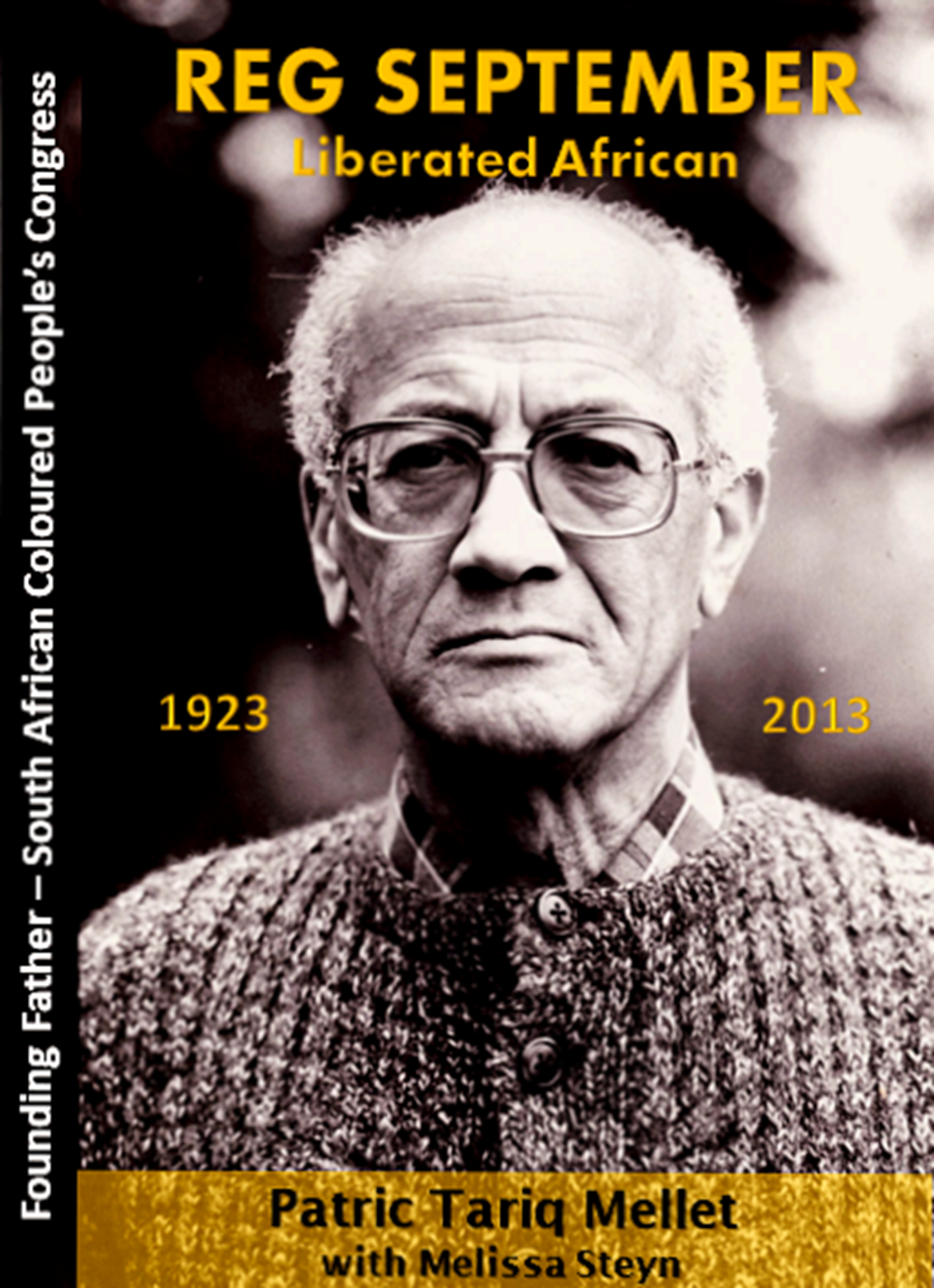


 from the southwestern Malabar Coast of India which after 1956 with the combining of the Malayam-speaking regions of India, became the State of Kerala with its capital city being Thiruvananthapuram. It also incorporates the old Kingdom of Cochin.


